
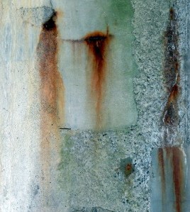
Light Lit
Reflector / \ Conductor
of Car Park
Transmutation

In / \ at the car parks of Rosyth Halt and Inverkeithing railway stations, Fife.
Now playing: Ulrich Krieger – /RAW: ReSpace/
Murdo Eason - From Hill to Sea
walking / writing / between world and word
Light Lit
Reflector / \ Conductor
of Car Park
Transmutation
In / \ at the car parks of Rosyth Halt and Inverkeithing railway stations, Fife.
Now playing: Ulrich Krieger – /RAW: ReSpace/

I like maps, because they lie.
Because they give no access to the vicious truth.
they spread before me a world
not of this world.
Wisława Szymborska
There are only shadows here
A Field in England (Dir. Ben Wheatley)
The commuters scurrying down the stairs at Rosyth Halt railway station, are unlikely to give much thought, if any, to the field on their left as they descend to the platform below. Some may notice subtle changes in colour throughout the year. The recent appearance of yellow broom blossom; the overhead sun creating a dappled patchwork of greens, sandy browns and heathery purple. In a few weeks, the hawthorn blossom will sit like scented snow on the ancient hedge.
Standing at a certain part of the station platform, it is possible to hear the gentle purr of the Whinny Burn tracing its route through the field on its way to the River Forth at Inverkeithing Bay. Magpies, rooks and collared doves appear to take a curious interest in the arrivals and departures of station commuters whilst overhead, the sun splinters around the extended wings of a buzzard soaring like Icarus ever higher into the blue.
The field is now bounded on all sides by motorway, dual carriageway and the railway line. A severed island of abandoned agricultural land cast adrift with no easy public access. At the top of the halt steps, there are no particularly distinguishing visual features as we look over the land which we are going to walk through. As a train arrives at the platform below, a late flurry of commuters hurl themselves past us and down the stairs to squeeze into the carriages before the doors close. Most are unlikely to be aware that there may be as many as 2,000 bodies buried somewhere in the vicinity.
The fields between the railway and the A823 (were) where the last and bloodiest part of the battle took place … it is likely to be where the majority of the killing took place. (Historic Scotland).
it is said that the burn ran red with blood for three days.
The casualties on the Scots side were certainly heavy. Most sources agree that about 2,000 were killed and around 1,500 taken prisoner, although various figures are reported for the casualties of the Highland regiments. Cromwell in his letter immediately after the battle reported at least two thousand dead.
July 1651
It was during the night or early morning of 16th /17th July 1651 that the troops of Oliver Cromwell’s New Model Army landed on the north shore of the Forth in the vicinity of Inverkeithing Bay. Whilst they had inflicted a heavy defeat on the Scottish army at Dunbar on 3rd September 1650, they had been thwarted by attempts to advance further into Scotland. Cromwell came to the conclusion that Fife was the key and by 20th July, 4,500 of Cromwell’s Parliamentarian force were dug in on Ferry Hills, whilst a Scottish force of a similar size had grouped at Castland Hill. The threat of Scottish reinforcements coming from Stirling provoked Cromwell’s Parliamentarians to attack and force the Scottish infantry to retreat north towards Pitreavie Castle. On land close to Pitreavie Castle, the Scottish infantry made a final stand but were soon overwhelmed by the more experienced Parliamentarians who had the additional advantage of cavalry. The Scots suffered heavy losses. This became known as The Battle of Inverkeithing (sometimes The Battle of Pitreavie) and was the last major battle of the Wars of the Three Kingdoms in Scotland. From 1652, Scotland was wholly under control of Cromwell’s Protectorate.
Entering the field is not too difficult. Not far from the station steps there is a locked gate but a little further along we find a gap in the hedgerow. If you are prepared to navigate or slide down a steep slope, this will deposit you amongst the discarded plastic bottles and assorted rubbish tossed from the stairs above. At ground level, the topography of the field is much more apparent. Pronounced undulations ahead of us, sloping off to the right towards marshy ground around the Whinny Burn. Ground cover is a mix of meadow type grasses, whin bushes, dandelions and what look like dock leaf plants gone to seed.


You only have to look towards the perimeter of the field to be aware that you are surrounded by human presence. The rooftops of Rosyth to the right and the hum of motorway traffic a constant low-level signal. Yet on the actual land we are walking, it is rare to find an almost complete lack of evidence that humans have recently passed. No litter, no discarded cans or bottles or burnt out barbecues. There are hints of desire lines traversing the space, perhaps made by committed dog walkers or something else. It is only as we move further into the field, that there is a clear sense that we are being watched.

At first, we wonder if it is a dog but it soon becomes apparent that it is the eyes of a tiny roe deer that are fixed on our movements. We are both probably equally surprised to encounter each other. This is not an area where you would typically expect to see deer. Where on earth has it come from? We lock into that non-time state of reciprocal, motionless, staring. Eventually the deer decides to break for it. Great elongated leaps for something so small; as if bouncing off the air itself, not really touching the ground. I manage to retrieve the camera and fire off some random shots in the hope that we obtain some record of this actually having happened.

We notice our presence is also alarming a number of skylarks which appear to have made the field their own. Their nervous, vertical flight and fluted song a mix of terror and beauty as we try to avoid what must be their nesting areas.
The field separates in two at a ridge of hawthorn bushes. On the other side:


From a distance
criss-cross
to new horizons

A field of time
history layered
on geography.
Transparent globes
of wind held tension
time scattered
yellow flowerings
of the eternal return


The field eventually tapers to a point where we can go no further, blocked off by the railway and the smooth, solid concrete structure carrying the A823 motorway spur.
We know that beyond the A823 another field will take us to a concrete flyover of the M90 motorway. We work out a way to access the field and head off on a detour. Our serendipitous findings are recorded in a separate blog: Cartographies of Chance – Underneath the M90 (II).


Returning to the field, we walk close to the northern perimeter with only a thin hedgerow between us and the A823. Such a slight threshold separating us from our field of time, skylarks and deer. On the other side, the surveillance cameras, crash barriers, lay-bys and signs – all the material apparatus of the modern motorway.


We are quite surprised to come across a footbridge over the motorway that enters the field only to stop at a complete dead-end. The proximity of this easier access results in the usual heaps of fly tipping, something that is hard to understand. It must be much more difficult to dump this stuff here than take it to the municipal waste recycling.


Place and non-place are rather like opposed polarities: the first is never completely erased, the second never totally completed . . . But non-places are the real measure of our time.
Marc Augé
The footbridge takes us over the A823, (Why does an empty motorway always evoke a Ballardian descriptor?) and into the relatively new ‘non-place’ of Carnegie Campus. We know from the old maps and records that this land was also once part of ‘the field’. Being a Sunday, the ‘campus’ is completely deserted as we wander amongst the new build office blocks, many of which still look unoccupied. Roundabouts appear to have been built in hope of a time still to come as roads come to an abrupt end. Rab’s Little Kitchen snack van is closed.


Where the manicured non-space runs out, an explosive wild bouquet of whin sits amongst a covering of red campion:

And yet amongst all the shiny new sheen of this place, older voices intrude. A hexagonal brick structure whose original purpose is unclear:

time stacked textures
brick and concrete
.

Nestled in at the side of the main road into the campus we come across the cairn. As far as we are aware it is the only explicit acknowledgement of what happened on this land.
the Scots were driven back to the level ground between Hillfield and Pitreavie. Here, in one of the most famous episodes of the Battle of Inverkeithing, the Clan Maclean of Mull regiment, commanded by their chief, Sir Hector, found themselves surrounded by superior enemy forces. The clansmen fought fiercely in defence of their chief, calling out, “Fear eile airson Eachainn!” (Another for Hector!), as they sacrificed themselves.

The battle involved musketry, cavalry, pikes, swords and even archery on the Scottish side, with considerable hand to hand fighting

Near here, Sir Hector MacLean of Duart was killed
at the Battle of Inverkeithing
along with some 760 of his men
20th July 1651
“Another for Hector”

Nearby to the cairn, stands another material presence in the layered history of the field. Peering over a substantial stone wall allows us a view of the Dovecot in the grounds of Pitreavie Castle.

Pitreavie Castle was originally built in the early 17th century by Henry Wardlaw of Balmule, later Sir Henry Wardlaw, 1st Baronet of Pitreavie. Wardlaw was Chamberlain to Queen Anne, wife of James VI of Scotland.
The Battle of Inverkeithing/Pitreavie was fought nearby on 20 July 1651, between an English force commanded by Colonel Robert Overton and a Scottish force, including some 800 Highlanders from the Clan Maclean. After the battle, which was a decisive victory for the Cromwellian forces (contemporary reports speak of 2,000 Scots killed and 1,600 captured, all for the loss of 8 of Overton’s troops), a group of Macleans sought refuge in Pitreavie Castle. The Wardlaw family refused them sanctuary and the Macleans were likely to have been captured or killed.
The Maclean dead … are more likely to have been buried in a mass grave.
We pass the old dovecot of the castle, turn left and past the front door where the initials of Henry Beveridge are recorded. Beveridge purchased the Castle in 1883 and extensively remodelled it in 1885.

Henry Beveridge was a wealthy mill-owner, philanthropist and educator from Dunfermline. He was an associate of Patrick Geddes having attended Geddes’s summer meetings in Edinburgh. He subsequently became one of the Directors of Geddes’s Edinburgh Town and Gown Association in 1896. As a member of the Carnegie Dunfermline Trust, Beveridge was also partly responsible for arguably Geddes’s greatest work – City Development: a study of parks, gardens and culture institutes. A report to the Carnegie Dunfermline Trust. Geddes also introduced Beveridge to the artists John Duncan and Charles Mackie who painted murals in the castle illustrating the legend of Orpheus and Sir Patrick Spens.

It is believed that these murals may now be at best over-painted and at worst destroyed. A good example of John Duncan’s Symbolist style can be seen in his famous work, The Riders of the Sidhe:

As noted above, Henry Wardlaw’s granddaughter-in-law, Elizabeth Wardlaw, is claimed to be the author of Sir Patrick Spens. (Although the evidence appears somewhat tenuous).
“The king sits in Dunfermline toune
drinking the blude reid wine,
“O whar will I get a guid sailor,
To sail this schip of mine?”
…
Walking past Pitreavie Castle today, it has now been converted into flats and apartments and offers no clue as to another more recent past life. It was bought by the Ministry of Defence in 1938 and after the second world war, deep in a basement bunker became the headquarters of NATO’s Northern Maritime Region. During the Cold War, all Soviet ships and submarines on exercise in the North Sea were monitored from here. The base closed in 1996 and operations moved to RAF Kinloss. There is little or no outward trace of this today, although some photographs of its past life exist:
Access to the underground bunker

The teleprinter room 1944

As we head along Castle Drive, we notice that a small housing estate has a story hidden in the street names:
Covenanters Rise: The Scottish army was a Covenanter army, acting under allegiance to Charles II.
MacLean Walk: the aforementioned Sir Hector Maclean of Duart, commander of the Scottish Highland infantry.
Sir John Brown Place: Sir John Brown, commander of the Scottish lowland infantry.
Overton Crescent: – Colonel Robert Overton led the assault party of New Model Army troops that landed in Fife on the night of 16th/17th July.

Our final part of the walk will take us along Castle Drive where we will loop around to bring us back to where we entered the field. Despite the changes over the centuries, we have walked the area of the field as it was in 1657. We continue to ponder our mysterious encounter with the roe deer. Perhaps a manifestation of “only shadows here”?
Four days after the Battle, Cromwell crossed to Fife in person. For him the victory was “an unspeakable mercy”.
As we walk down Castle Drive we pass another new addition to the landscape on the left. A customer contact centre for Rupert Murdoch’s Sky empire.
On the other side of the road, a magpie picks at the carcass of a dead squirrel.

≈≈≈
Appendix
Present day map showing the boundary lines and key sites of the Battle of Inverkeithing. (Historic Scotland/Ordnance Survey).

Now playing: June Tabor – ‘Sir Patrick Spens’ from An Echo of Hooves.
or a more jaunty version: Fairport Convention – ‘Sir Patrick Spens’ from Full House.
References:
Marc Augé, Non-places: Introduction to an Anthropology of Supermodernity (London and New York: Verso, 1995).
Charles Holme (ed), The International Style, Vol. 1 No. 1 (New York: The Bodley Head, March 1897).
Helen Meller, Patrick Geddes: Social Evolutionist and City Planner (London and New York: Routledge, 1993).
Wisława Szymborska, Map: Collected Poems and Last Poems (Boston and New York: Mariner Books, Houghton Mifflin Harcourt, 2016).
Ben Wheatley Dir. A Field in England (Film4, 2013). Film.
Area Combined HQ Rosyth – Pitreavie Castle (Flag Officer, Rosyth, RN & AOC No 18 Group, RAF Coastal Command) on Subterranea Britannica
The Inventory of Historic Battlefields – Battle of Inverkeithing, Historic Scotland, 14th December, 2012.
