
.

.

.

.
Now playing: The Jesus And Mary Chain – Alphabet Street (Cover).
Murdo Eason - From Hill to Sea
walking / writing / between world and word
.
.
.
.
Now playing: The Jesus And Mary Chain – Alphabet Street (Cover).

≈
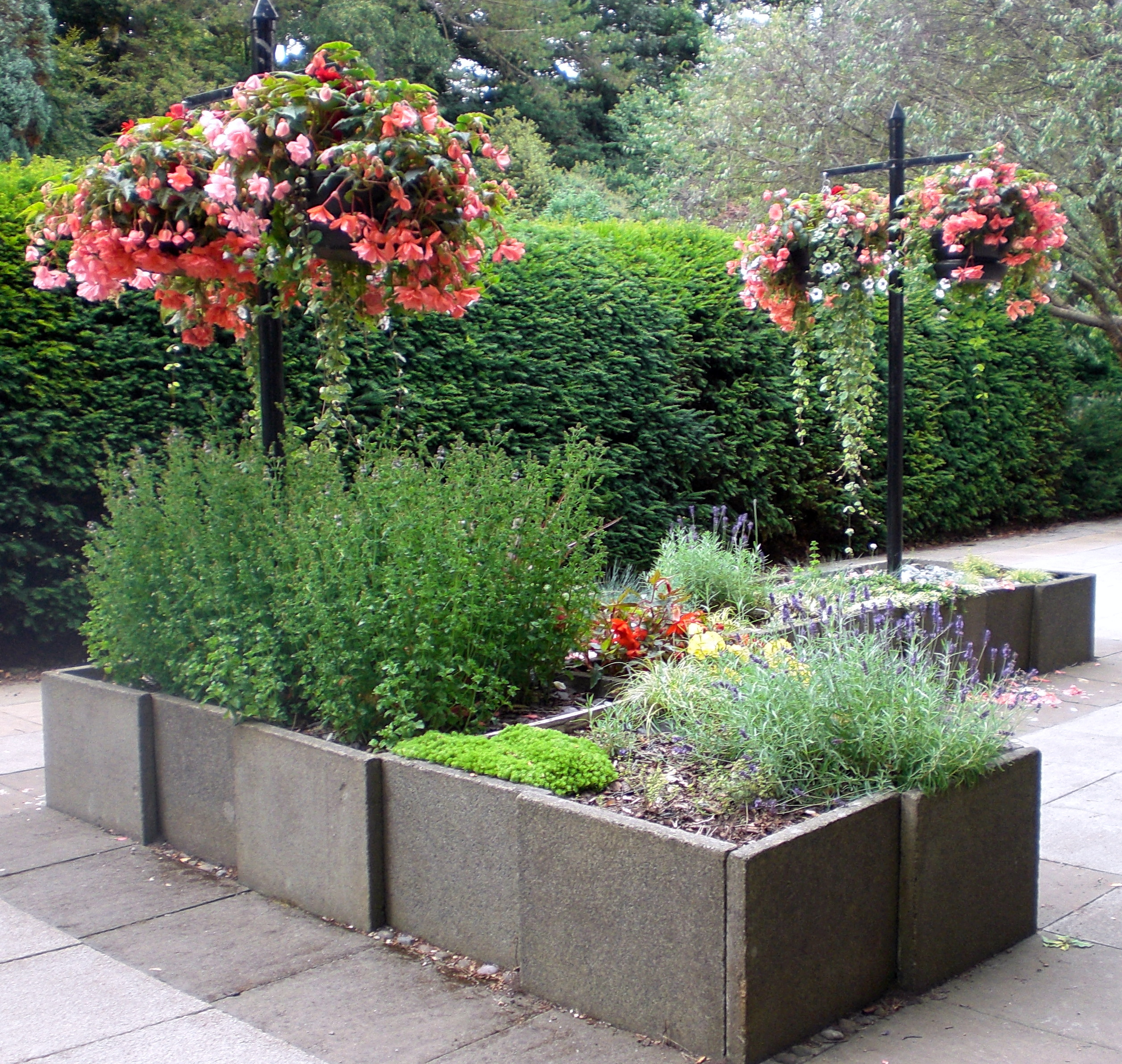
We are walking out, along the shoreline, from Leven towards Lundin Links. Coastal energies are in full flow, our field of vision filled with an excess of sand, sea and sky.

In the distance, an intensity of white light appears to drift in the Firth of Forth like a frosted iceberg. The Bass Rock. Invisible threads loop in the conical forms of Berwick Law and the sacred hill of Largo Law. Three nodes of a triangle that collapse North and South; earth and water; land and sky. An energy field that pulls us into an expanded world. Bardic bird yells, brine on the tongue and buffeting sea breezes whip up folding white breakers that fizz over the sand.
≈
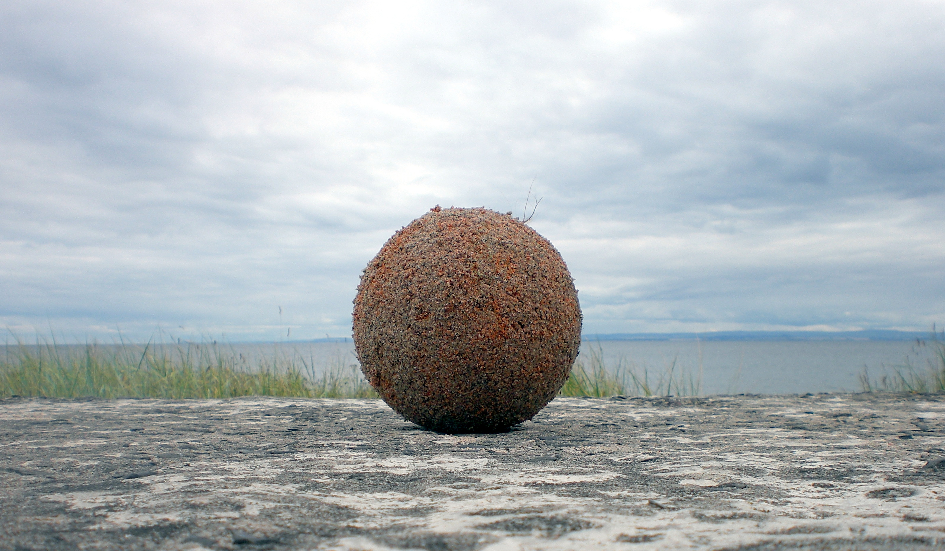
We soon encounter the talisman lying in the dunes. It’s protective, synthetic membrane, perished long ago by wind and water. Now crusted with sand and water-logged, it has transmuted into a living entity. Green tendrils sprout from the surface. It appears to be an auspicious omen, a process of alchemy worthy of the legendary Wizard of Balwearie, Michael Scot, (1175 – c.1232), reputed to have form in these parts.
Local legend has it that Scot summoned his three imp familiars, Prig, Prim and Pricker to Largo Law with a view to levelling it. A sort of job creation scheme for hyper-active familiars. As they began to dig, Scot had a change of plan and the imps were hurriedly despatched to Kirkcaldy to make ropes out of sand. This was to assist Scot in his showdown with the devil on Kirkcaldy beach. Scot appears to have triumphed in the encounter as evidenced by a local saying: “The devil’s dead and buried in Kirkcaldy”. As a result of the ‘Kirkcaldy interruption’, only a single shovelful of earth was thrown from Largo Law to create the cairn of Norrie’s Law at the wonderfully named farm of Baldastard. There are also local folk tales about an abundant goldmine that supposedly exists underneath Largo Law and that sheep have returned from grazing on the foothills with golden fleeces.
≈
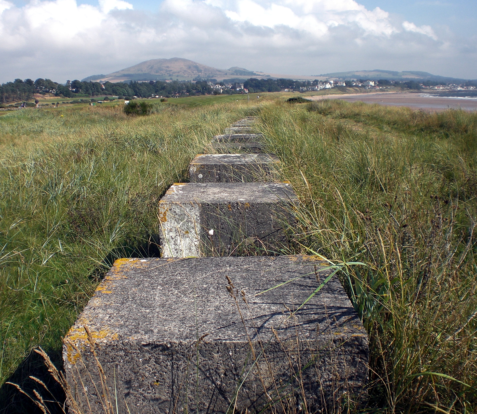
Huge concrete blocks line this part of the coast like giant stepping-stones. Could we step all the way to Largo Law? The blocks were part of the necklace of coastal defences installed during WW2 and were designed to frustrate any German tank invasion from the sea. The blocks were constructed and laid by the Polish army who had several divisions based in Fife during WW2. Today, the original purpose of the blocks may be somewhat forgotten but their solidity and mass provide a pleasing sculptural rhythm to the foreshore.
One of the blocks serves as a makeshift altar to revere the action of the natural world on our talismanic old football. A process of transmutation – of rebirth and growth.
We turn inland from the coast to take the path, called Mile Dyke, that heads between the links golf courses. This will take us to Silverburn and we can now feel its connection to Leven and the coast. S i l v e r – b u r n is a name to roll around the mouth and along with golden fleeces and transmuted footballs we can sense that we are truly in an alchemical landscape.
≈
Silverburn – a Brief History
Silverburn is the former estate of The Russell family who were owners of the Tullis Russell paper making business. The land was originally part of the Barony of Durie and was leased to Mr David Russell by Charles Maitland Christie of Durie in 1854. Arthur Russell purchased the land in 1866 and rebuilt Silverburn House. A dower house known as Corriemar was also built and a flax mill was established on the site.
David Russell died in 1906. His son, (also named David) and who later became Sir David Russell was born at Silverburn in 1872 and in 1912 married and went to live in Aithernie House. He returned to Silverburn in 1929. Sir David had a great interest in trees and many were planted including some rare and unusual species which continue to thrive today.
The flax mill closed around 1930.
In 1973, Sir David Russell’s grandson, Major Russell (Head of Tullis Russell Paperworks) gifted the houses and grounds to Leven Town Council, but also stipulated through the National Trust for Scotland that the “subjects should remain forever as a quiet area used for the benefit of the public in general and the people of Leven in particular for nature trails, quiet parkland and organised camping”. In the mid to late 1980s, the former Kirkcaldy District Council undertook a Job Creation Programme to reinstate Silverburn House for use as a Residential Centre for groups to use such as scouts and guides; school parties, caravan rallies etc. A stand alone wing to the rear of the House was used by crafters to make and show their wares throughout the Summer and Christmas/New Year periods.
Between 1990 and 1999, an average of 20,000 + people per year visited Silverburn. Its main attraction was the former “Mini-Farm” which had on show a wide range of domestic and exotic animals, birds, reptiles and insects. However, following a Council policy decision in 2002, to cease operating Animal Centres across Fife there have been very few visitors to Silverburn, other than local people. Financial constraints have also led to year-on-year reductions in revenue expenditure with no meaningful capital investment in the Park.
Over the years, various ideas have been proposed for Silverburn including the setting up of a Scottish Music/Arts and Craft Centre and redevelopment as a crematorium. None of these have come to fruition.
However, work is presently underway by Fife Employment Access Trust (“FEAT”) in collaboration with the local community, agencies and local authorities in the Levenmouth area on a project entitled ‘Heart Mind Soul Silverburn’. This aim of this initiative is to secure a long-term future for the park and to promote wellbeing and employment opportunities.
≈
We have visited Silverburn a number of times over the past few months. Drifting around the mixed woodland trails and environs of the estate at different times, on different days and in different weather conditions. Most apparent is observing and feeling the subtle changes of a thriving natural world; an incipient wildness forever encroaching on the deteriorating materiality of the buildings. Silverburn is a place highly conducive to the immersive dérive. A locus of past, present and possible.
≈
The excellent Blacketyside Farm Shop is a wonderful place for sustenance at the start or finish of a Silverburn visit. However, this does means crossing the A915 road which is the main artery into the East Neuk of Fife. The road is a long, straight stretch which can be very busy with vehicles tanking past at high-speed:
wheeeeeeeeeeeeeeeeeeeeeeejjjjjjjjjjjjjjjjjjjggroooooooooooooooooooooooom
mmmmmm oi nnnnnnnnnnnn
nnnnnnnnnnnn oi mmmmmm
mmmmmm oi nnnnnnnnnnnn
wheeeeeeeeeeeeeeeeeeeeeeejjjjjjjjjjjjjjjjjjjggroooooooooooooooooooooooom
≈
Enter Silverburn
Overhead, a charcoal smudged blue, heralds a chorus of rooks riffing off the traffic screech.

Giant American redwoods stand sentinel, stretching for the sun. “Ambassadors from another time” silently announcing that this may not be your conventional Scottish woodland:
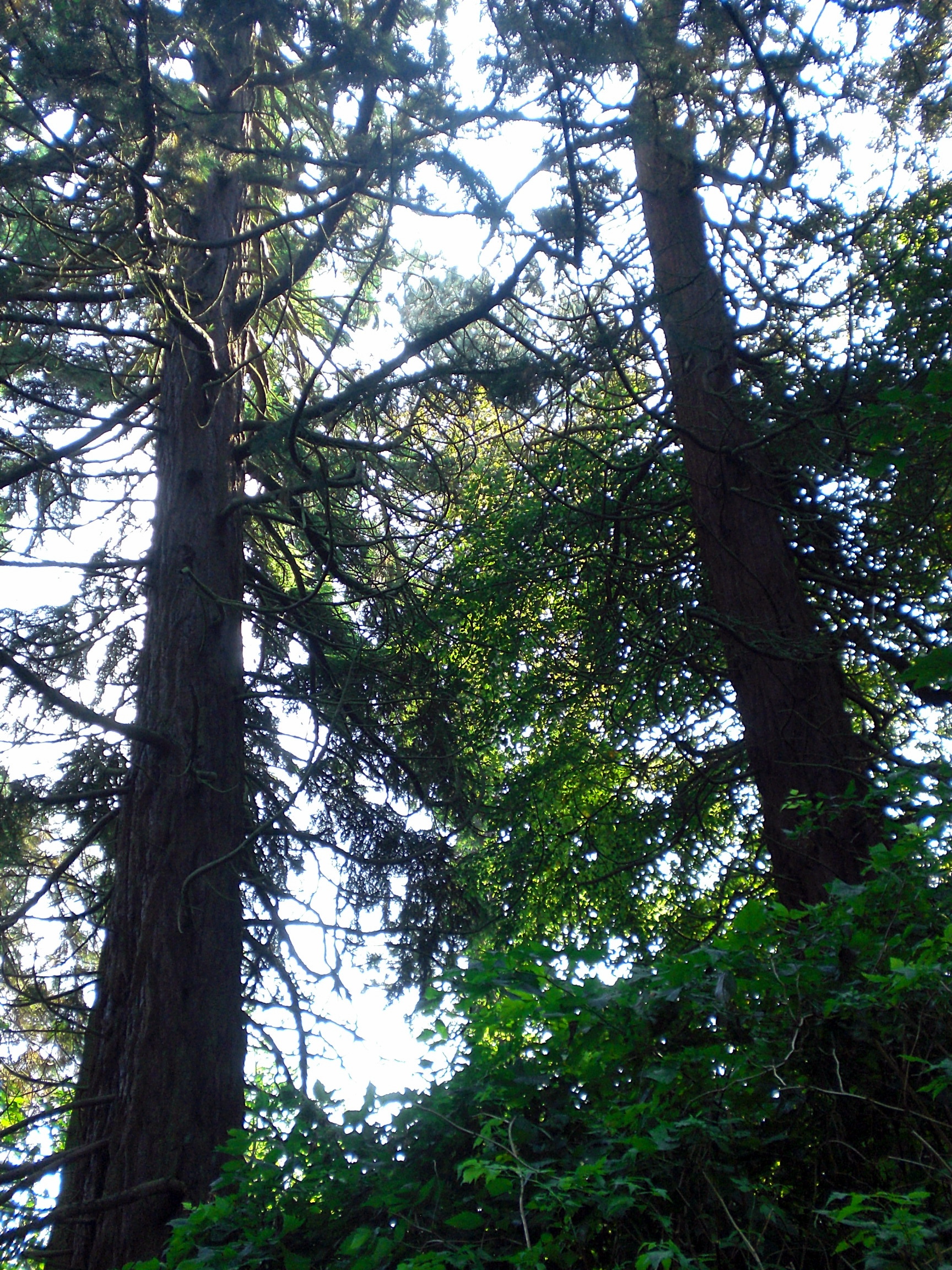
The redwoods, once seen, leave a mark or create a vision that stay with you always. No one has ever successfully painted or photographed a redwood tree. The feeling they produce is not transferable. From them comes silence and awe. It’s not only their unbelievable stature, nor the color which seems to shift and vary under your eyes, no, they are not like any trees we know, they are ambassadors from another time.
John Steinbeck
N: “do you know you can punch a redwood and it doesn’t hurt your hand?”
Blue melts to green as sunlight showers through the tree canopy, dappling the forest floor. Traffic thrum gradually dissolves in the low lipping burr of the flowing burn. A sunken path beckons and so our immersion into Silverburn begins.

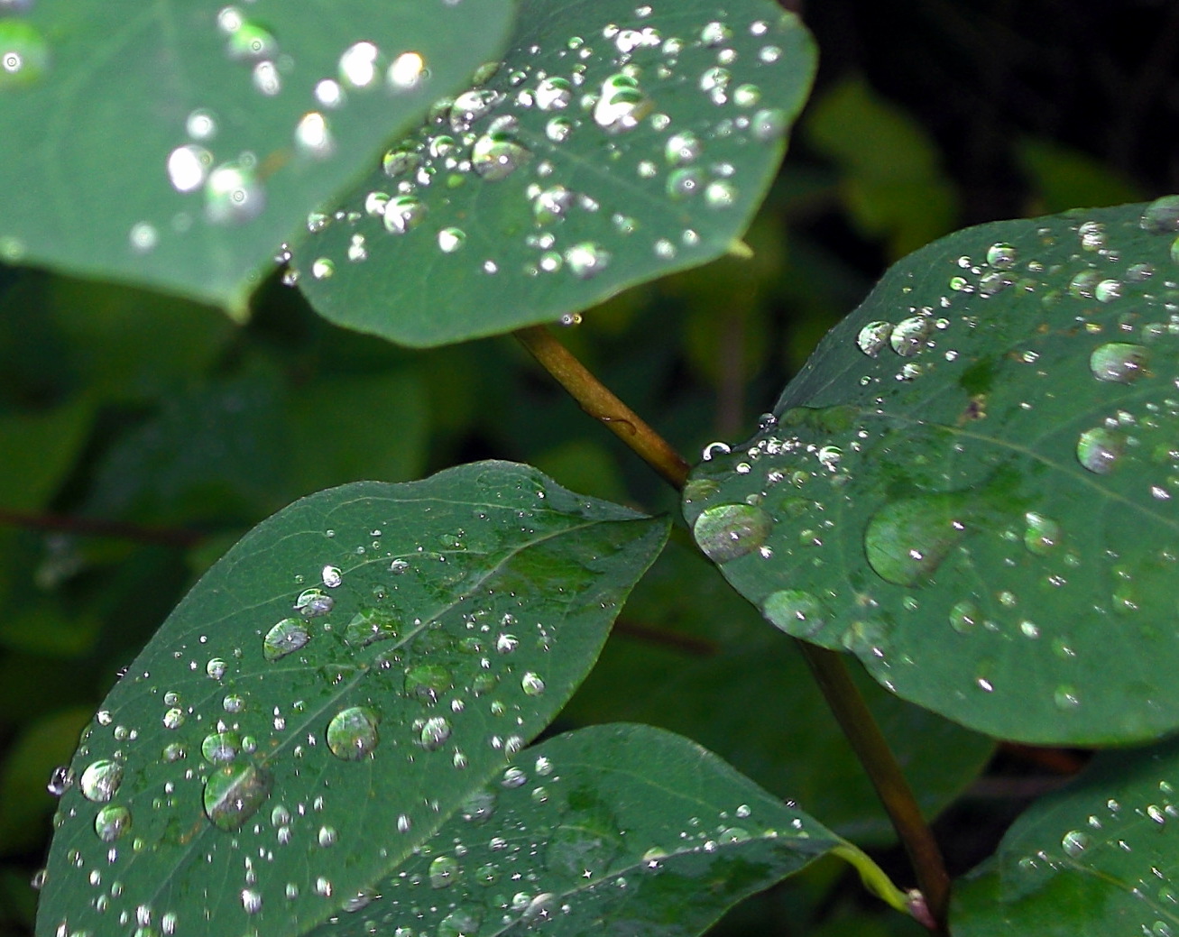
Once in the shade, a sprinkling of light and water; a scattering of silver drops:

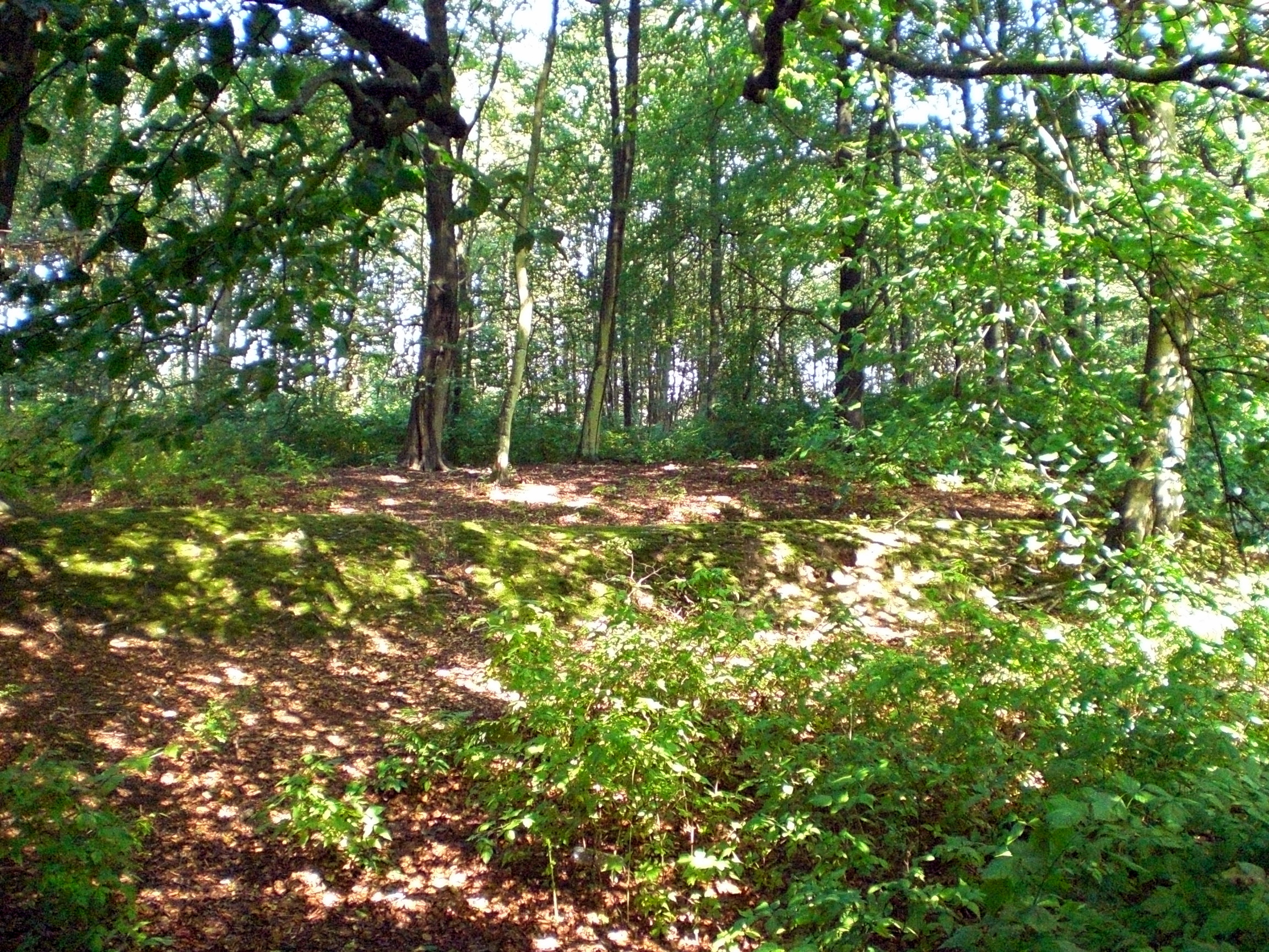
A network of wooded paths through and around Silverburn provide ample scope for aimless drifting. The topography is interesting with a long flat elevated plateau where Silverburn House sits which tumbles away quite steeply down to the flax mill with the golf courses and coast beyond.


Depending which path you take you will soon stumble across one of the ghosts…
≈
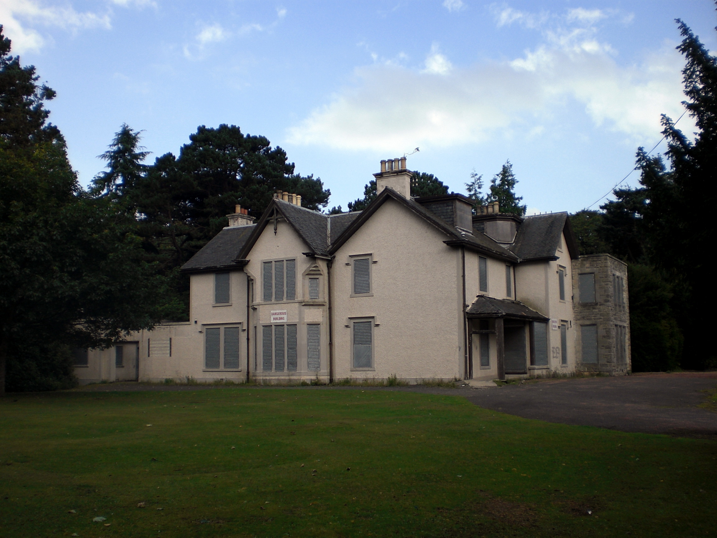
Corriemar: The Dower House
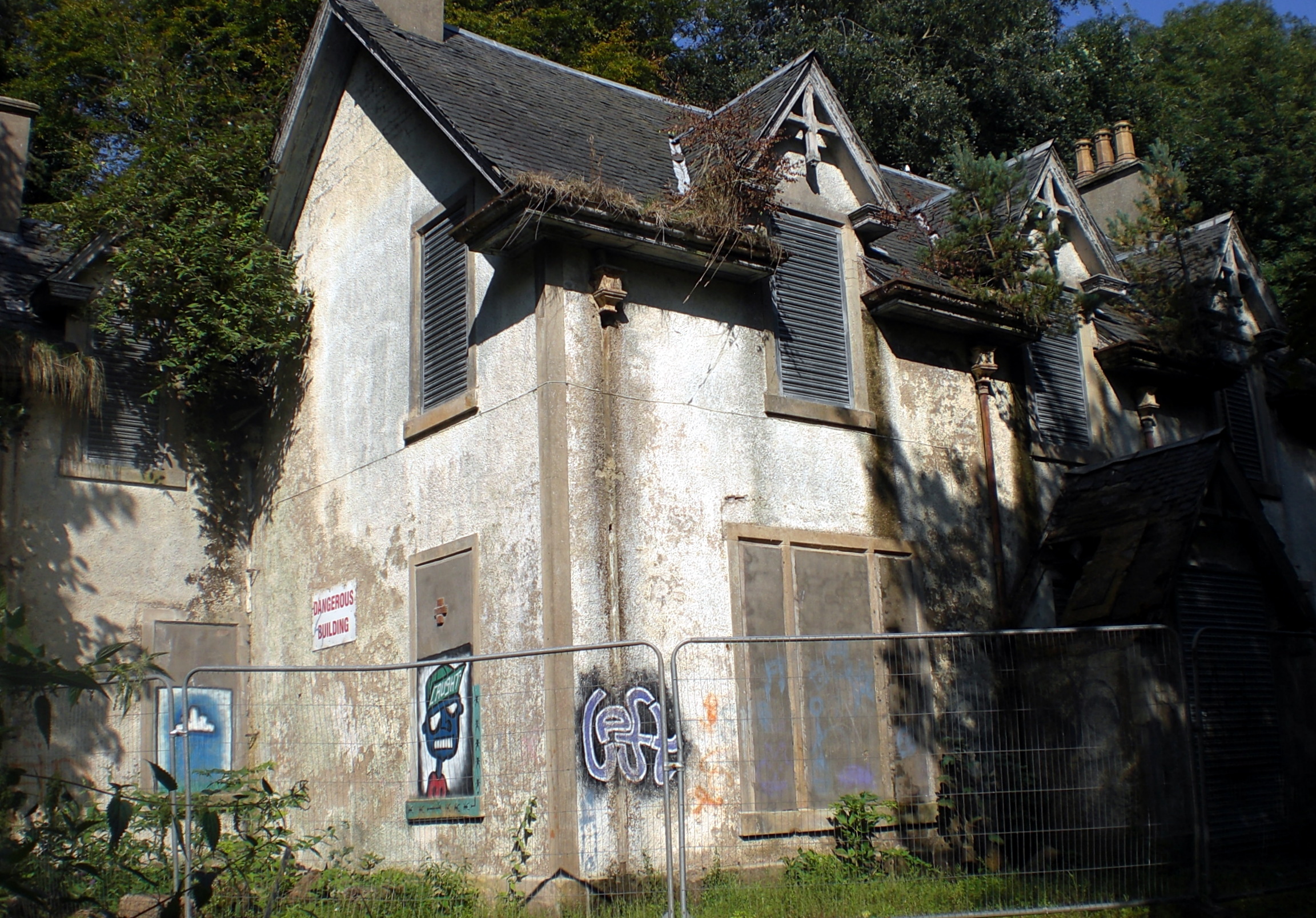
Corriemar is thought to have been the dower house for Silverburn House. A dower house is usually a moderately large house available for use by the widow (dowager) of the estate-owner.
Corriemar has been vacant since 1970, having previously served as day patient accommodation for Stratheden Hospital or the Fife and Kinross District Asylum as it was formerly known. (Stratheden will be a place-name that resides in the (un)consciousness of many Fifers. My mother used to say that the teenage antics of my brother and I would send her there. In hindsight, I hope that she was only joking. RIP Mum).
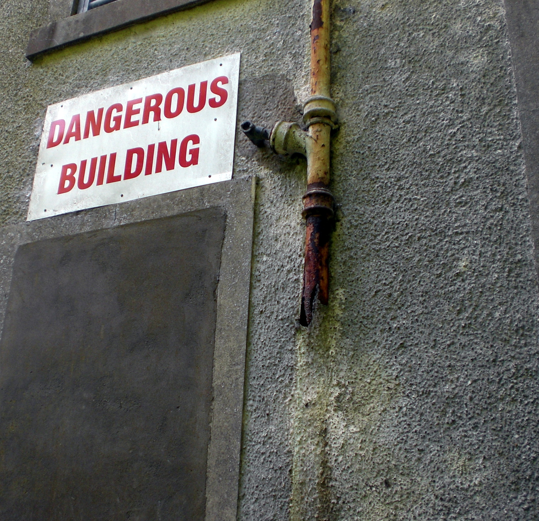
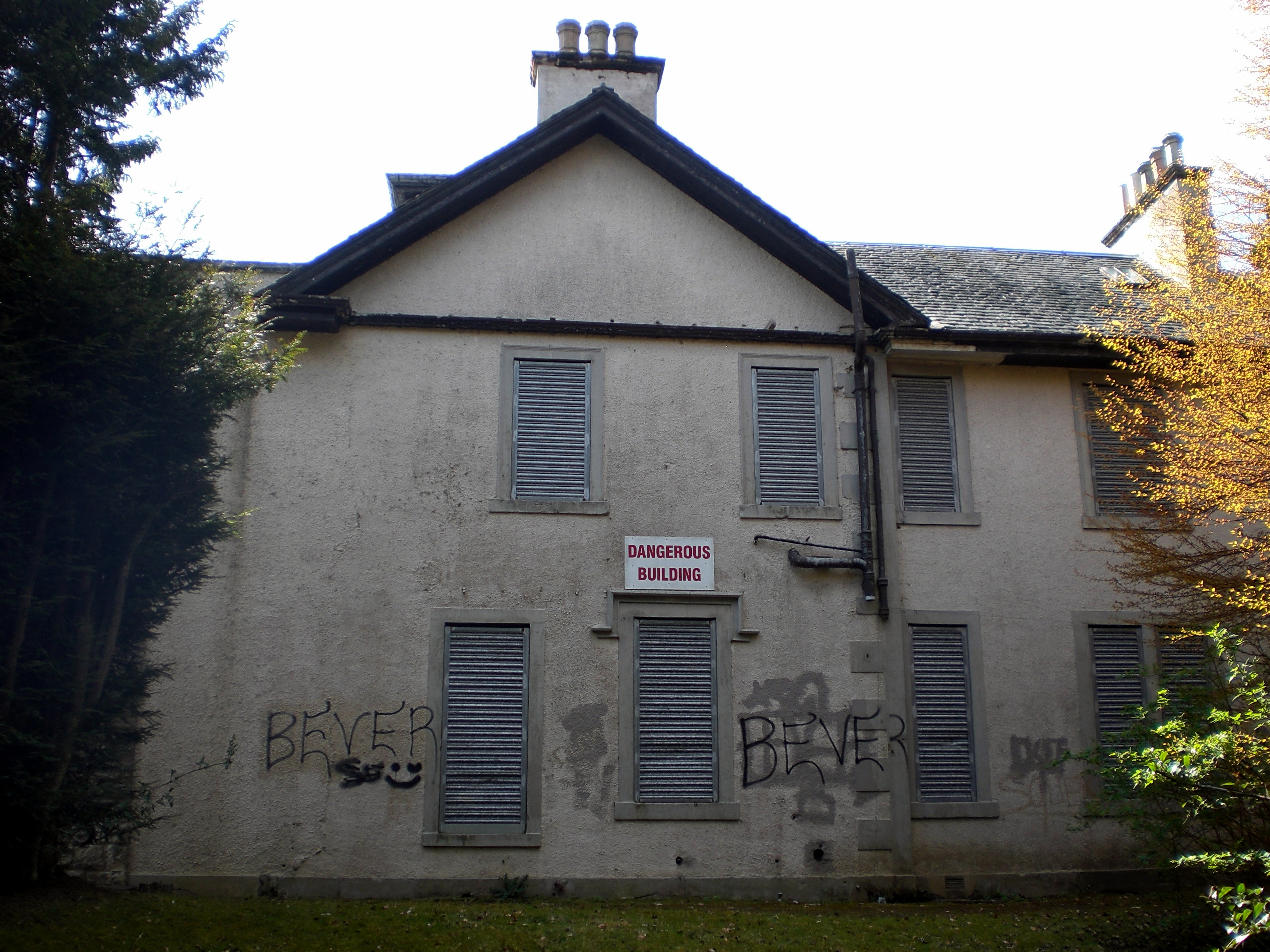
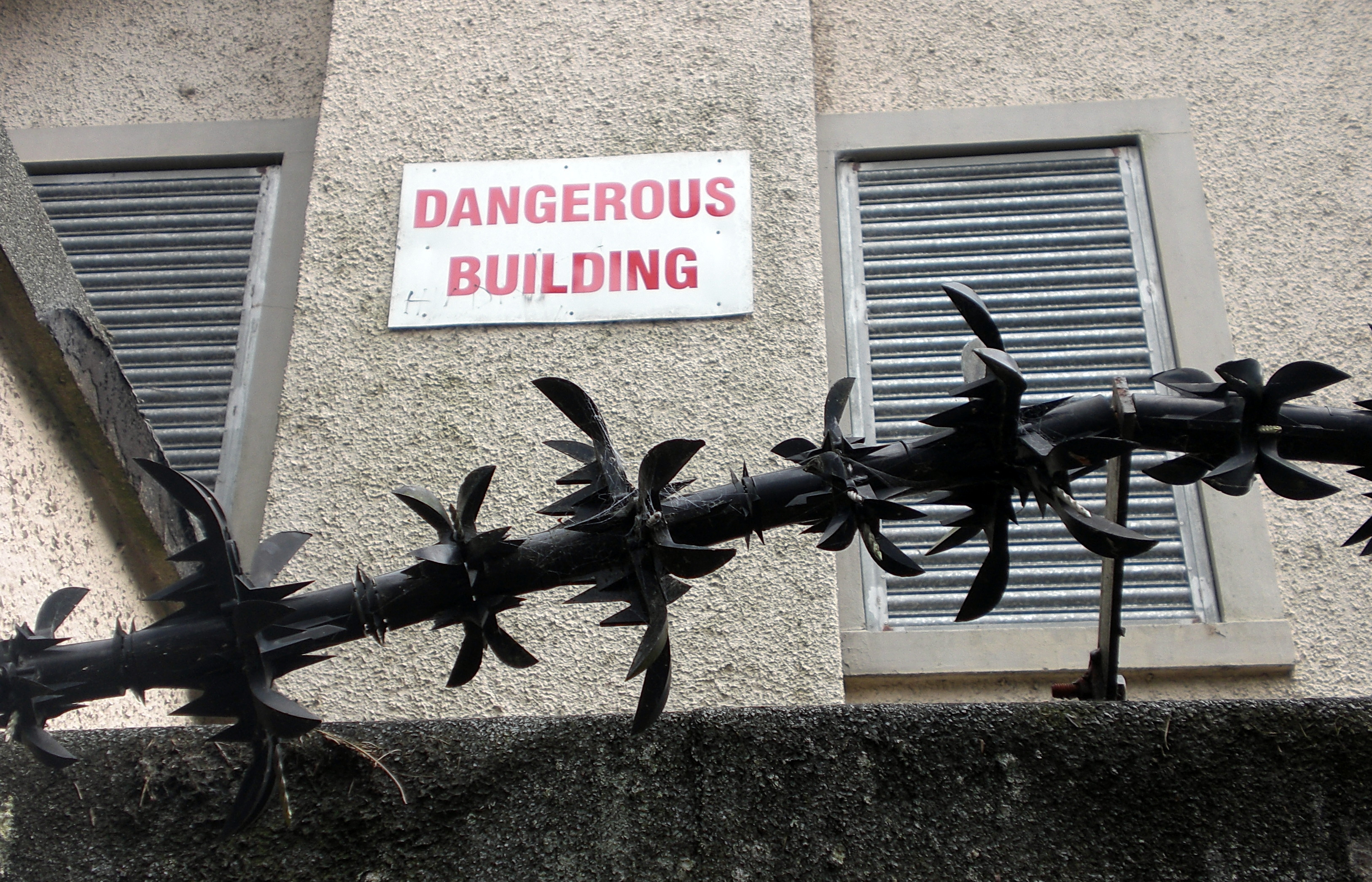
The house today is a crumbling ghost of a building. Buildings need capital, care and a purpose to thrive and Corriemar has had neither of these since the 1970s. Now officially classified as a dangerous building and on the Buildings at Risk register, nature is slowly restaking her claim.
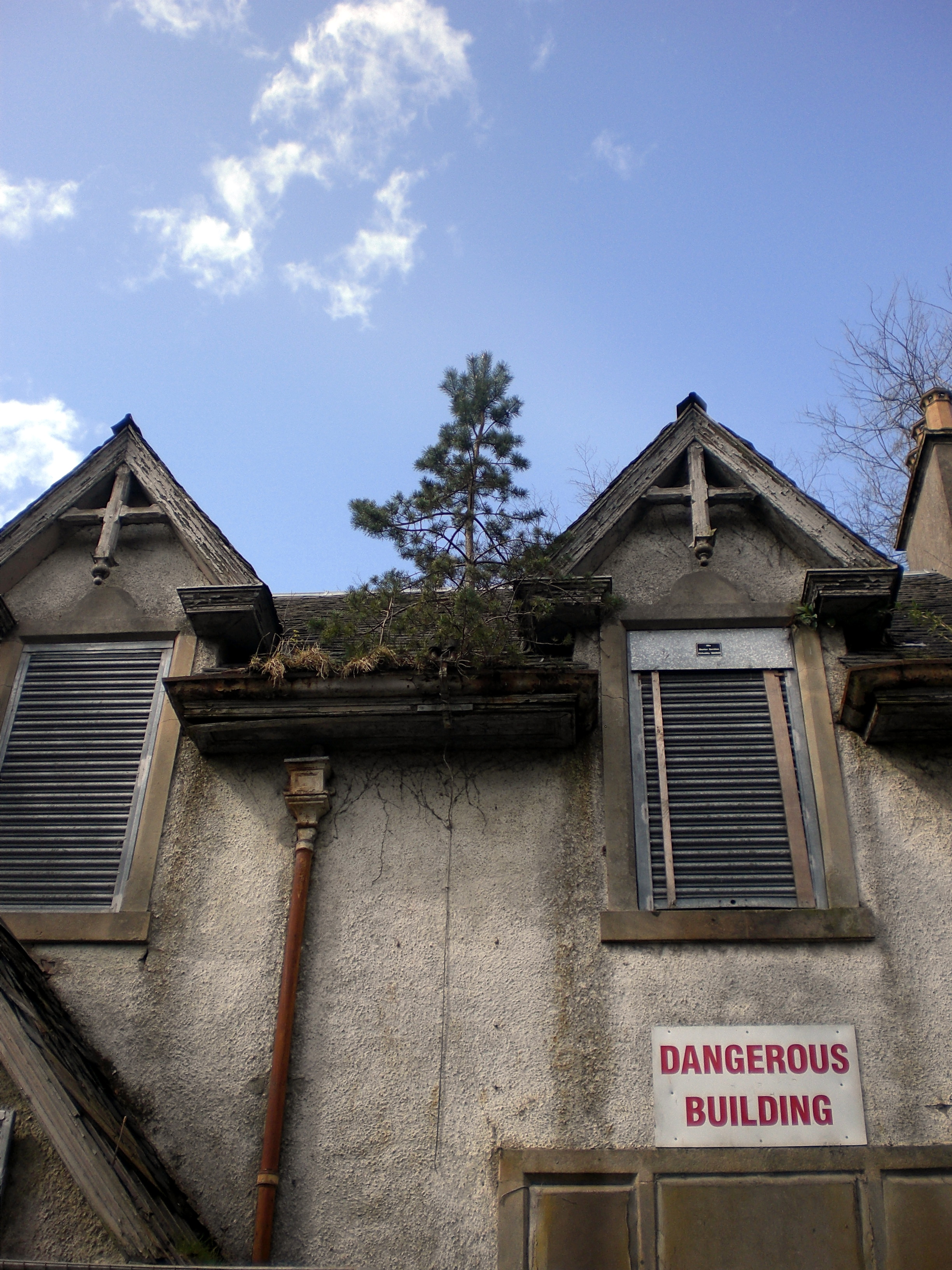
A pine tree grows out of the roof guttering. Many slate tiles have been lost to the elements, leaving the roof like a mouth full of smashed teeth.

The building is not just boarded but sealed.
Mute.
All flow and circulation broken:
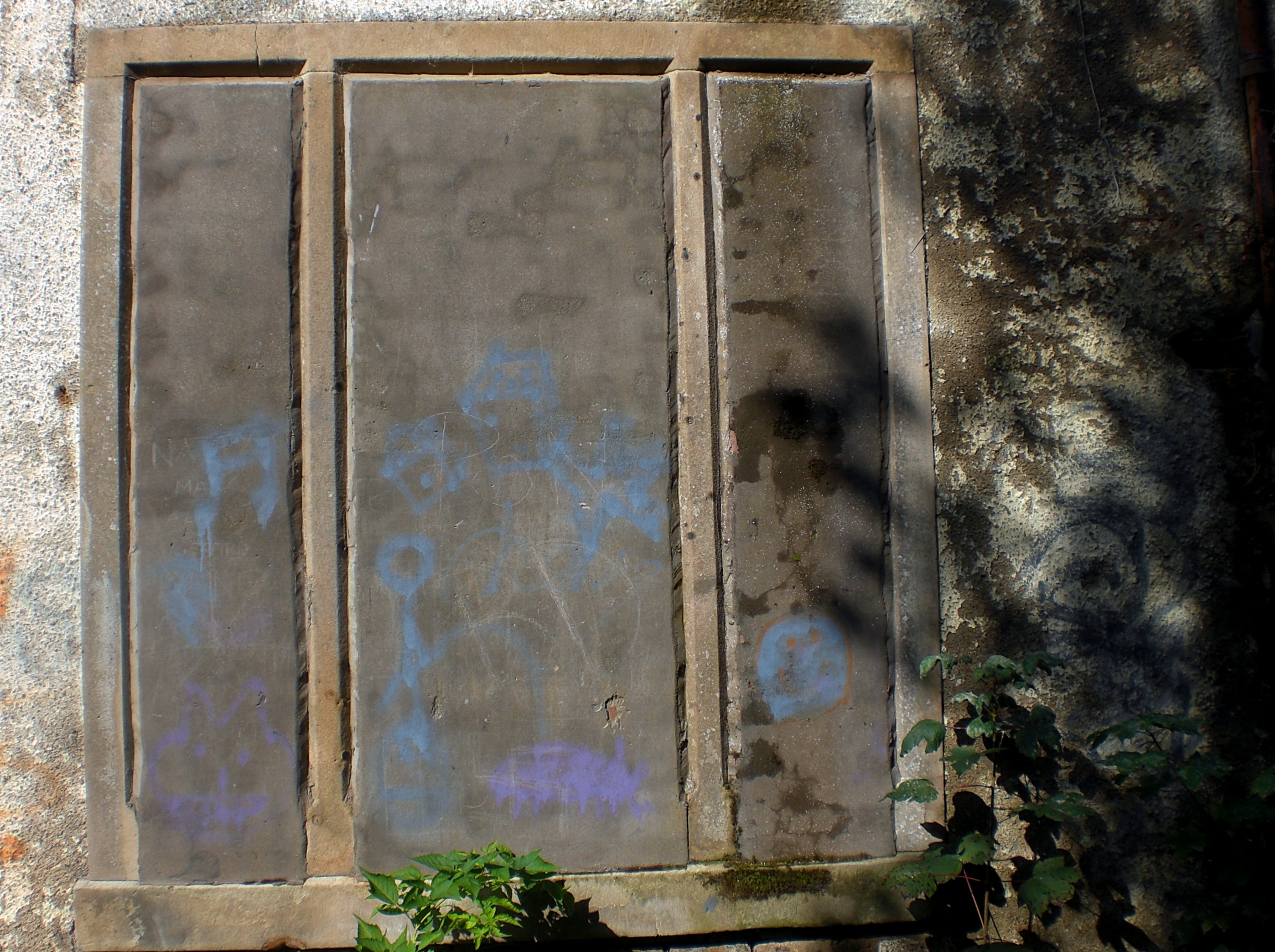
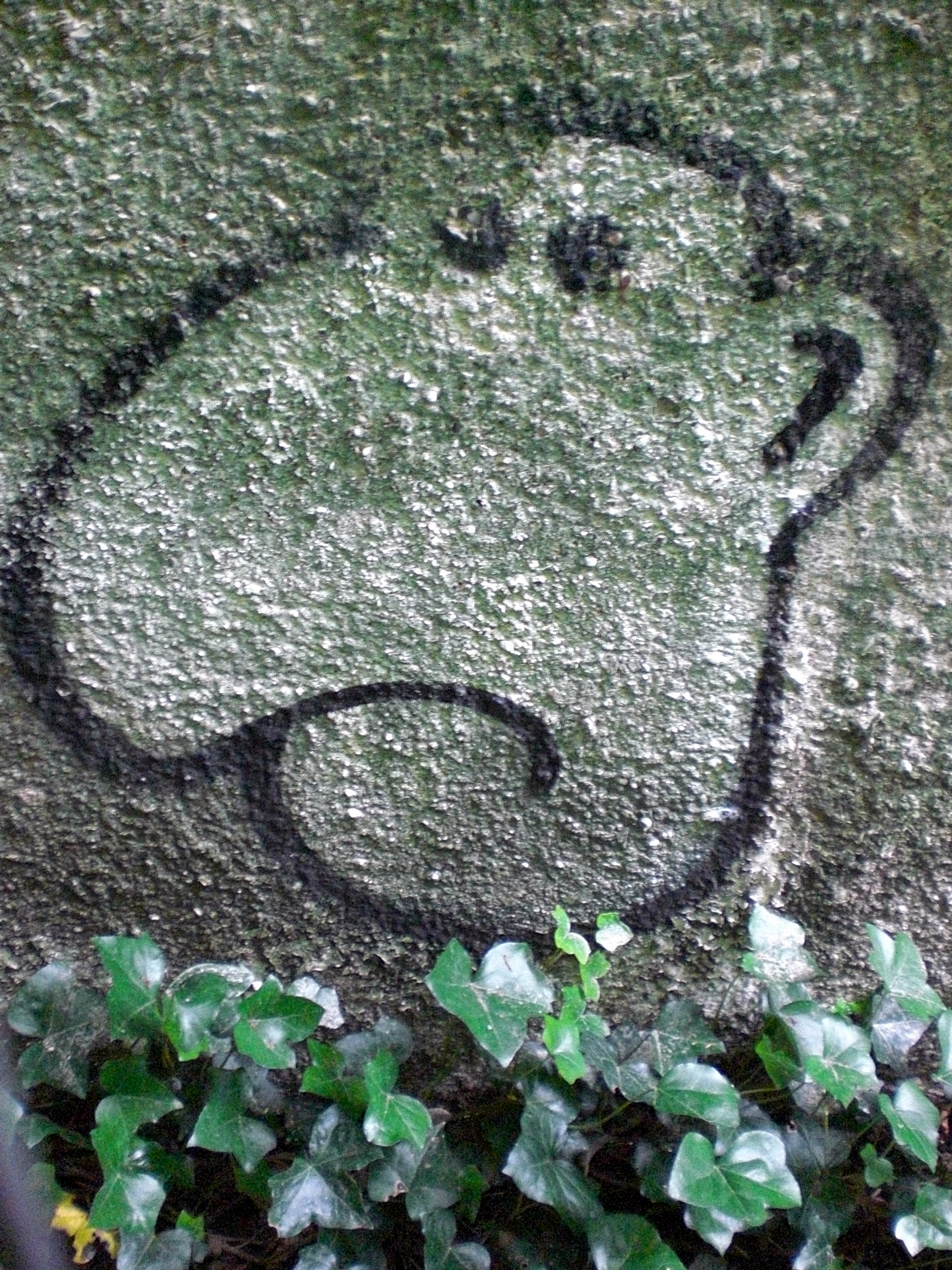
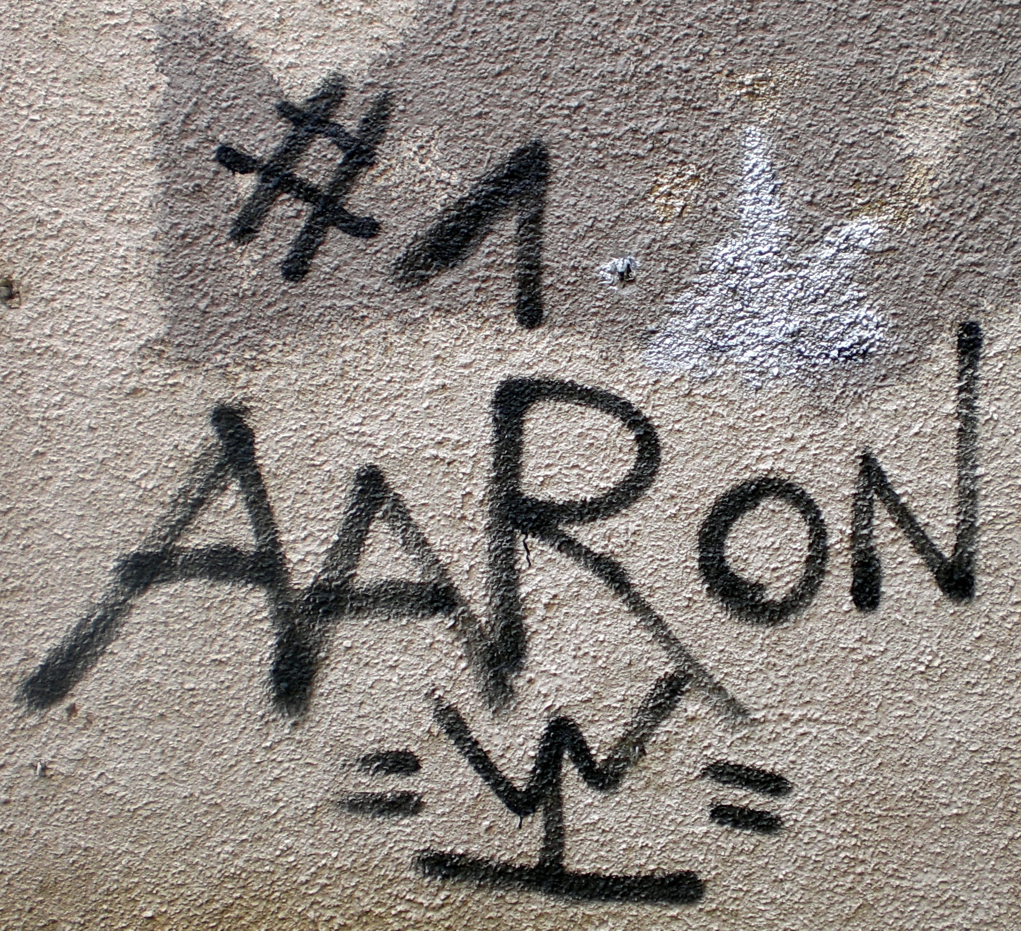
Graffiti abhors a blank surface and Corriemar has become a canvas for a surprisingly diverse display:


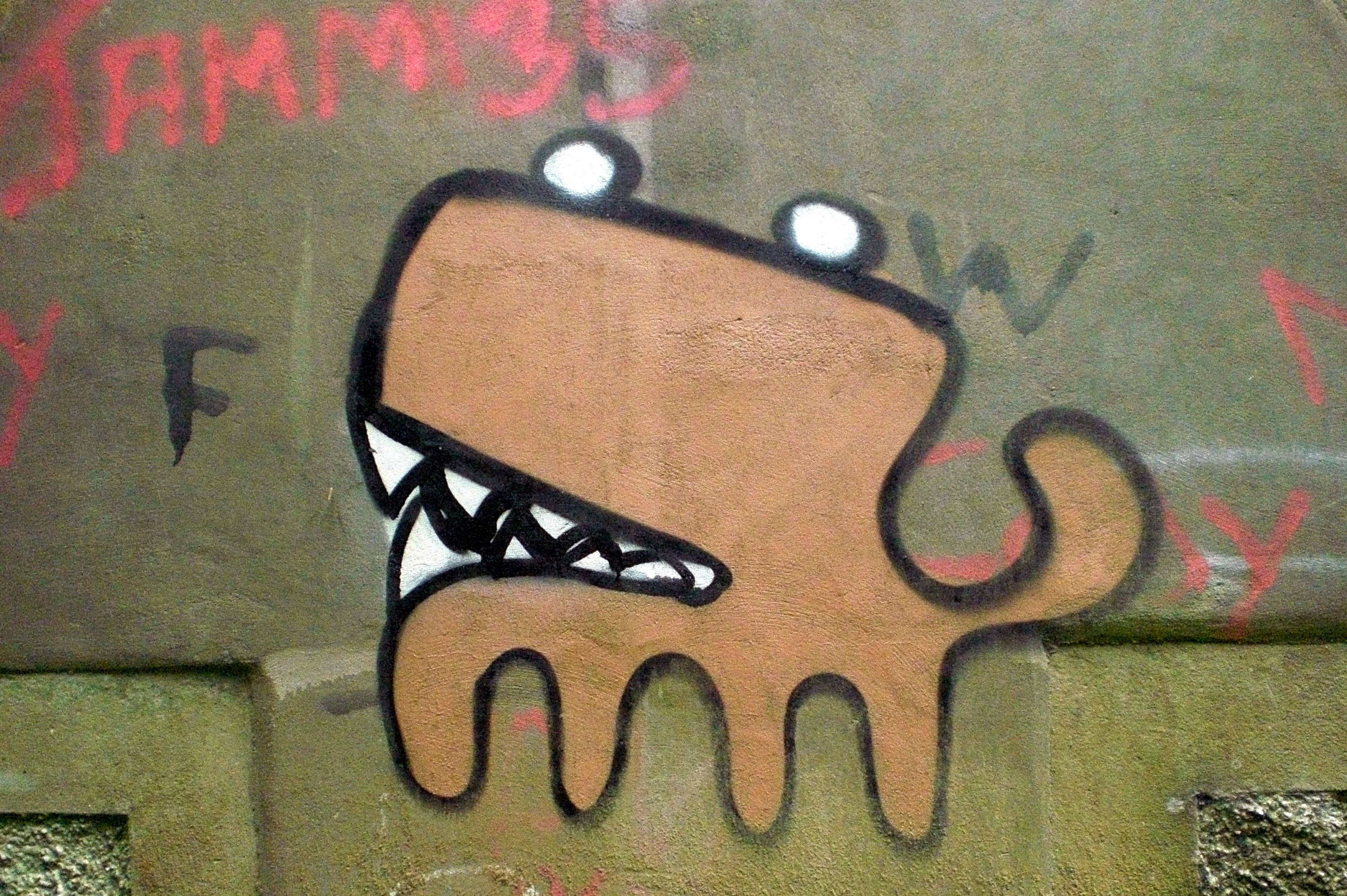


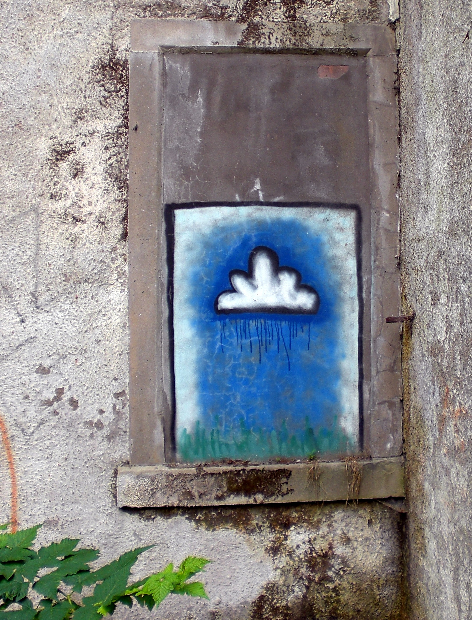
Interesting in that all of these shots, the green leaves of nature always encroach into the frame.
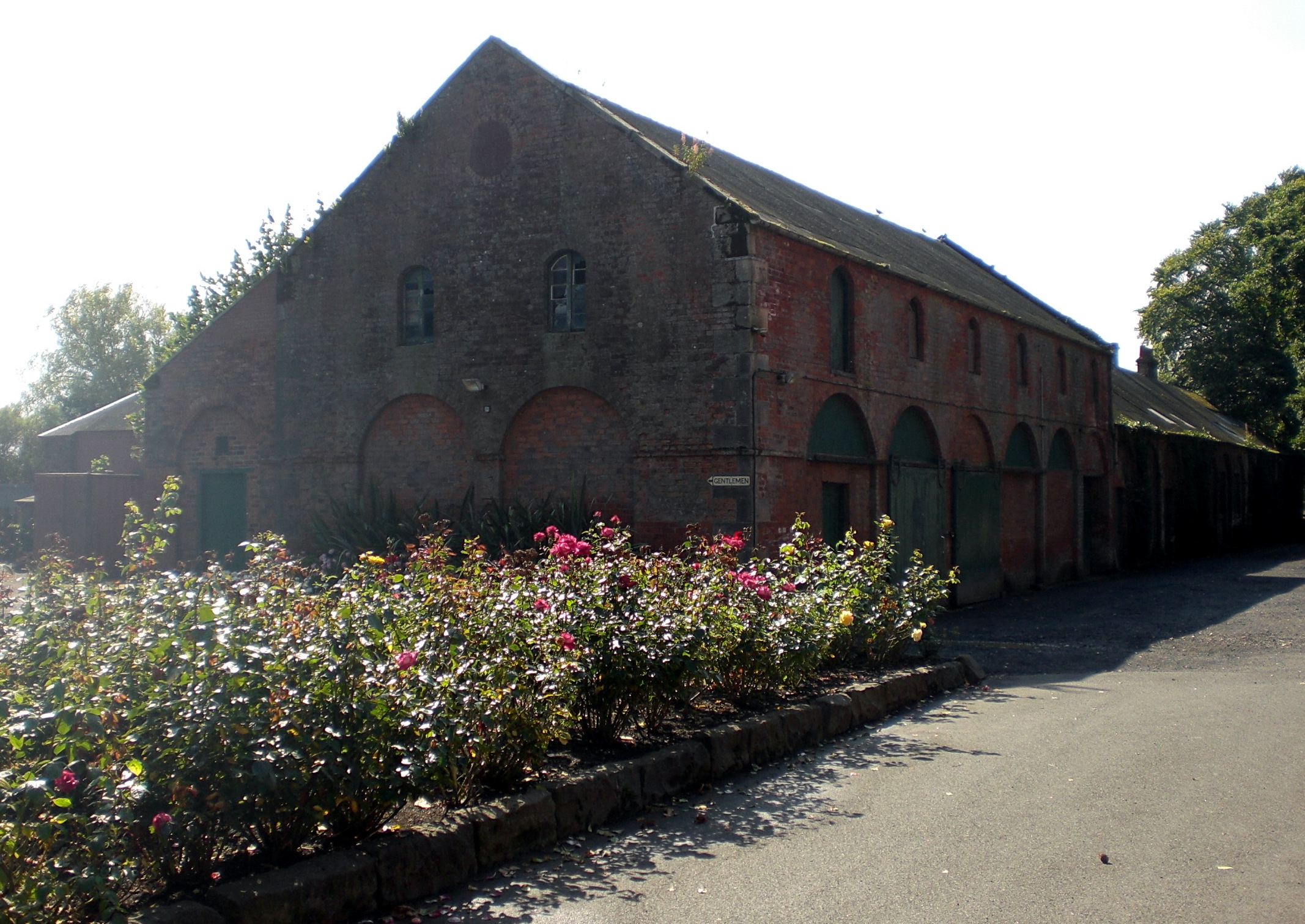
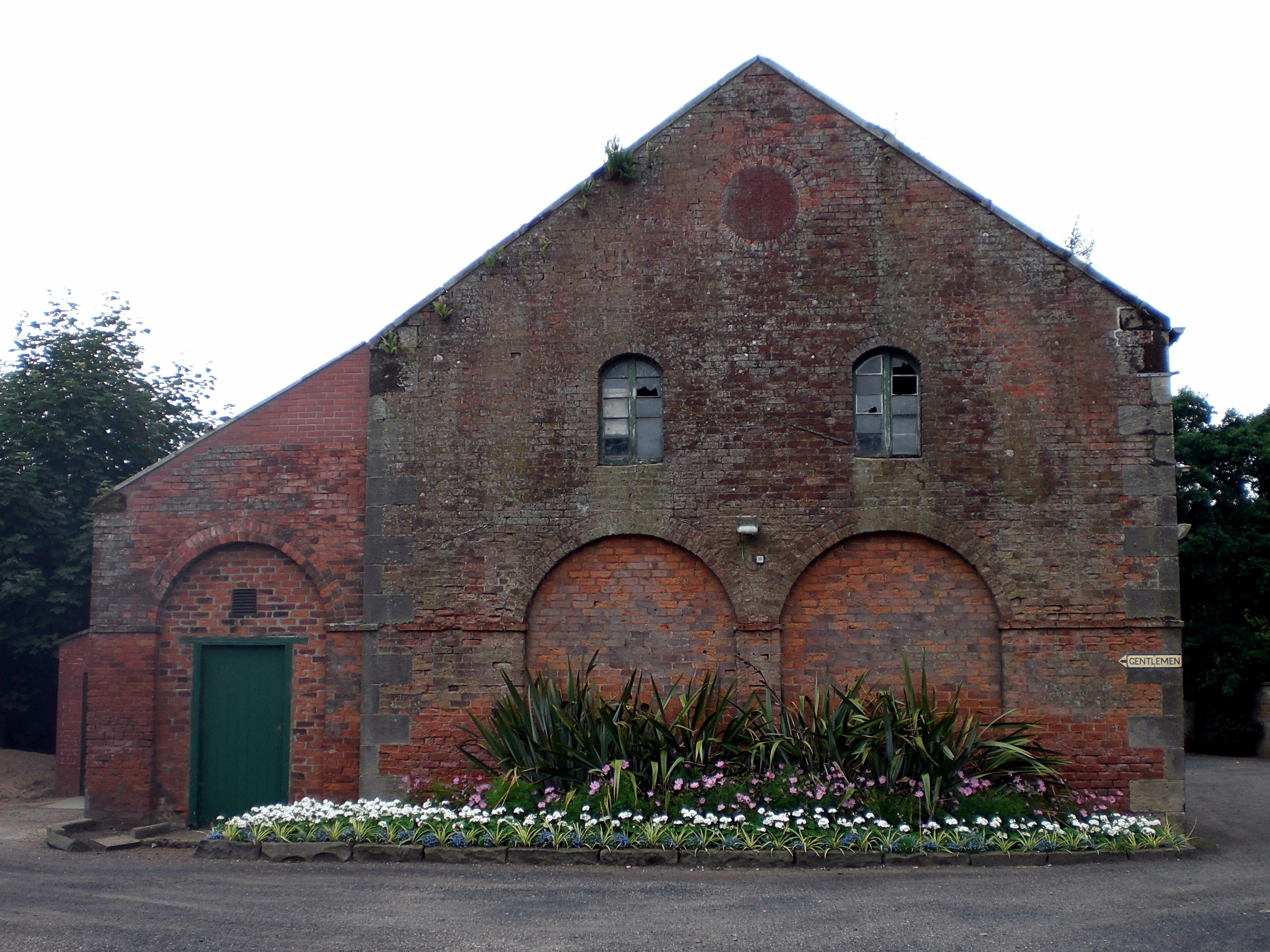
Silverburn House
Once a home to the Russell family. Old, super-8 film shows children playing and running around on the lawn in front of the house. Adults relax in deck chairs, smoking and chatting…
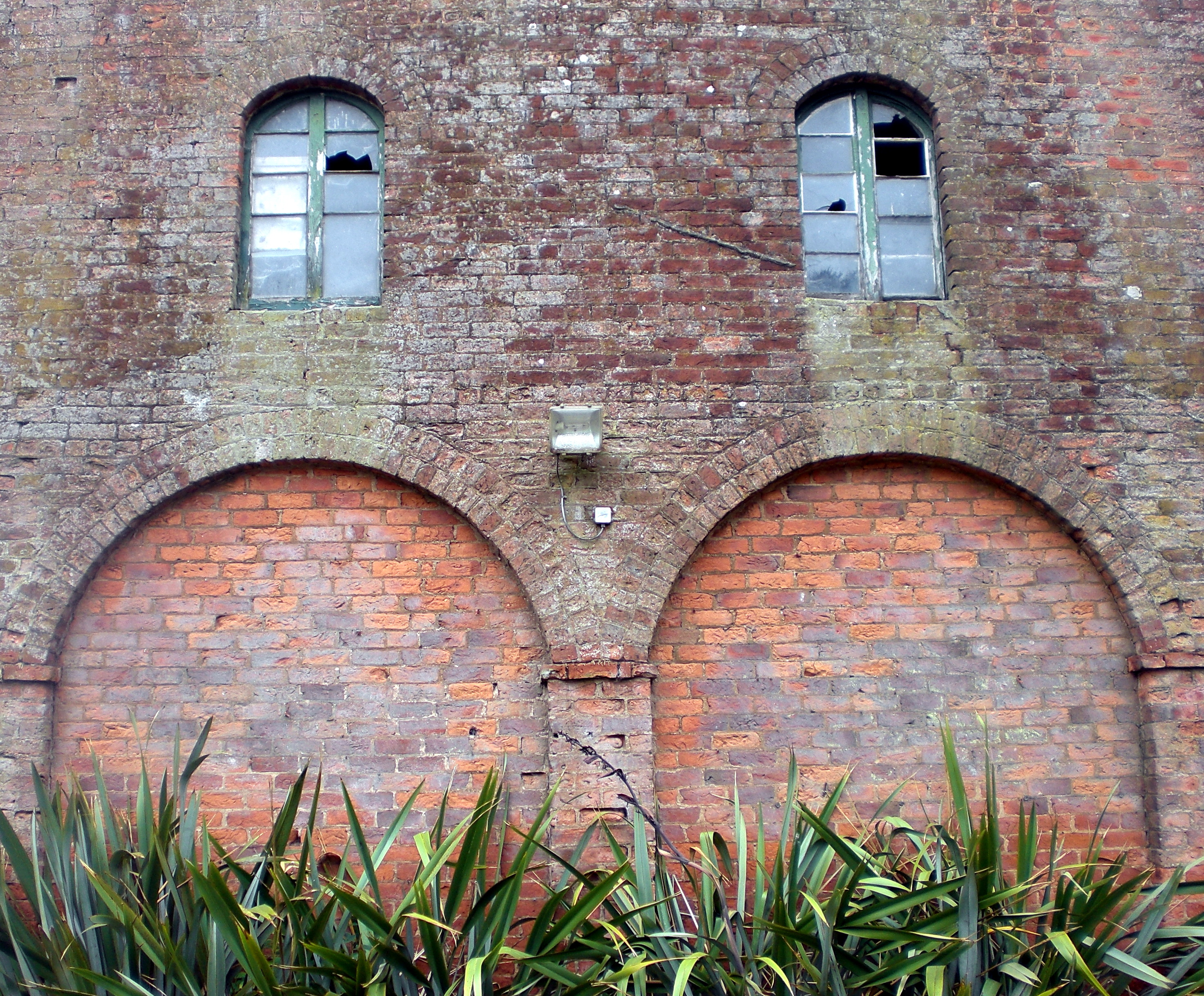
Now, like Corriemar, Silverburn House is sealed up and dangerous:
Broken Flows:


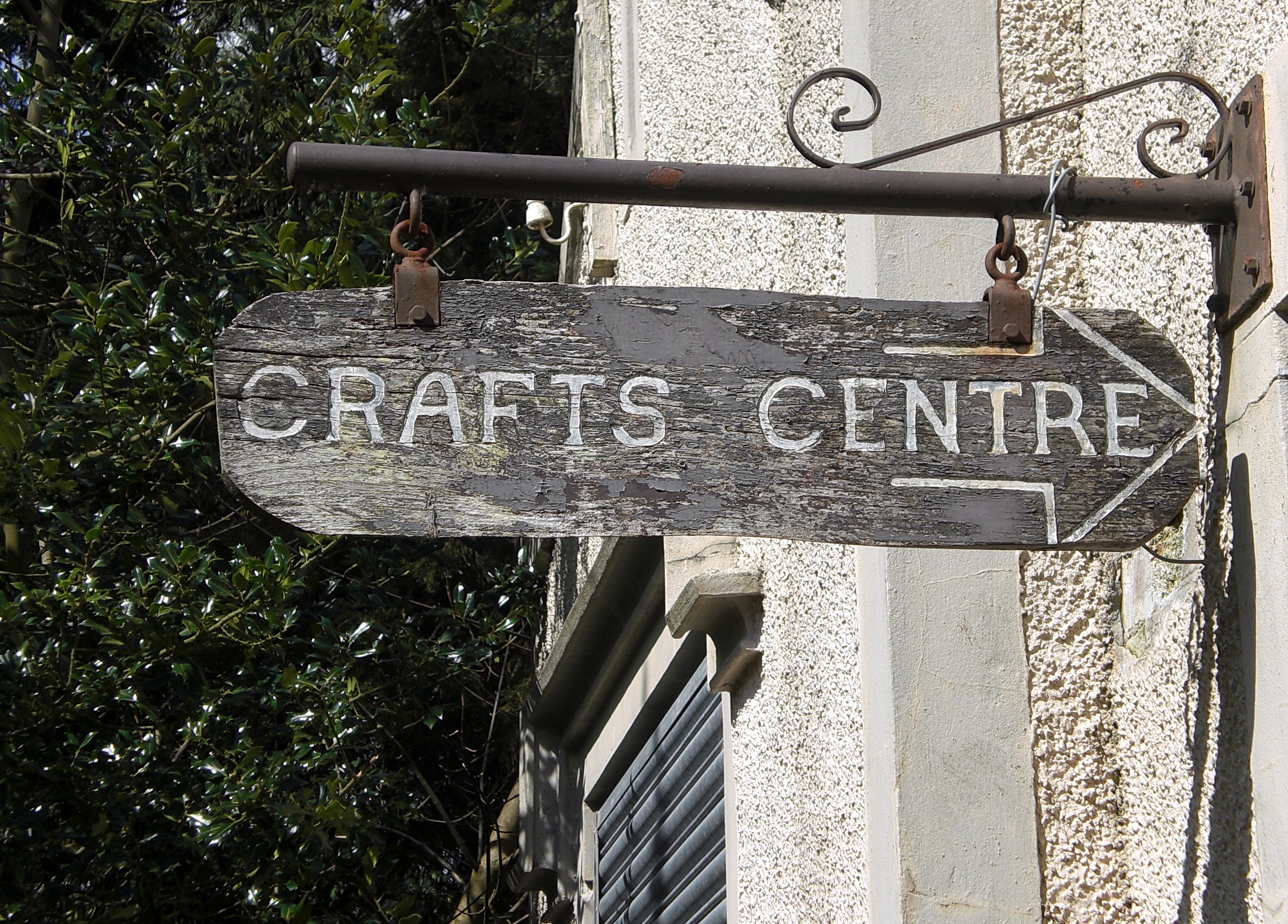
The entrance to the old crafts centre:
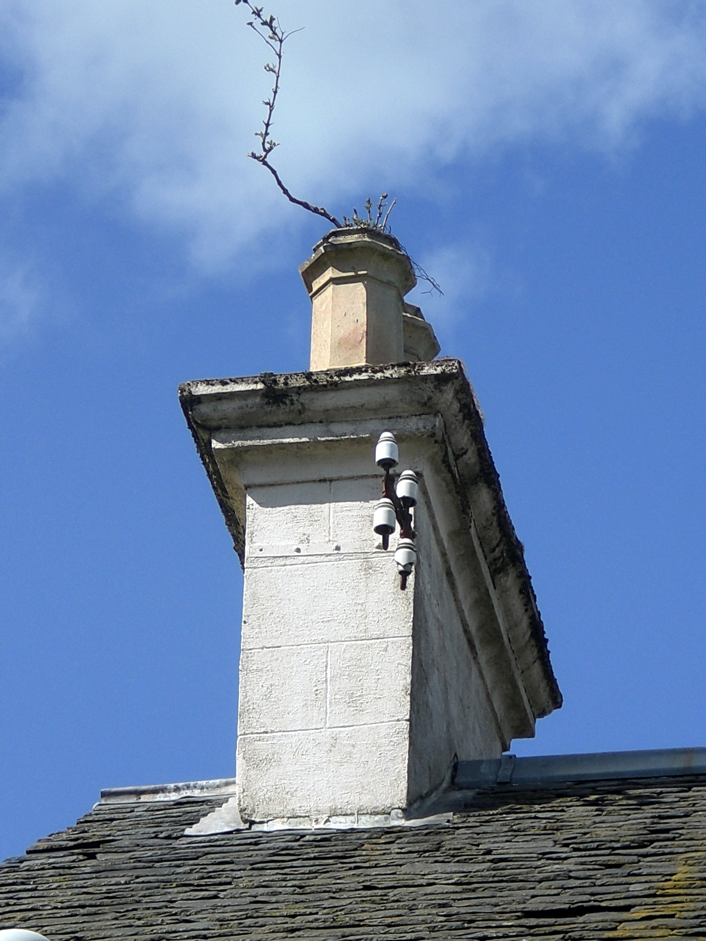
Stretching for the sky:
On our last visit, we noticed a new addition. Some outdoor seating has been added, fashioned out of tree trunks:
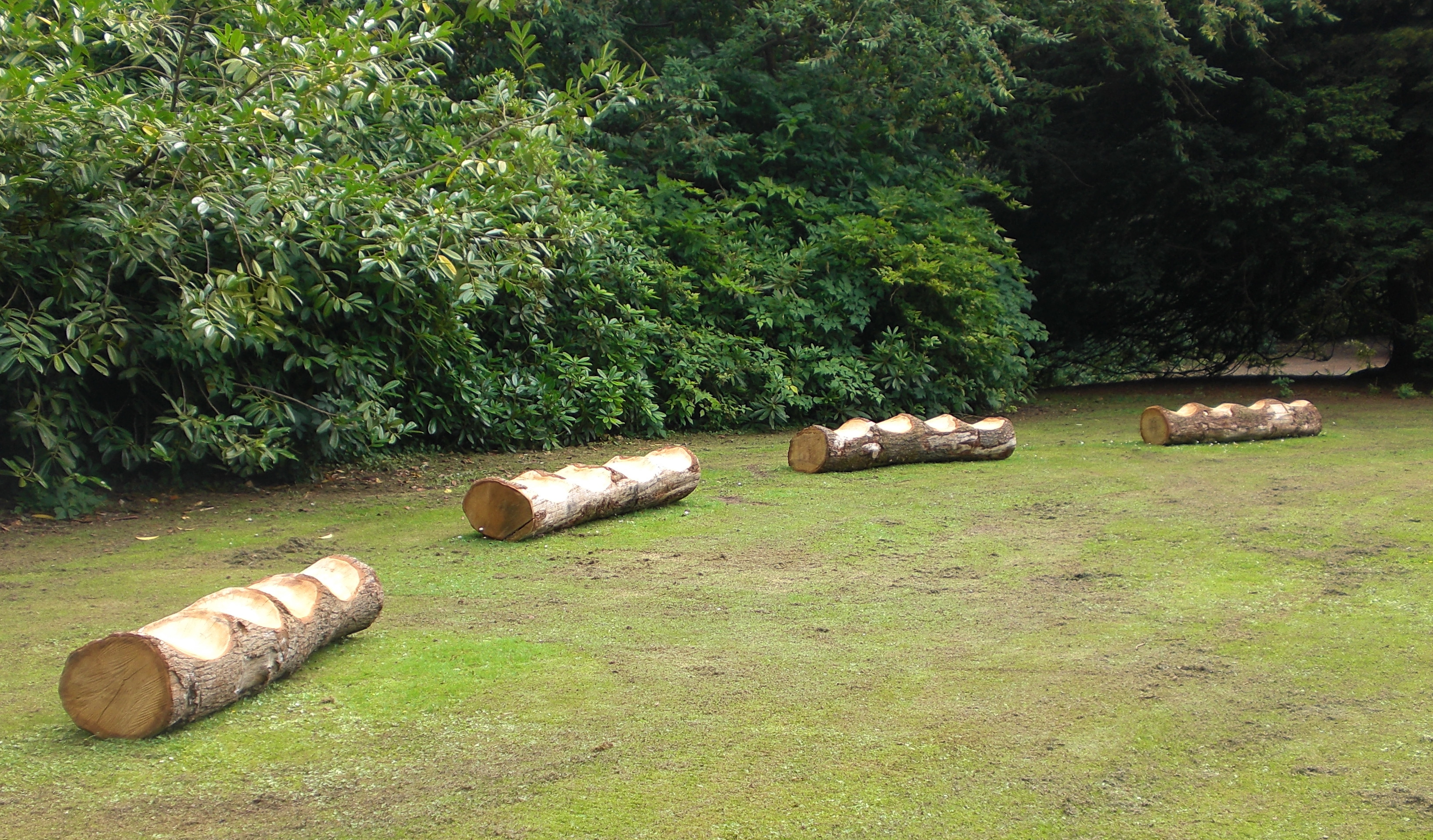

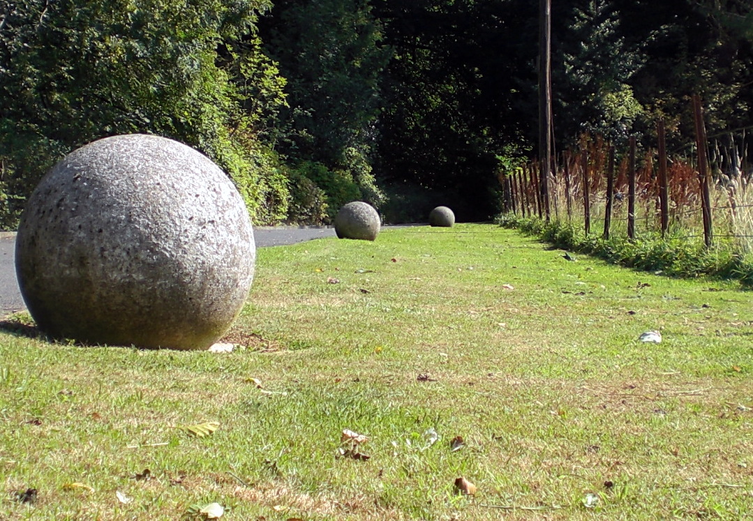
And at the opposite end of the lawn, a collection of shamanistic divining posts in the family sculpture area:


As is common with any drift, with a little attention, a surreal world can reveal itself:
The shoe tree:

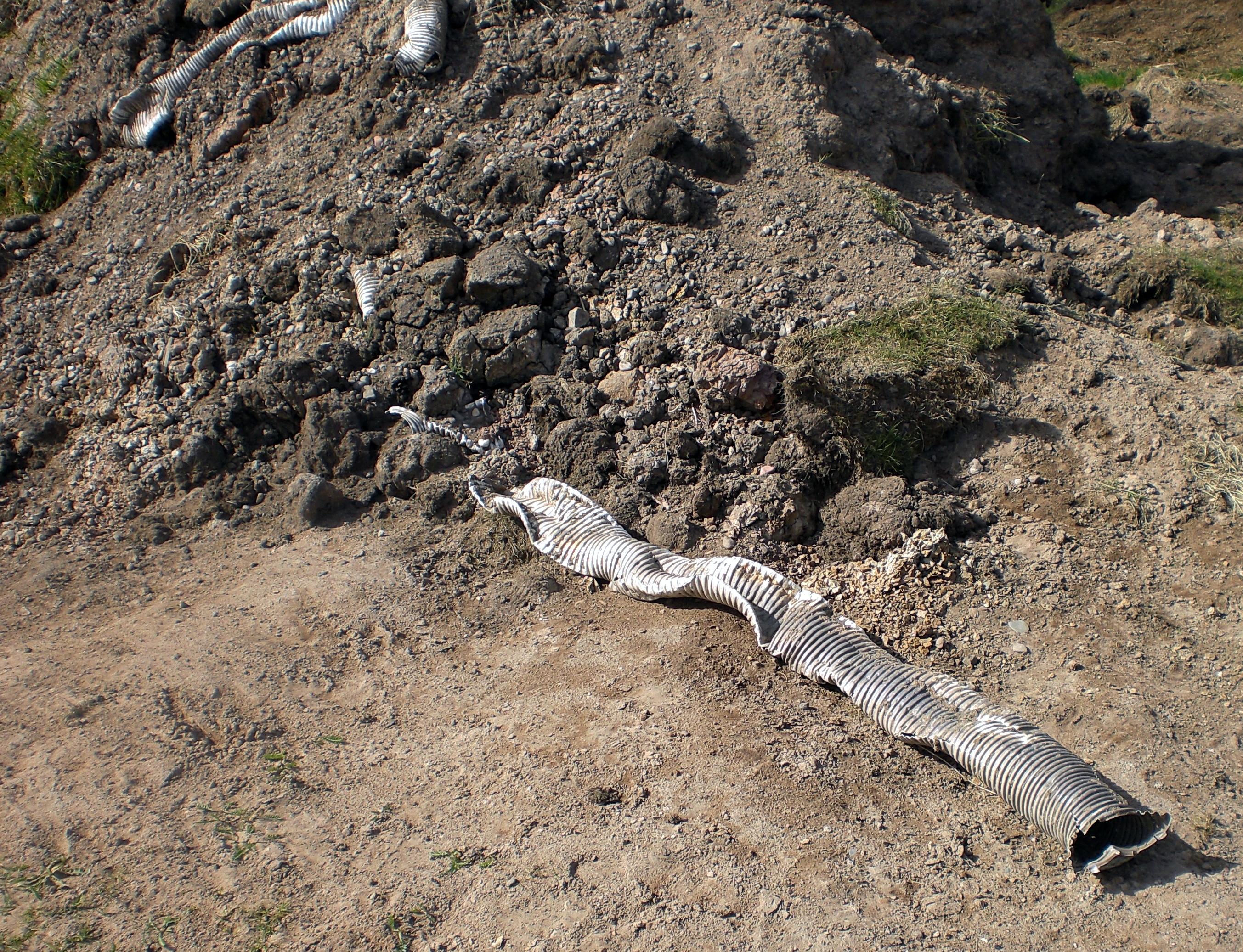
The worm mound:

One tries to wriggle free:
The giant pencil:

The stalled roundabout:

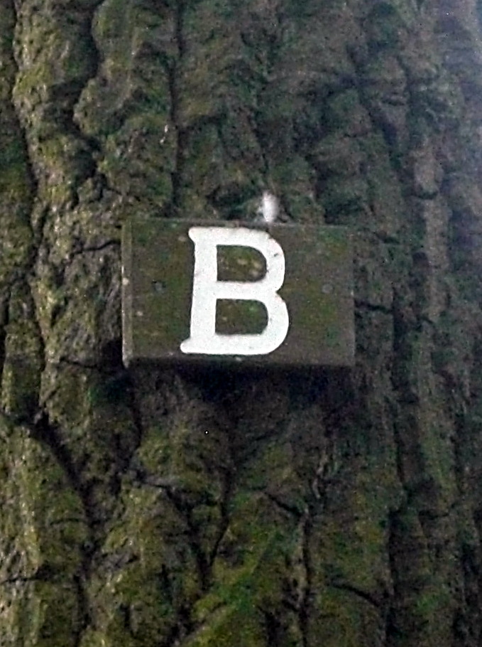
The unknown and undecipherable signs:

.
.
≈
One visit, late Saturday afternoon, a dull twilight. No other humans around and even the bird song is subdued. Only the rustle of leaves – hopping blackbird and scurrying rabbit. The fungi radiate a pale light:

A message from the trees:

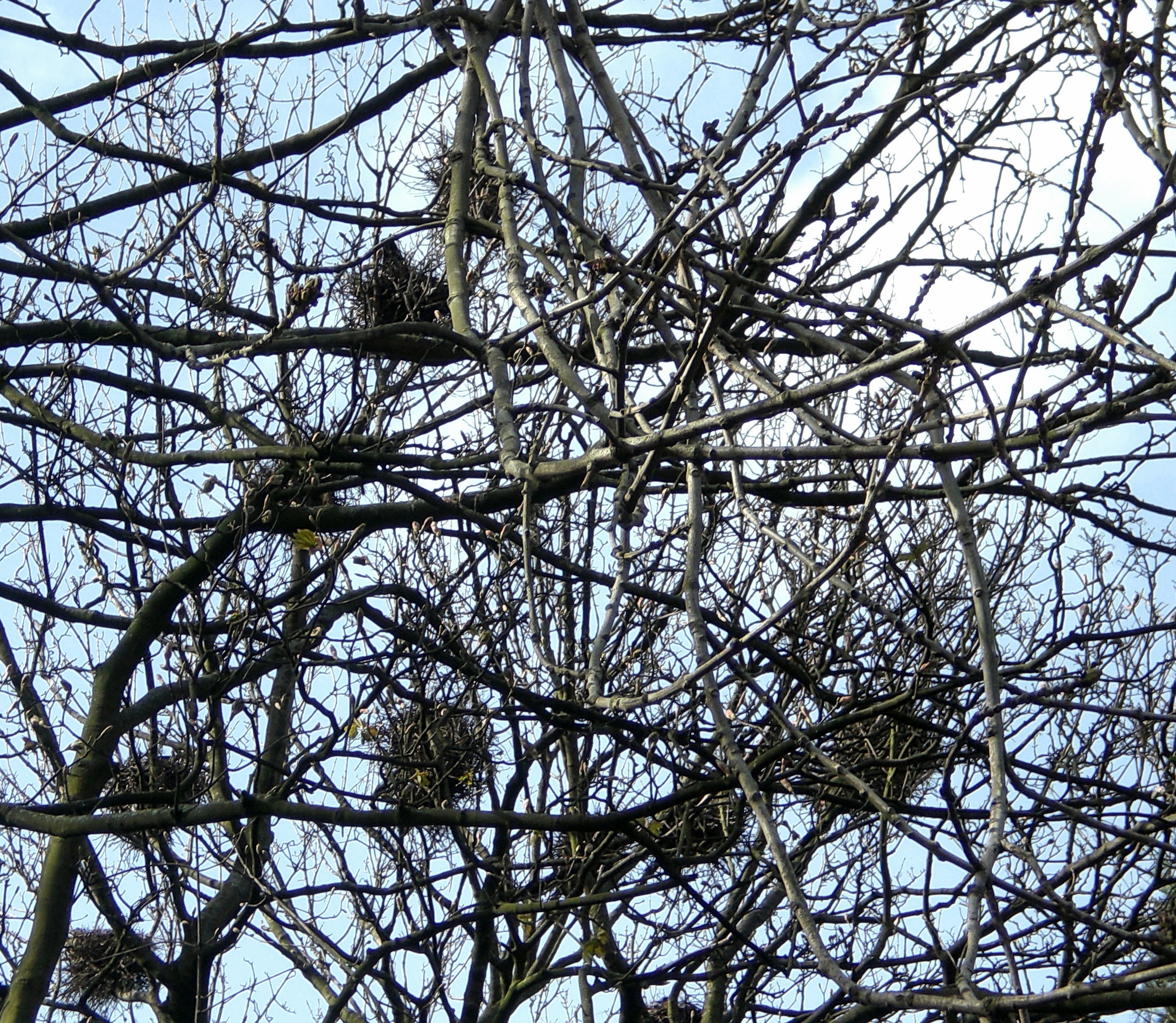
Stare for long enough and the tree spirits begin to reveal themselves:
dog-bear
Tusked boar
Cyclops
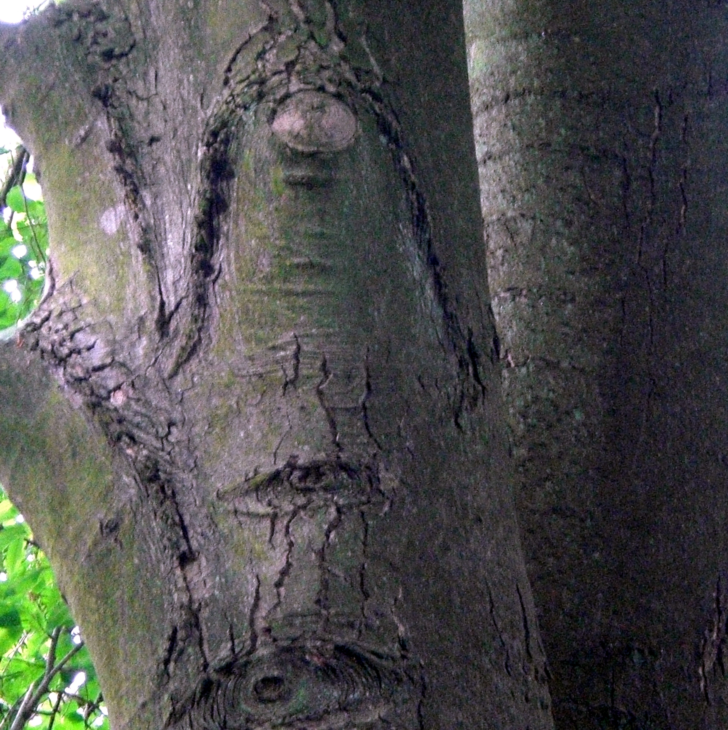
Preying Mantis
 tentacle clawed … ?

≈
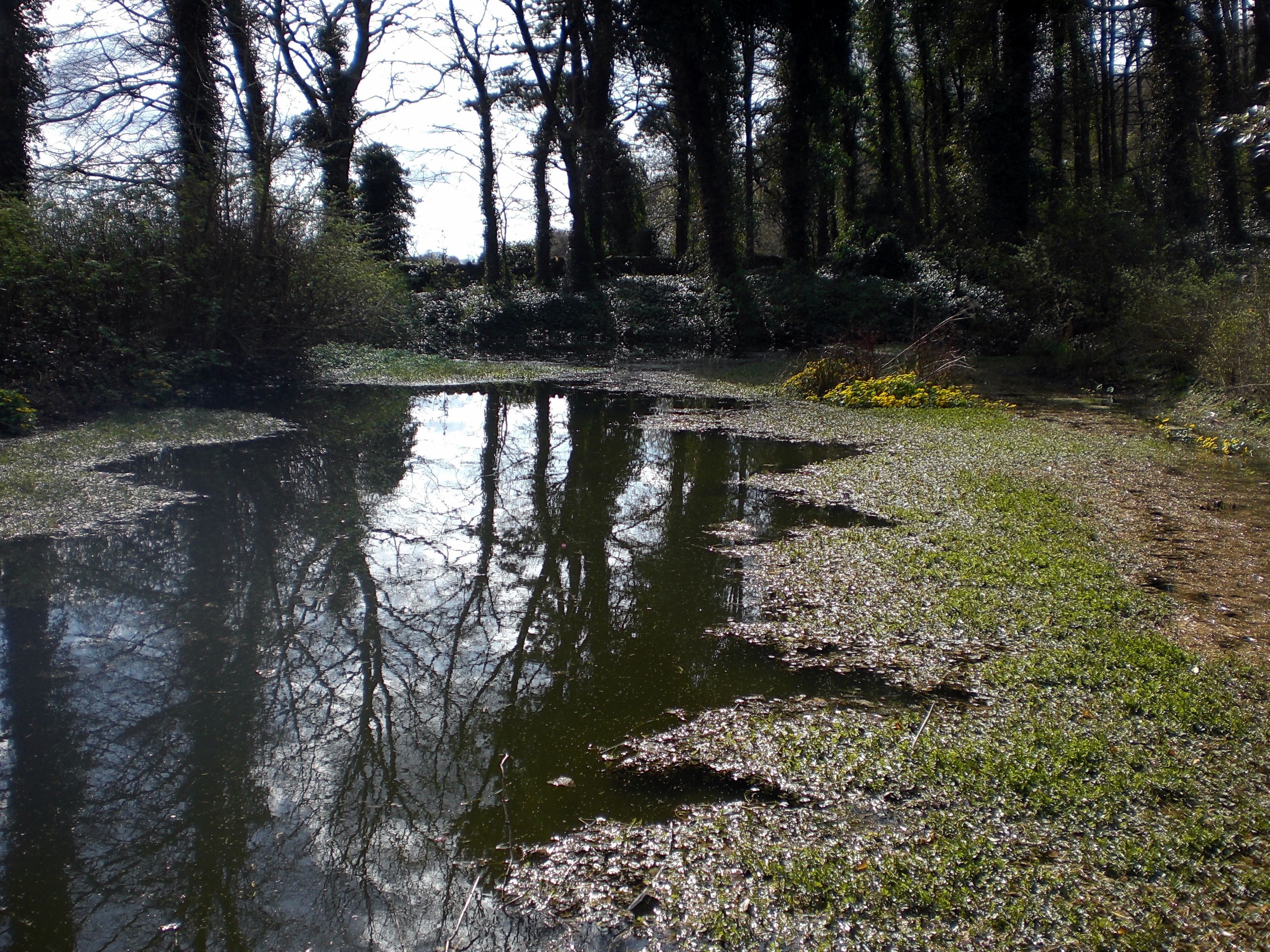
The Flax Mill & Retting Pond
On the lower level of Silverburn sits the Flax Mill and its associated retting pond.
Retting is a process which employs the action of micro-organisms and moisture on plants to dissolve or rot away much of the cellular tissues and pectins surrounding bast-fibre bundles. This process is used in the production of fibre from plant materials such as flax and hemp stalks and coir from coconut husks.
The flax mill was built in the mid 1800s and was one of the first industrial buildings to be roofed with a ‘new material’ called corrugated iron. Flax fibre was prepared for spinning at Silverburn and was soaked in the retting ponds for about 10 days, after which it was thrashed. Retting Ponds were brought into play after an Act in 1806 prohibited the use of local streams due to excessive pollution which occurred from the process. The flax mill itself was run on steam power. The mill closed in 1930, although, as previously mentioned, the outbuildings were used for the mini zoo during the 1990s. Today, the brickwork is failing in some places, with over 50% of the brick turned to dust. An adjacent row of cottages were probably built for the flax mill workers and remain used and in good condition today.

Look out for the face in the factory:
and the quizzical ghost:


.
.
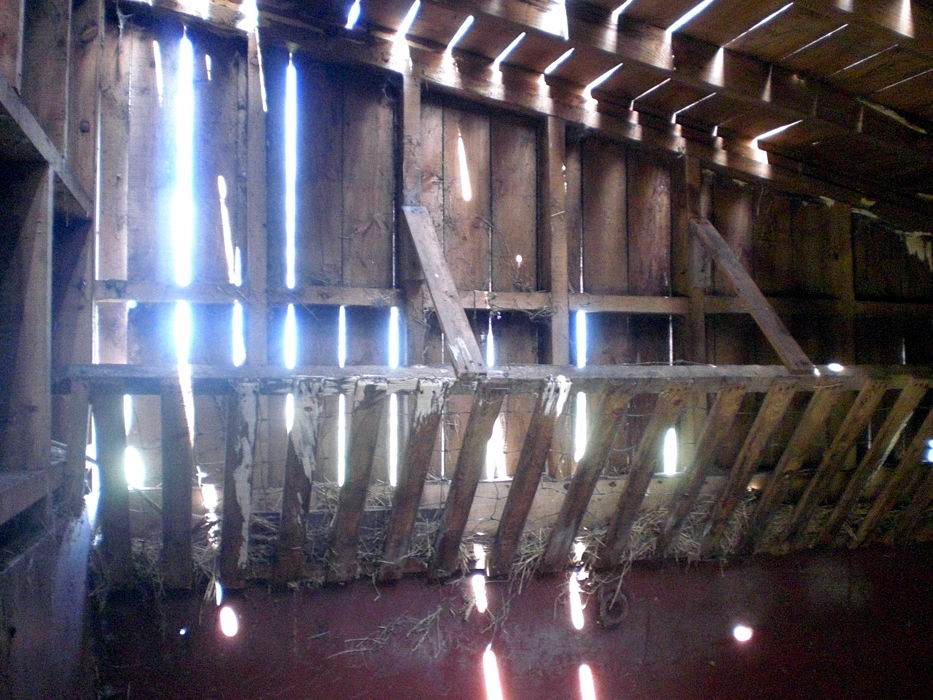
The outbuildings:

The old stables:

Inside the old stable
the darkest corners – bleed
in slatted sunlight
The retting pond where the flax was soaked is close by. Now heavily overgrown with vegetation, it is a meditative spot to watch the reflected trees in the water and the teeming pond life on the surface:

≈
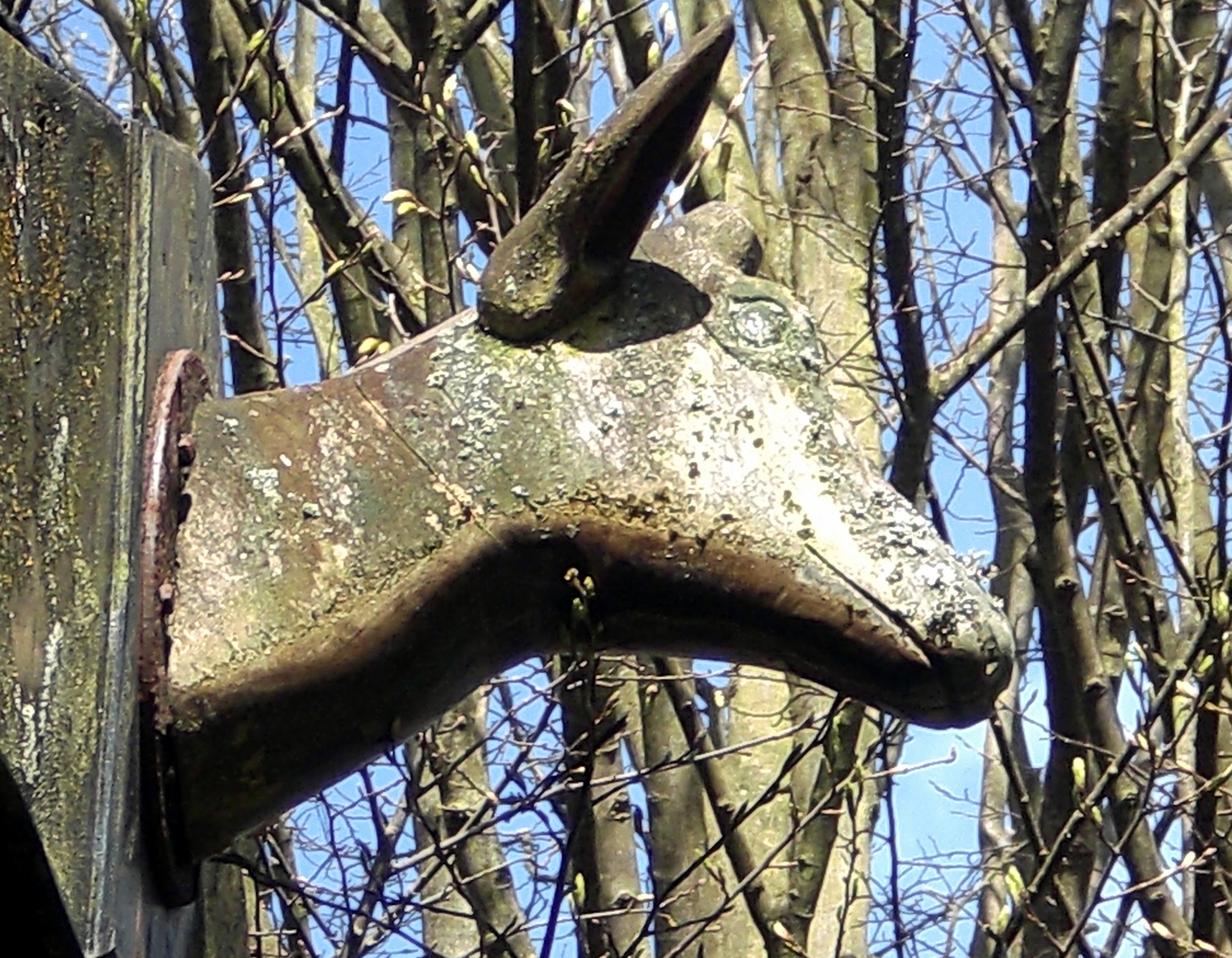
The Tree House and Formal Gardens
How could anyone not be captivated by the tree house? It looks as if it could walk away at any moment on its stilted legs:

The sense of being watched by the animal heads on either side add a touch of the uncanny:

.
.
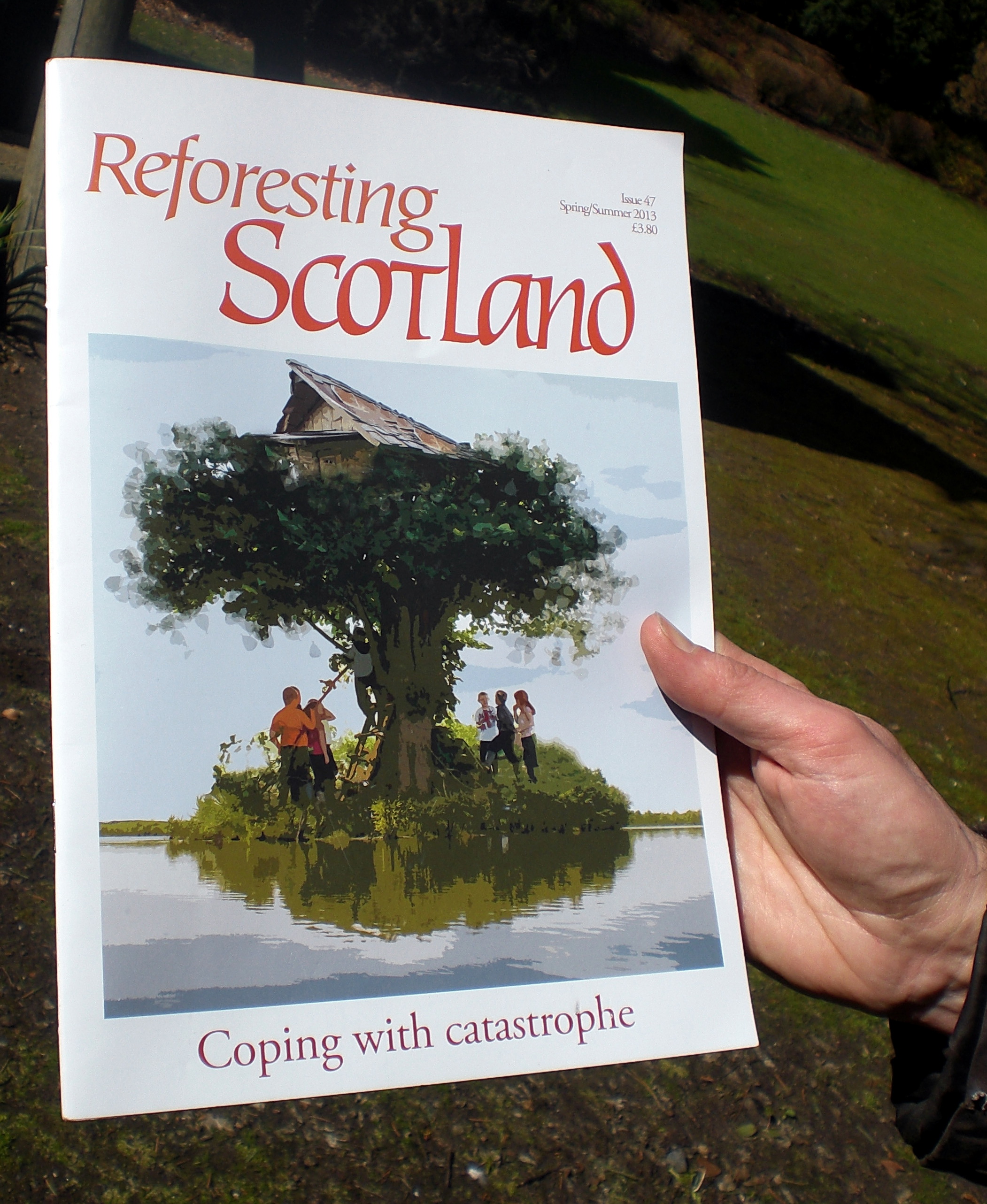
By complete coincidence, N has a copy of Reforesting Scotland in his bag. The cover illustration an echo of what we are standing underneath:
The formal gardens, also comprise a sensory and walled garden. They are clearly places of meaning and memory. On our first visit, we find a wreath of knitted flowers:


By the time of our second visit they have gone. There are also the lives commemorated and remembered. Emotional linkages between people and place.

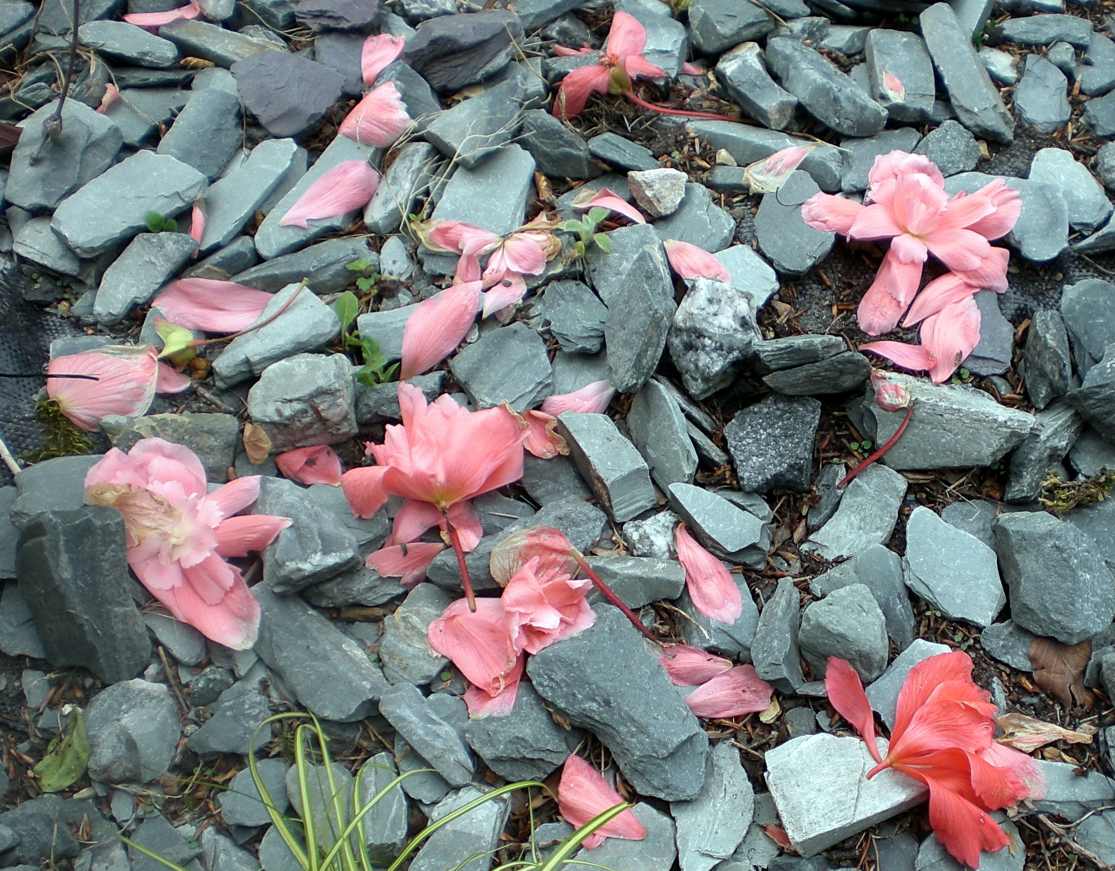
From the sensory garden, the gentle trickle of running water projects around the natural amphitheatre. Bees congregate upon yellow and pink petals shower down on grey.


Perhaps there is also evidence of the cunning folk at play. A small entrance through a hedge; a portal to another world?

≈

What is in a Name?
We leave Silverburn to head for the coast once again. Following the flow of the burn back down Mile Dyke to where the silver stream meets the sea.

We reflect on the name:
Silver – precious, with, the highest conductivity of any metal, allowing energy to flow.
Burn – always in flux/flow. As Heraclitus said, you never step in the same river twice and we know we will never visit the same Silverburn twice. There is also the idea of how prescribed burning of vegetation can recycle nutrients tied up in old plant growth to invigorate new growth. With the current FEAT and community initiative ‘Heart Mind Soul Silverburn’ perhaps new possibilities for Silverburn are emerging.
And to end. A whispered message from a beach encounter:

≈
To end with a name and only the name. To end with only the letters of the name:
.
Silver sun sliver –
burrs liven us.
.
River veils runes
in blue siren lures.
.
Briers line ruins,
burn rises in
river lens.
.
Vein in burn
silver in vein
burn silver
S i l v e r b u r n.

Now playing: The Necks – Silverwater
References:
Buildings at Risk Register for Scotland
County Folk-Lore Vol VII. Examples of Printed Folk-Lore concerning Fife with some notes on Clackmannan and Kinross-Shires collected by John Ewart Simpkins (London: Sidgwick & Jackson for the Folk-Lore Society, 1914).
John Steinbeck, Travels with Charley: In Search of America. (New York: Viking, 1962).
Marysia Lachowicz, Polish Army in Fife. (Work in Progress).
With very special thanks to Margaret and Aiveen for the invitation to “come and see what we make of it” and also Aiveen, Margaret, Graham and Ninian for inspiration and sharing that first visit.
≈
Three steps may be all it takes to alter our perception of place
≈

A fairly idyllic view taken last weekend from the Fife Coastal Path at Dalgety Bay. An expansive sky animated by great dollops of scudding cloud, mirrored in the calm, glassy sea. Inchcolm Island lies straight ahead and over to the right, the contours of Edinburgh and Arthur’s Seat ink the horizon.
Waders and gulls amble and preen on the bay foreshore with divers, ducks and the occasional seal bobbing in the deeper water.
≈
take three steps back
o
n
e
≈
t
w
o
≈
t
h
r
e
e
≈

…
You find out that you are actually standing on radioactive contaminated land.
The contamination is believed to originate from the residue of radium coated instrument panels that were used in military aircraft. Between 1946 and 1959, over 800 planes were incinerated and the ash was land-filled in the area.
Radioactive material was first detected on a part of the foreshore in 1990 and, since then, more than 1000 radioactive items have been removed.
It has taken twenty-three years for the MoD to be ‘officially’ named as polluter of the site by the Scottish Environment Protection Agency (SEPA). However, the MoD continue to prevaricate in actually admitting responsibility and most importantly undertaking remediation options. This week, the can has been kicked forward, once again, until September when another ‘discussion’ between SEPA and the MoD will take place.
There is a possibility that SEPA will be required to formally designate the beach at Dalgety Bay as a radiation-contaminated area. If this happens, it will be the first such designated site in the UK.
“It would be extraordinary that in a Britain that has nuclear storage sites, nuclear processing sites, nuclear weapons and nuclear waste, the beautiful beach at Dalgety Bay would stand out as the first and only radiation-contaminated site in the country.”
(Gordon Brown, MP, Hansard, 9th July 2013)
The layered traces of human activity embedded in the land takes on another dimension when the presence of absence can be measured in half-lives.
Now playing: Sun Ra – Nuclear War.

It is often the shortest journey, undertaken with least expectation, that offers up an excess of possibility beyond what we expect to see.
It’s always worth exploring the other side of the barbed wire fence.
Never keep to the path.
(Extracts from FPC Field Guide).
Time constrained by commitments later on in the day and yet compelled by the need to go for a walk, we settle on a local part of the Fife Coastal Path. The very short stretch between Inverkeithing and Dalgety Bay is a narrow tarmacadam / cinder ribbon of a mile, or so, that meanders around the coastline. Whilst offering fine views of the Forth Rail Bridge and over to Edinburgh and Arthur’s Seat it is unlikely to trouble any tourist brochure. Indeed, the walking guide for the Fife Coastal Path devotes one short paragraph to it. There is a clear implication that this is a space that you can simply pass through. It is also a functional path, popular with dog walkers, leisurely strollers and is even lined with street lighting. However, as the sign above indicates, the traveller is asked to keep within the marked path. We cannot help thinking of Little Red Riding Hood but can only read the sign as an invitation to stray …
There is a distinctive topography to the land along this stretch of the path which edges around Inverkeithing Bay with sloping scrub and wooded elevations up to Preston Hill and Letham Hill behind. These factors and lack of road access, has prevented any urban coalescence between the nodal points of the old industrial harbour of Inverkeithing and the 1960s new town of Dalgety Bay.

However, there is also a distinct feeling of crossing a threshold, as you escape the gravity and material ephemera of the human settlement, and move into this zone from either end. A feeling of the wildness encroaching, long forgotten histories written into the land, whispered stories at the periphery of perception. A freeing up of the rules.
~~~

Leaving from Inverkeithing, we walk past a row of lock-ups, that are not without some semblance of aesthetic beauty in their irregular order and contrasting colours. You wonder what is behind these out-of-the-way closed doors? Some have obviously not been accessed for some time given the overgrown vegetation in front. We also notice that as soon as you pass the last lock-up, the wild space is already there, encroaching green fingers, edging into the human space and into the photo frame. There is also a rather cryptic graffiti announcement:


We are not sure whether to read this utterance as a comment on some existentialist predicament (“Out of it”) or a marker post to signify a transition point of moving out of the urban setting. (Moving oot it). Later on, when we reach the Dalgety Bay end of the path we find more graffiti on the first inhabited house. There is a clear sense that both of these graffiti bookend an entry – or exit. We read these signs as an intimation that what lies between these threshold markers is a different place – a zone. Not urban, yet not rural. Not even ‘classic’ edgeland. Instead, an indication that what lies within is an escape from the ostensible order of the settlements. Possibly a play area, a hidden place, an out of sight place, a gathering place, a wildness.

We are not far out of Inverkeithing when our advice to keep to the marked path is quickly discounted. We are drawn to the barbed wire topped, chain wire fence that we can see across a flat area of post industrial wasteland off to the left. It’s a pretty feeble attempt at preventing access as a whole section has been removed and most of the barbed wire has been snipped off.
We follow the well trodden desire path through the fence to find ourselves in the heart of the abandoned Prestonhill Quarry, now filled up with water. There is a compelling, uncanny beauty to this place. A void gouged and hewn out of the Earth, with the remaining dolerite walls reflecting weak sunlight like a cubist canvas. The acoustic ambience has also noticeably changed. We are in a huge reverberating chamber so that the slightest noise pings around the walls. A distant ice cream van sounds as if it should be coming from somewhere within the quarry, possibly submerged underneath the water. At the same time swallows dart and zig-zag above our heads, whilst magpies hop and skip around the top rocks, observing us with curiosity. A couple of buzzards circle in the distance . There is no one else around.


What is noticeable is that even in these most barren of conditions, non-human nature is restaking a claim with outcrops of growing vegetation, clinging to the quarry walls, thriving in the most hostile of conditions and the thinnest scrapings of soil.

We soon find the ubiquitous discarded fridge. Lying face down, its broken body surrounded by other accumulated fly tipped debris. The human stain of the dumping ground. It is always a puzzle to consider the time and energy it must take to fly tip a fridge in an ‘out of the way’ area, such as this, compared with taking it to the recycling point. Perhaps it’s for the sheer visceral thrill of throwing a fridge into a quarry. We assume that it has been pushed over the top and has been there for some time.

~~~
There is perhaps another attraction of the quarry. It is an unseen place with very deep water. Every surface has another side. What else lurks underneath the skin of calm blue water? What is submerged down there in the green depths with the little fishes?
~~~~~
g
o
i
n
g
~~~~~
b
e
l
o
w
~~~~~
t
h
e
~~~~~
s
u
r
f
a
c
e
~~~~~~~~~~~~~~~


All underwater photographs of the quarry are by ‘Zibi’ and can be accessed here along with many others. Whilst we have attempted to seek permission from Zibi to use these images, we have not received any reply to our request. Clearly if our request is subsequently refused we will remove the photographs from the blog but in the meantime were are grateful to Zibi for their inclusion.
It would appear that the quarry is also a favored disposal spot for stolen cars, making for an ideal symbiotic relationship with the diving community who find the quarry an attractive destination for underwater exploration. There is plenty to see and investigate below the surface. We are also told later that local fishermen stock the quarry with fish which they then try to catch again, fostering a fledgling underwater eco-system. There are rumours that someone may have introduced a pike.
~~~
The quarry is also clearly a gathering place. A hidden place of escape and unregulated recreation. We walk around the void, recording some of the many tags that have been written on to the rocks.


Staring up at the quarry wall and contemplating the material passage of time ossified in these rocks. The play of light on the angular shapes conjures up dynamic planes of movement and appear to imbue the rocks with an almost animistic quality. We can eventually see a cubist rock giant, emerging from time with right arm raised:

~~~
Back on the path, we head off to the right hand side this time.
Stretching out over the water is a fretwork pier of rusting metal which we find out later was the old industrial conveyor system used to load the quarried stone on to tethered ships.

We stand for a while to listen out for the lost sounds of this place. The kling klang ghosts of the industrial machinery, the heft of monolithic slabs of dolerite rattling down towards the waiting ships.
almost silent now
now almost silent
only the ack-ack-ack
of a solitary gull
riding the wind currents
overhead.

A large steel plate has been placed across the structure presumably in an attempt to prevent people from climbing out along the pier. It’s unlikely to be a deterrent but it no doubt satisfies some health and safety regime. The plate has rusted and weathered into something resembling a Richard Serra sculpture:


Once again, we can see how the wildness is staking its claim with tendrils of green growing up, through and out of the lattice structure. “Shugg and Leanne” evidence the human urge to make a mark. The basic proof of existence. A name recorded. A demonstration of love?

Running parallel to the fretwork structure is another abandoned jetty. The pulleys remain suspended from the cross beam conjuring up something of the gibbet or perhaps some form of cosmic launch mechanism to project the traveller up and into the pillows of cloud:

all of this
abandoned history
lost stories, forgotten stories
sounds of absence
whispering in the wind.
We decide to explore a bit further underneath the conveyor structure sensing that this may yield possibilities. We are not disappointed when we alight on this gathering site:


What is noticeable is that there is no rubbish strewn here. It’s as if this is a place of respect. Strangely enough, the atmosphere evokes a similar feel to another outcrop of rocks that can be found on The Binn (Hill) along the coast at Burntisland:

Humans have also made their marks on The Binn stones, albeit some 4,000 years earlier

~~~
We pick up a bit of walking pace to take advantage of the seascape.
a sounded wave, persistent and seductive –
plays the shoreline.
flux and flow of sea brine –
a spilling over
of elemental energy.
Once again the unusual topography is such that we can hear a mash-up of field and hedgerow bird song against foreshore waders and gull talk. A chorus of crows, darting finches and tits; a wren bobs along the wall before taking refuge in the trees. What looks like a falling red leaf is actually a robin. On the foreshore, oystercatchers, and curlews wade and waddle whilst fulmars, cormorants and herring gulls dive and swoop. Symphonies of birdsong and gull chatter.
It doesn’t take long to reach Dalgety Bay, but just before the threshold graffiti we come across this:

Roofless and abandoned, it looks as if all of the surrounding land has been sucked away from the foundations leaving it sitting like an old tooth stump.


We try to piece together a narrative here but fail. Why has it been abandoned? Why left to ruin? It was clearly a property that had wealth behind it at some point, sitting in its walled garden. Enquiries are made of a few passing locals but yield nothing. “It’s always been like that” says a man who looks to be in his forties. “Ever since I was a wee kid”. He doesn’t know the story though.
~~~
We are on the reverse trip back to Inverkeithing when we spot a small opening in the stone wall with a signpost:

How could we resist? Off up the rickety path which didn’t appear overly well trodden.

We find a beetle on its back on one of the steps clearly distressed. A multitude of legs. flailing wildly, unable to right itself. We soon tip it on to its feet and the little jet black shell scuffles off into the grass.
The path ascends fairly steeply and it’s not long before we find ourselves on a high ridge which slopes away towards Letham Wood. That will have to wait for another day. Our immediate area of interest lies off to the left. Another barbed wire fence and it’s as easy to circumvent as the last one. This is what we had been leading up to. We could already feel what we were about to witness but were unprepared for the sheer scale of it. Compared to the ground level, water-filled heart of the quarry, we could now gain a perspective of the entire void and walk right up to peer over the edge.


Peering over the side, into the void, it’s as if a vacuum is trying to suck your insides out. I’m reminded of Aragon in Paris Peasant and the ‘suicide bridge’ in Buttes Chaumont park – coincidentally built in a reclaimed stone quarry. Before metal grilles were erected along the side of the bridge, it would supposedly claim victims from passers-by who had had no intention whatsoever of killing themselves but found themselves suddenly tempted by the invocation of the abyss.
Our photographic skills are unable to adequately capture the scale of this almost mournful absence, hewn from the Earth. It’s a place to simply sit and stare for a while.
.
.
.
.
.
.
It’s often easy to forget to raise our heads to the horizon. Having escaped the seduction of the void, we now realise how high up on the ridge we are. It changes our sense of the whole topography of the area. We can see how connected we are to the East side of Inverkeithing and marvel at the long view over to Dunfermline. We can see Spinner in the distance with the distorted perspective making it appear as if it is growing out of a housing estate.

We later discover that there is also an abandoned WW2 radio station complete with intact pill boxes not too far away but don’t see them today. Another time.
We descend back down the hill to the coastal path and reflect on our experience. What we had anticipated as a short, local coastal walk had been transformed into something else. A journey through a zonal space teeming with encounters and traces of the human, non-human and even the animistic. A co-existence of dumping ground, liminal playground, gathering place and nature sanctuary. The transient narrative of human activity inscribed in the abandoned house and the mute quarries and jetties a reminder of how financial capital abandons one exhausted void to migrate to the next site of profitable extraction.
Above all of this, the continually changing drama in the sky:


And as we return to Inverkeithing we can smell the sweet wood lying in the still functioning timber yard and take one last photo. It’s only later, that we notice that in this photograph, and almost all of the others, there is some intimation of wild nature straying into the frame.
An alert wildness, observing, perhaps patiently waiting for its moment to come.

.
.
.
.
.
~~~~~~~~~~~~~~~~~~~~~~~~~~~~~~~~~~~~~~~~~~~~~~~~~~~~~~~~~~~~~~
This has been a little slice of:

From The

Now Playing: James Plotkin : Mark Spybey – A Peripheral Blur
Part of the Fife Coastal Path between North Queensferry and Inverkeithing. Supposedly named by Norse sailors, given its physical resemblance to an old witch’s nose.
The carlin caught her by the rump, And left poor Maggie scarce a stump.
For a small area, it has clearly always been a site of fortification and strategic importance given its extensive outlook over the Forth. Evidence of anti-aircraft defences still exist and the silent dolorite stacks show the extent of quarrying in the 1800s to help build the bases of the Forth Rail Bridge. The area is now a SSSI designated site and given its relatively small size supports a diverse range of habitat and plant life.
Field Gentian
Bloody Cranesbill
Lesser Meadow-Rue
Dropwort
Bell Heather
Harebell
Burnet Saxifrage
Hairy Rockcress
Fulmar
Grebe
Calcareous Grassland
Warbler
Finch
Hawthorn
Song Thrush
Bullfinch
Tern
Now Playing: Zappa – Make a Jazz Noise Here
