Embedded in the Landscape: Psychogeography, Folk Horror and the Everyday

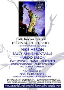
I’ve had a few requests to share the talk I gave at The Unseelie Court event organised by Folk Horror Revival in October.

So here it is:


 We’ll come back to that guy on the slide later.

I’m guessing that most people in the audience will be familiar with Ben Wheatley and Amy Jump’s film A Field in England. So, to kick off this talk, I’d like to invite you on a journey and imagine if you will:

 A Field in Fife:

 SLIDE

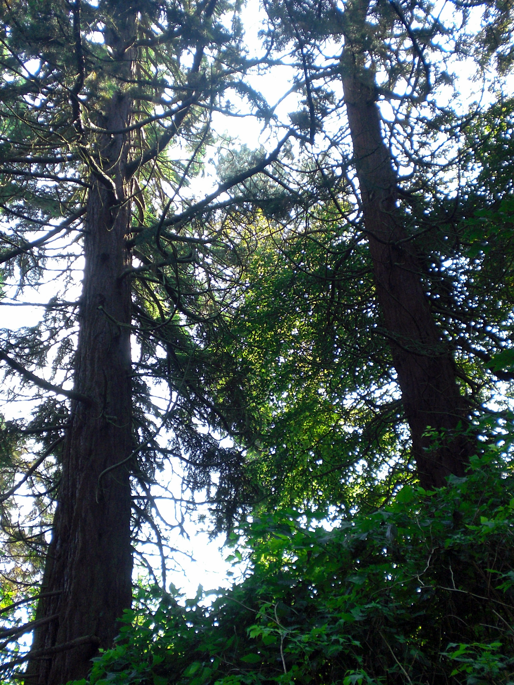
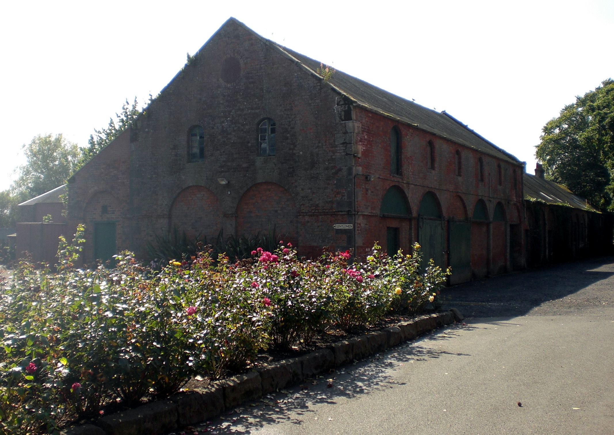
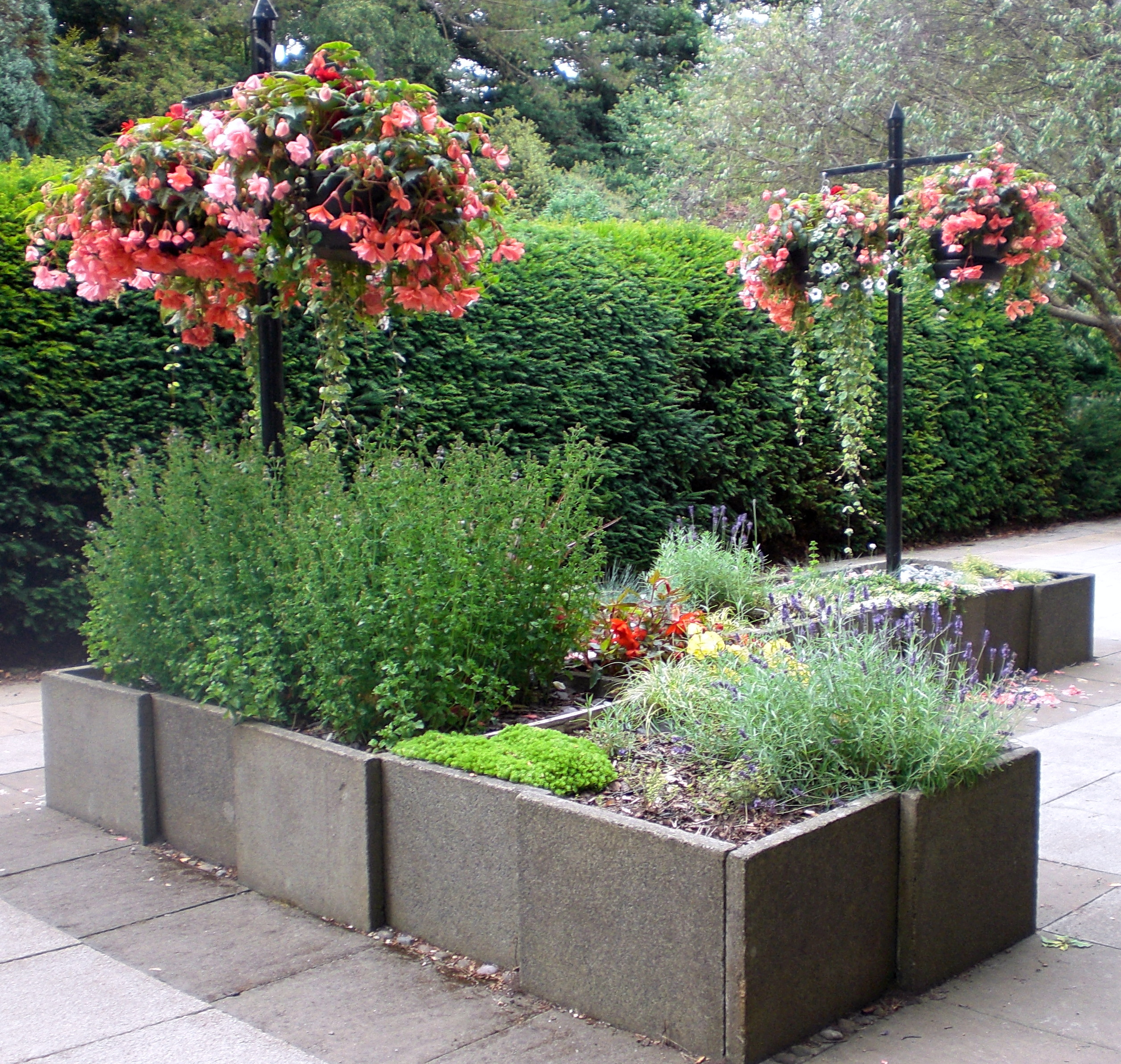
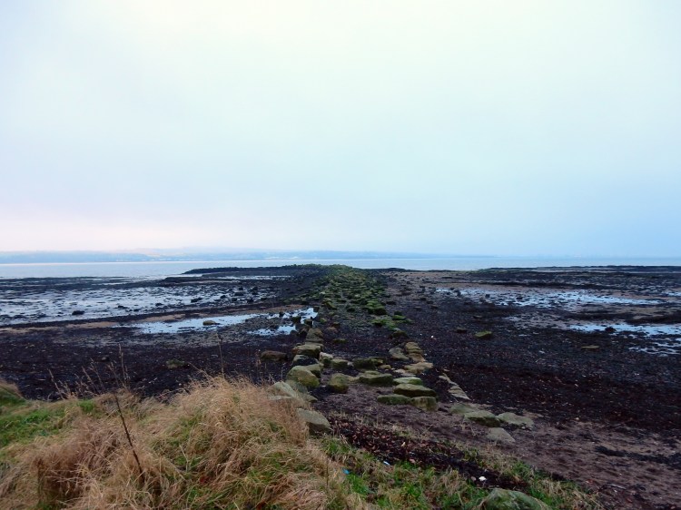
The commuters scurrying down the stairs at Rosyth Halt railway station, are unlikely to give much thought, if any, to the field on their left as they descend to the platform below.  Some may notice subtle changes in colour throughout the year. The recent appearance of yellow broom blossom; the overhead sun creating a dappled patchwork of greens, sandy browns and heathery purple. In a few weeks, the hawthorn blossom will sit like scented snow on the ancient hedge.

Standing at a certain part of the station platform, it is possible to hear the gentle purr of the Whinny Burn tracing its route through the field on its way to the River Forth at Inverkeithing Bay. Magpies, rooks and collared doves appear to take a curious interest in the arrivals and departures of station commuters whilst overhead, the sun splinters around the extended wings of a buzzard soaring like Icarus ever higher into the blue.

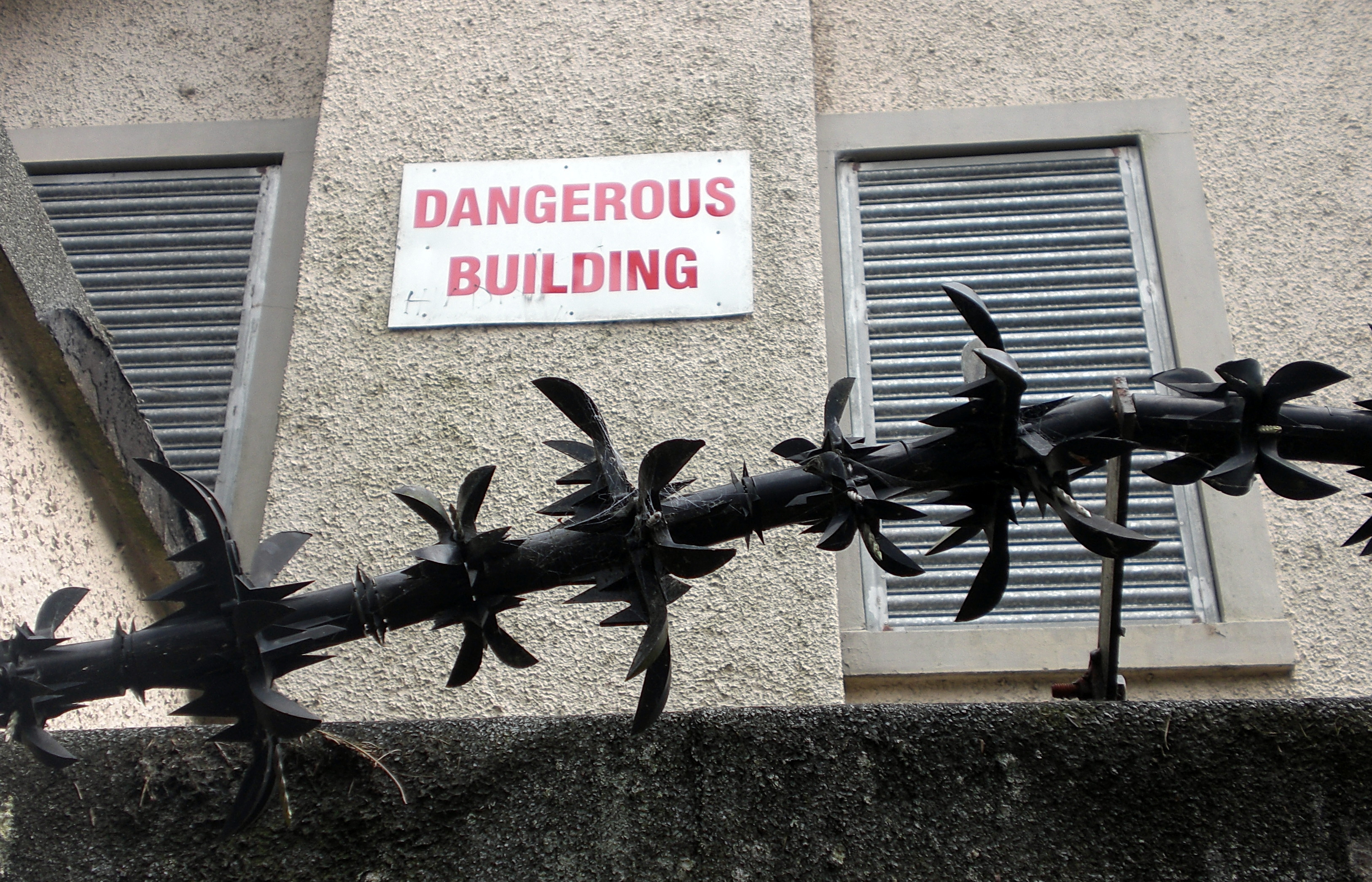
The field is now bounded on all sides by a motorway spur, a dual carriageway and the railway line. An almost sealed off and severed island of abandoned agricultural land cast adrift with no easy public access.

At the top of the halt steps, there are no particularly distinguishing visual features as we look out over the land which we are going to walk through. As a train arrives on the platform below, a late flurry of commuters hurl themselves past us and down the stairs to squeeze into the carriages before the doors close.

Most are unlikely to be aware that there may be as many as 2,000 bodies buried somewhere in the vicinity.

July 1651

It was during the night or early morning of 16th /17th July 1651 that the troops of Oliver Cromwell’s New Model Army landed on the north shore of the River Forth at Inverkeithing Bay. Whilst they had inflicted a heavy defeat on the Scottish army at Dunbar on 3rd September 1650, they had been thwarted by attempts to advance further into Scotland.

Cromwell had concluded that Fife was strategically key and by 20th July 4,500 of his troops were dug in on Ferry Hills, whilst a Scottish force of a similar size had grouped at Castland Hill. Both locations just outside present-day Rosyth. The threat of Scottish reinforcements coming from Stirling provoked Cromwell’s army to attack and force the Scottish infantry to retreat northwards. On land close to Pitreavie Castle, the Scottish infantry made a final stand but were soon overwhelmed by the more experienced Parliamentarian army who had the additional advantage of cavalry. The Scots suffered heavy losses. This became known as The Battle of Inverkeithing (sometimes The Battle of Pitreavie) and was the last major battle of the Wars of the Three Kingdoms in Scotland. From 1652, Scotland was wholly under control of Cromwell’s Protectorate.

The casualties on the Scots side were certainly heavy. Most sources agree that around 2,000 people were killed and around 1,500 taken prisoner.

It is said that the burn in the field ran red with blood for three days.

SLIDE


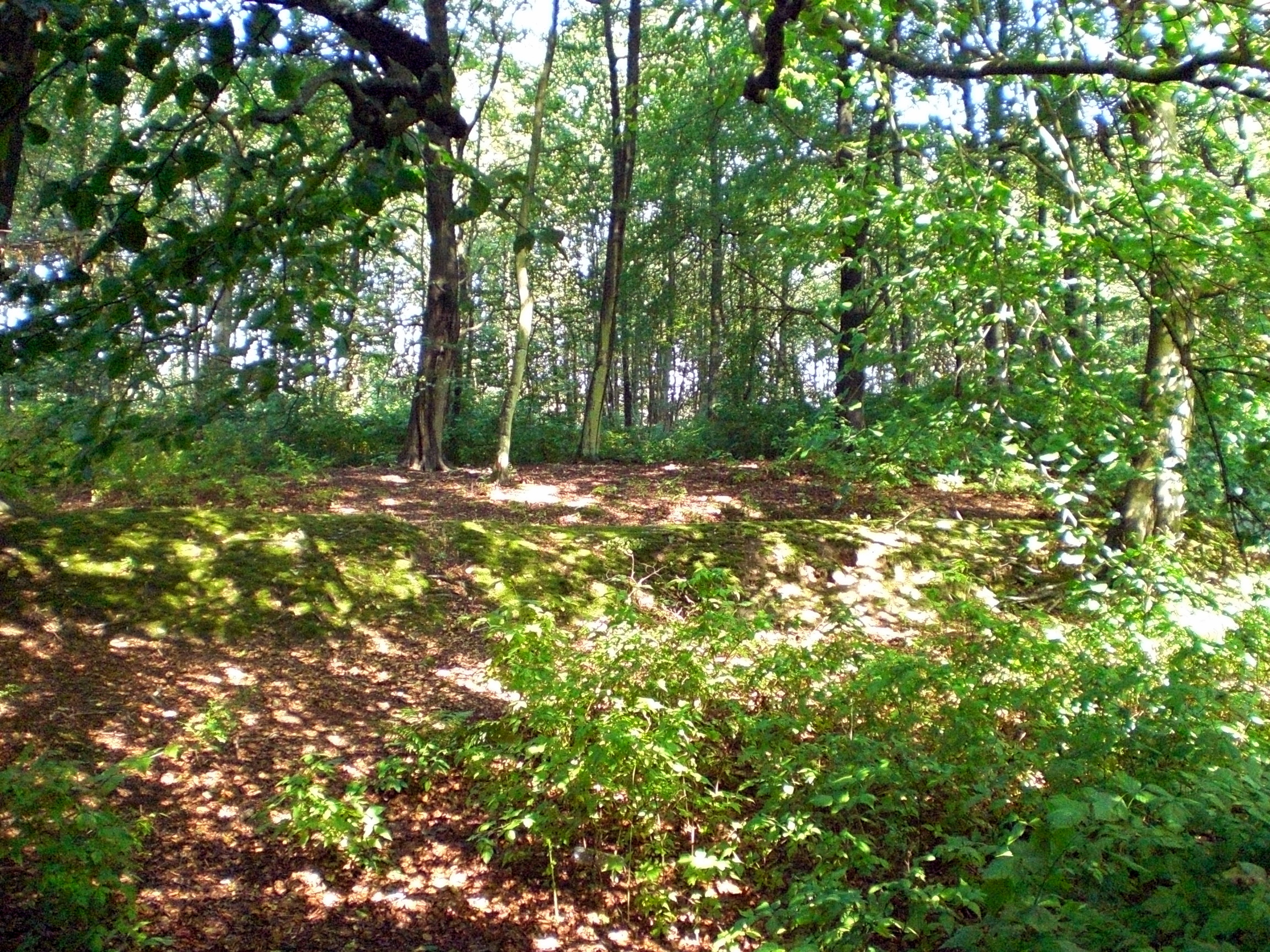
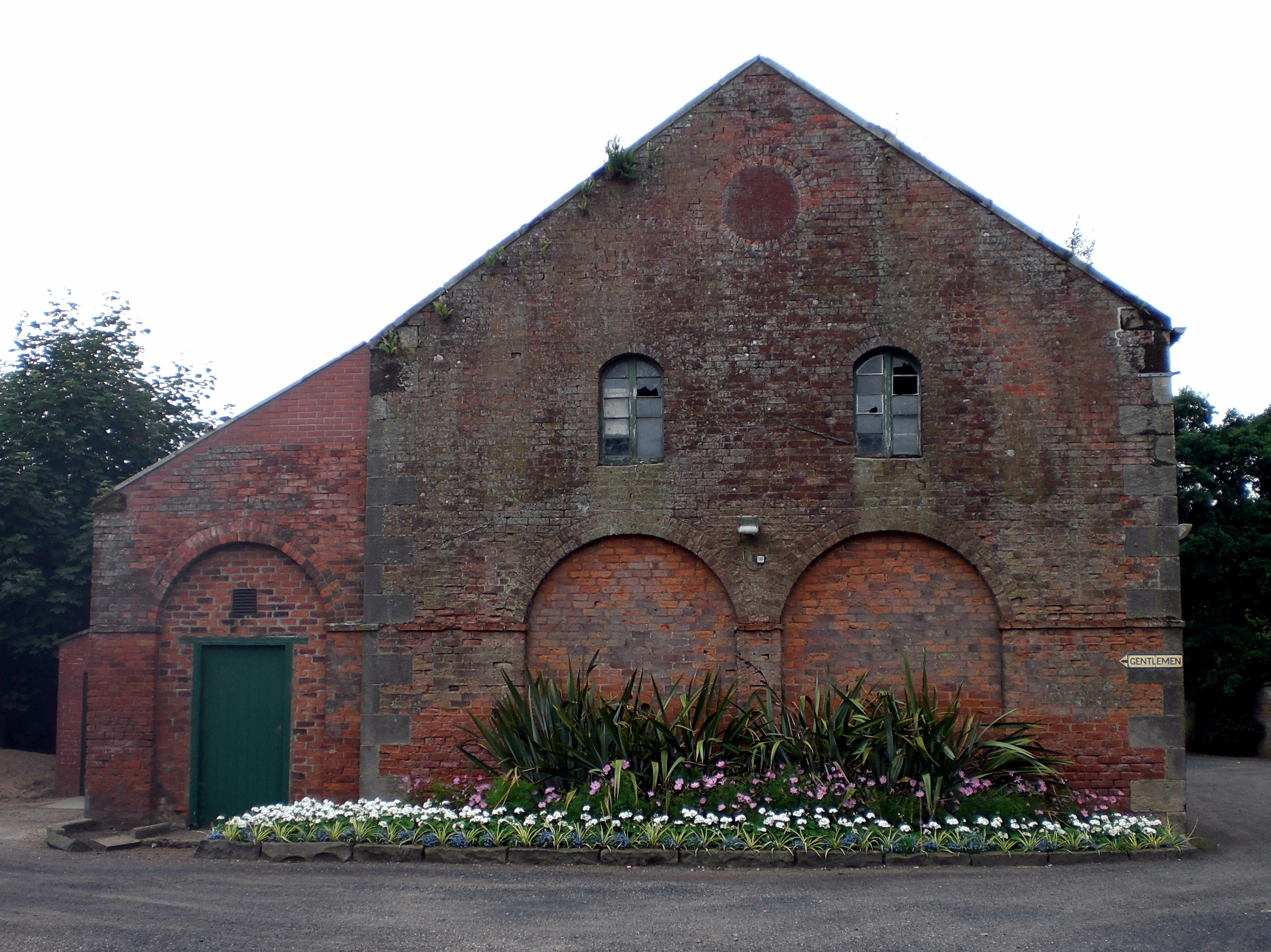
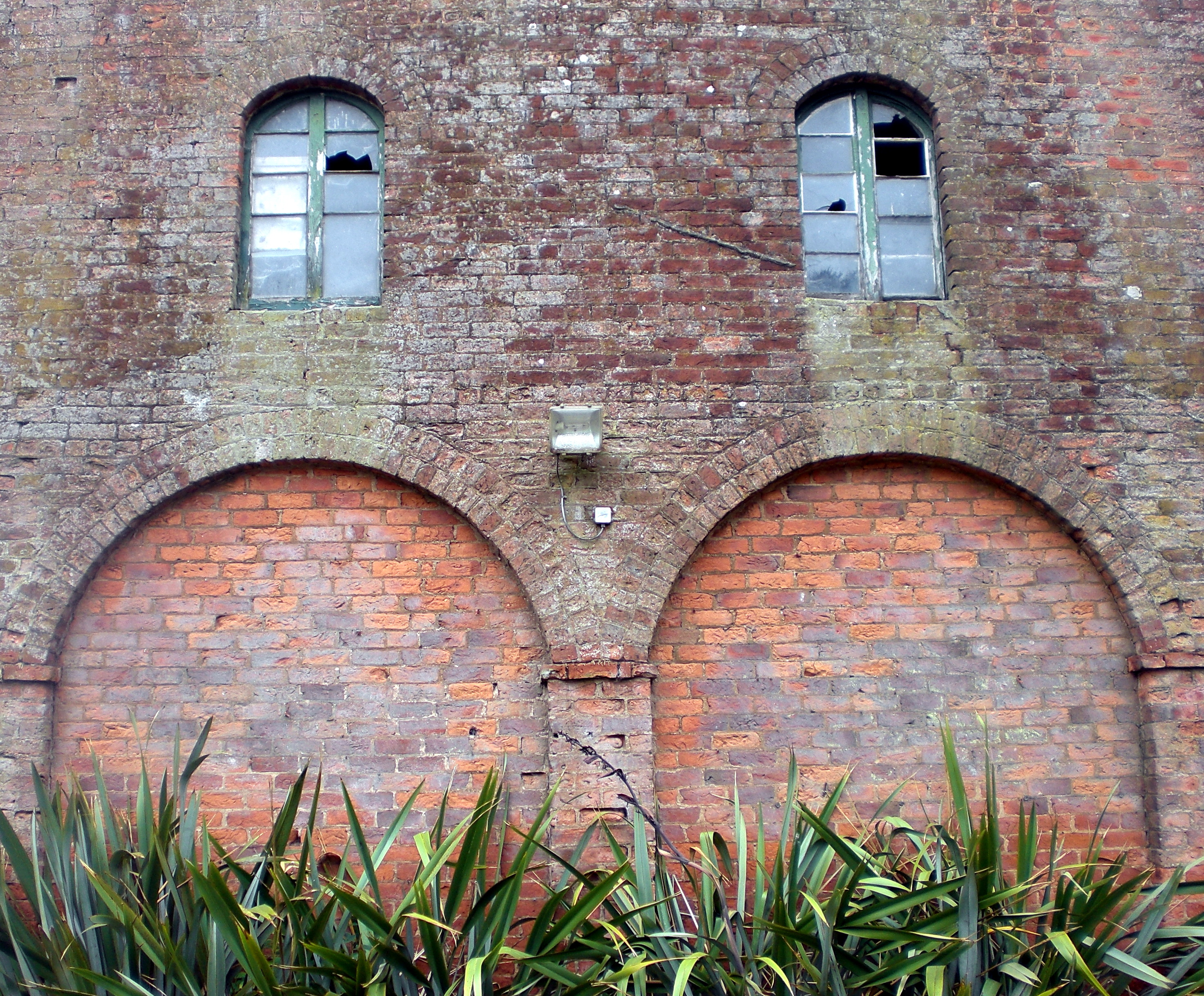
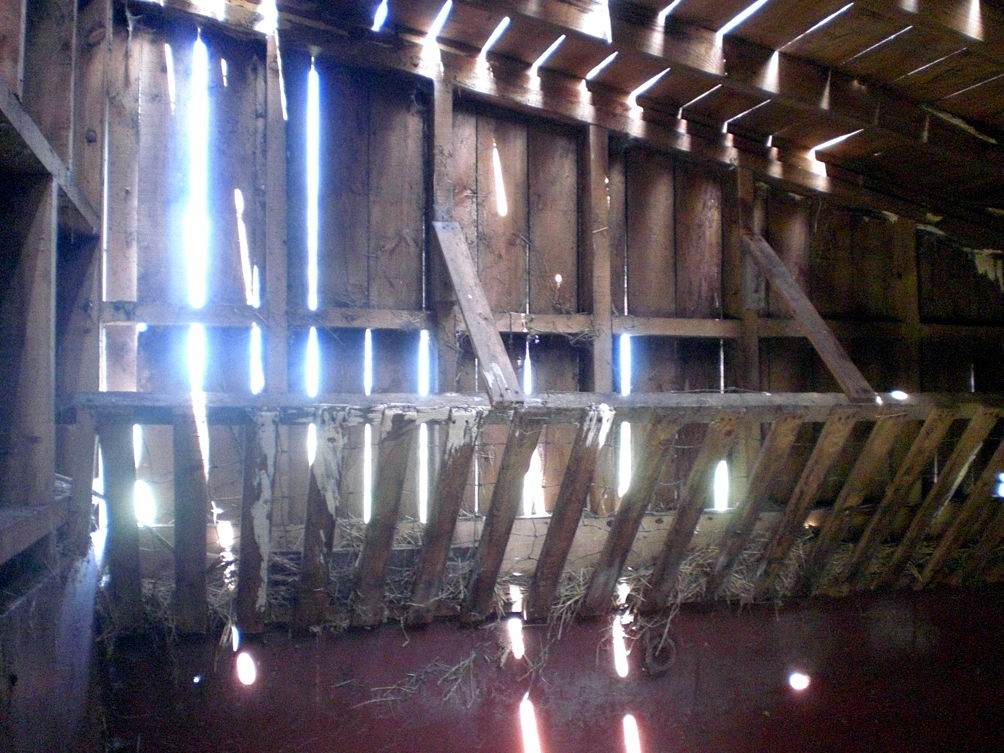
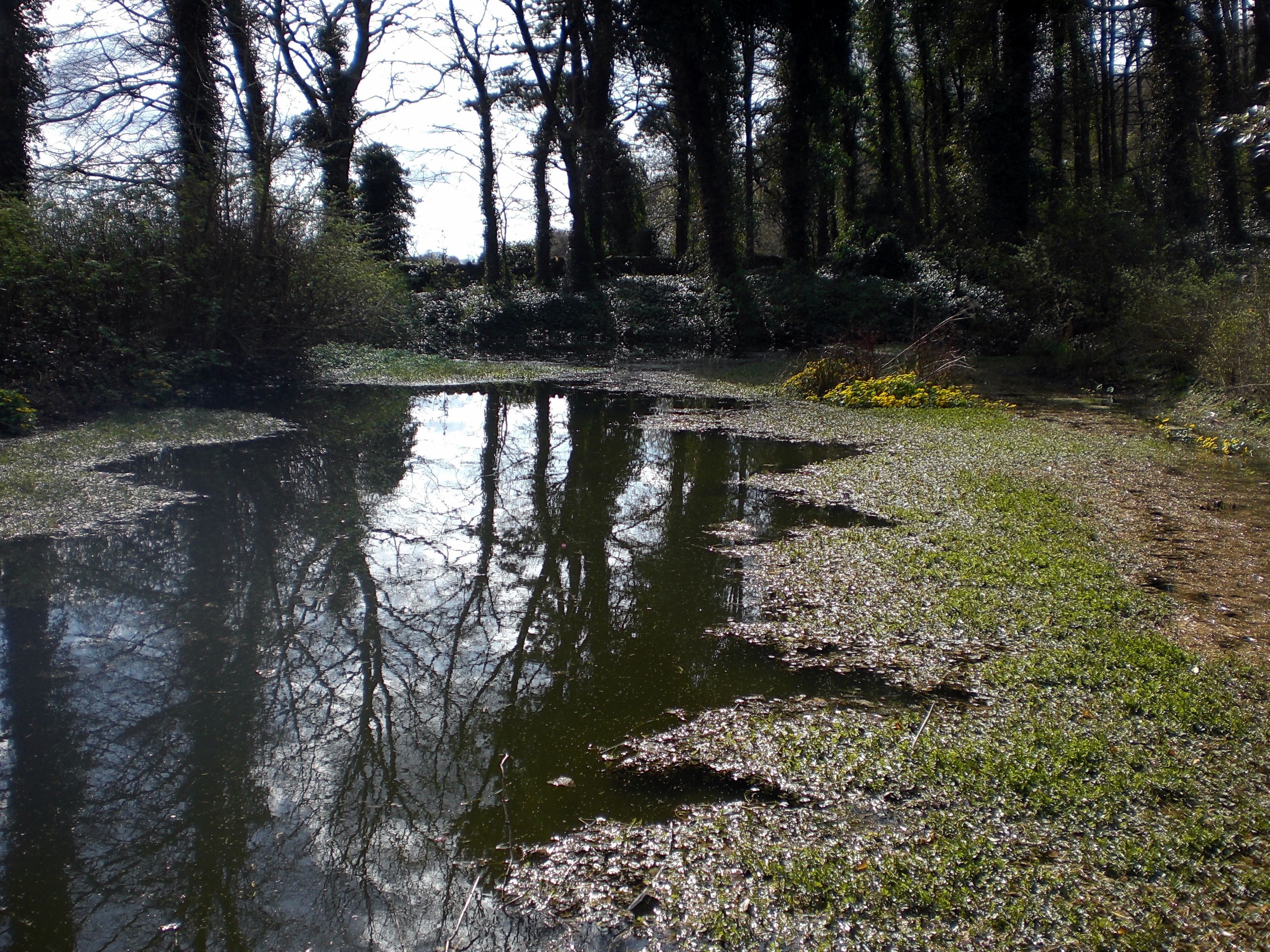
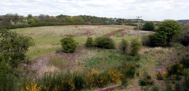
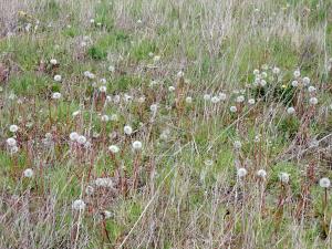
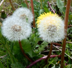
Entering the field is not too difficult. Not far from the station steps there is a locked gate but a little further along we find a gap in the hedgerow. If you are prepared to navigate, or slide down a steep slope, this will deposit you amongst the heap of discarded plastic bottles and assorted rubbish tossed from the stairs above. At ground level, the topography of the field is much more apparent. Pronounced undulations ahead of us, sloping off to the right towards marshy ground around the Whinny Burn.  Ground cover is a mix of meadow type grasses, whin bushes, dandelions and what look like dock leaf plants gone to seed.

You only have to look towards the perimeter of the field to be aware that you are surrounded by human presence. The rooftops of Rosyth to the right and the hum of traffic a constant, low-level signal.  Yet on the actual land we are walking, it is rare to find an almost complete lack of evidence that humans have recently passed. No litter, no discarded cans or bottles. No burnt out barbecues.

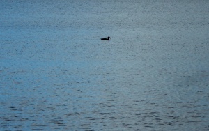
There are hints of desire lines traversing the space, possibly made by committed dog walkers, who have found a hidden access point, or could they be made by something else? It is only as we move further and deeper into the field, that there is a clear sense that we are being watched.

SLIDE

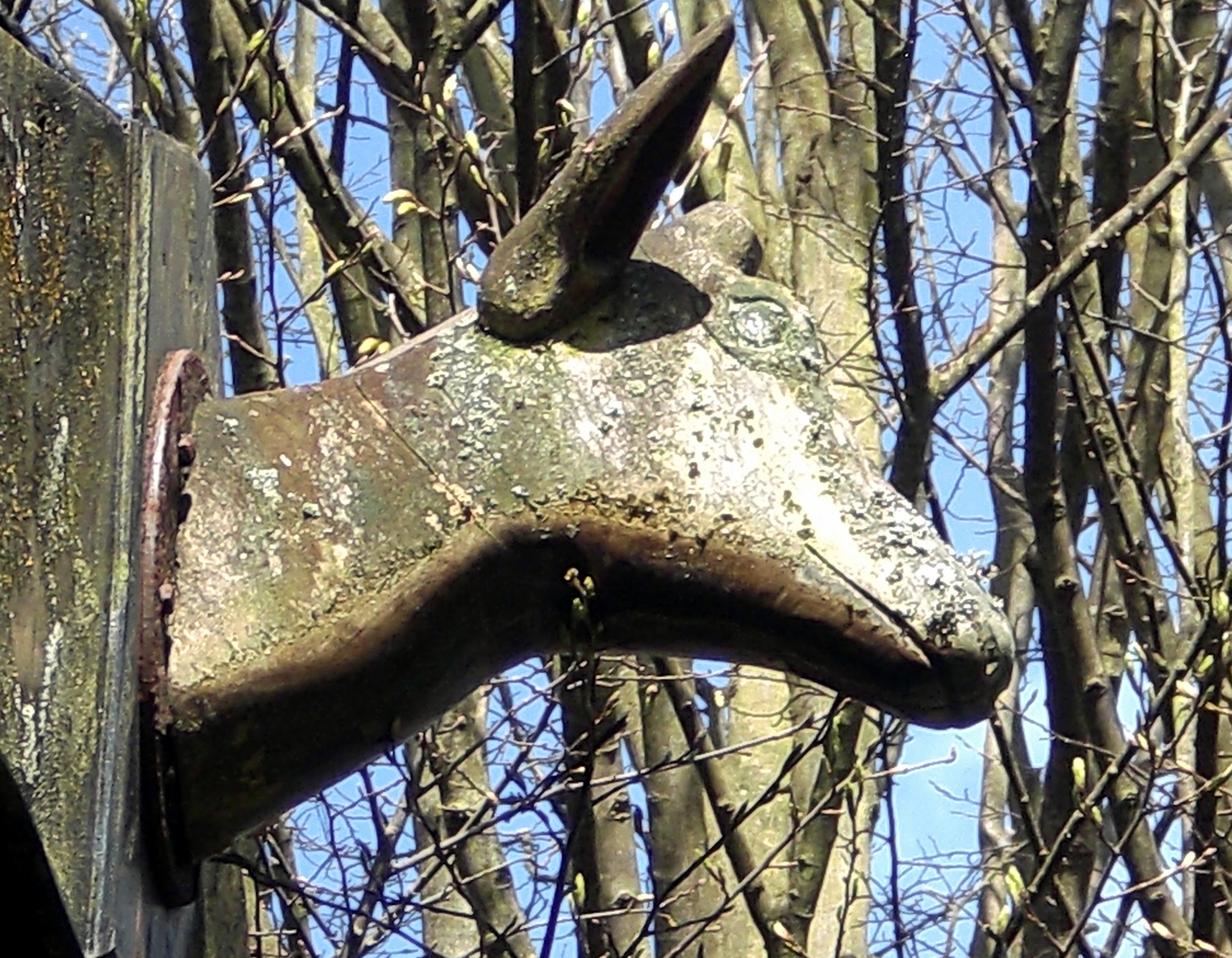
At first, we wonder if it is a dog but it soon becomes apparent that it is the eyes of a tiny deer, a tiny roe deer fixed on our movements. We are both probably equally surprised by this encounter. This is not an area where you would typically expect to see deer. Where on earth has it come from? How has it accessed the sealed off field? We lock into that non-time state of reciprocal, motionless, staring.

Eventually the deer decides to break for it. Great elongated leaps for something so small – as if bouncing off the air itself, not really touching the ground. I manage to retrieve the camera and fire off some random shots in the hope that we obtain some record of this having happened.

SLIDE

We notice our presence is also alarming a number of skylarks which appear to have made the field their own. Their nervous, vertical flight and fluted song a mix of terror and beauty as we try to avoid what must be their nesting areas. It is us who have made this land strange. We are the other.

The field separates in two at a ridge of hawthorn bushes.

On the other side:

SLIDE


A field of time

history layered

on geography.


Transparent globes

of wind held tension

time scattered

yellow flowerings

of the eternal return

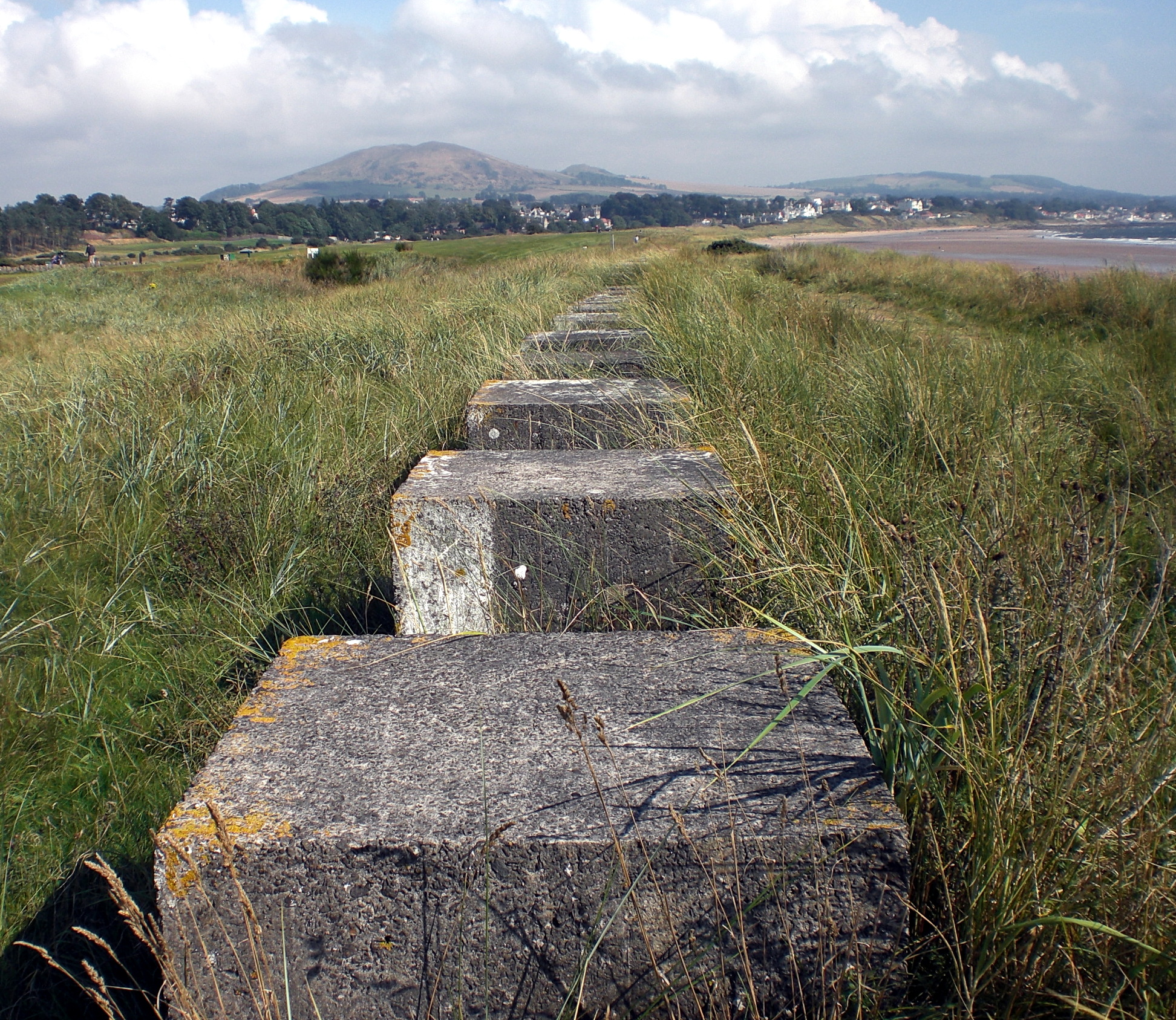
The field eventually tapers to a point where we can go no further, blocked off by the railway and the smooth, solid concrete structure carrying the A823 motorway spur.

We walk around the northern perimeter with only a thin hedgerow between us and the spur traffic. Such a slight threshold separating us from our field of time, skylarks and deer. On the other side, the surveillance cameras, crash barriers, lay-bys and signs – all the material apparatus of the modern motorway.

SLIDE

A footbridge takes us over this strangely empty vista, conjuring up something from Ballard, and into the relatively new ‘non-place’ of Carnegie Campus. As Marc Augé has said:

Place and non-place are rather like opposed polarities: the first is never completely erased, the second never totally completed . . .

SLIDE

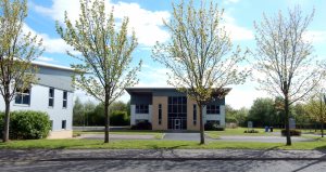
We know from the old maps and records that this land was also once part of ‘the field’. Being a Sunday, the ‘campus’ is completely deserted as we wander amongst the new-build office blocks, many of which still look unoccupied. Roundabouts appear to have been built in hope of a time still to come as roads abruptly end.

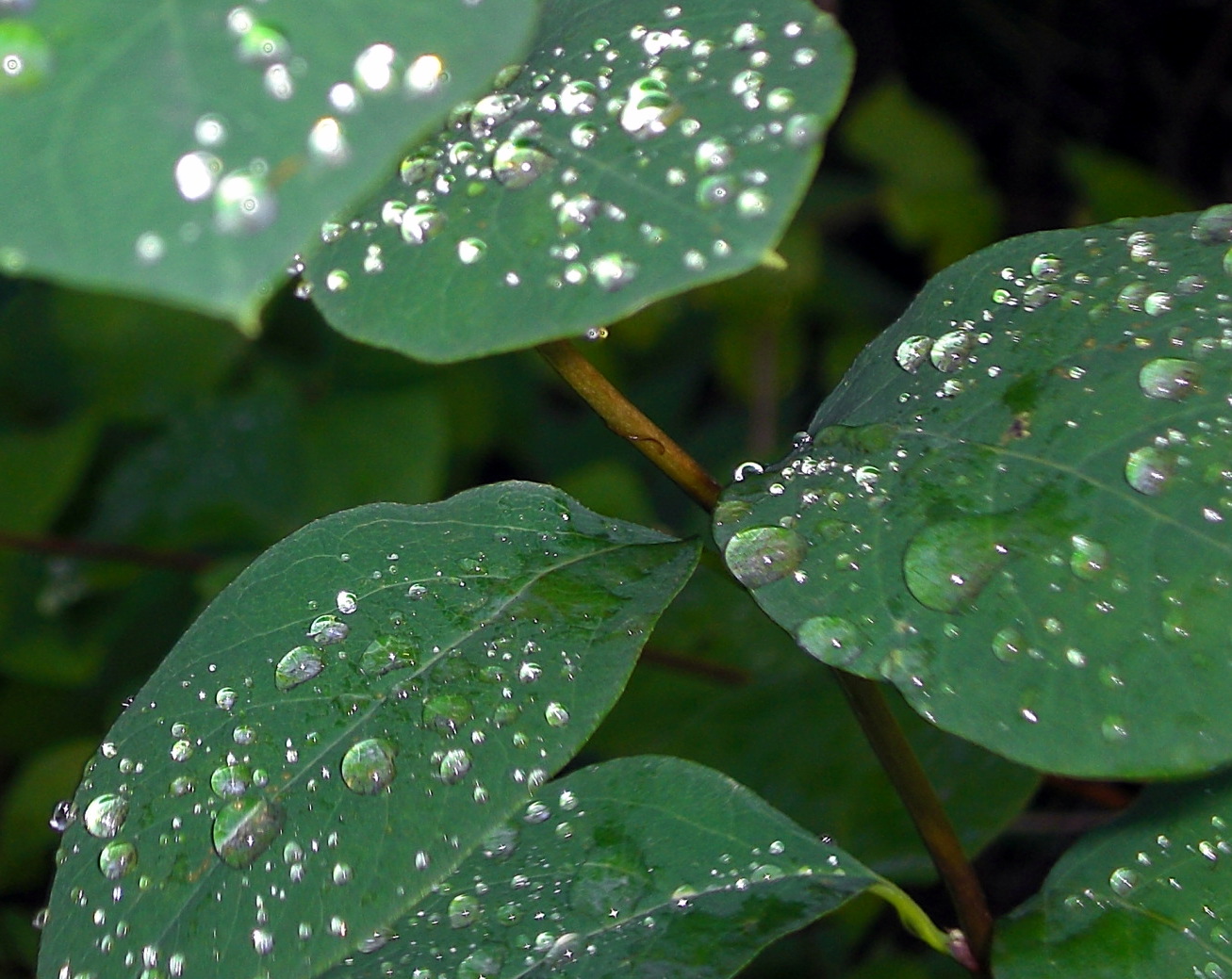
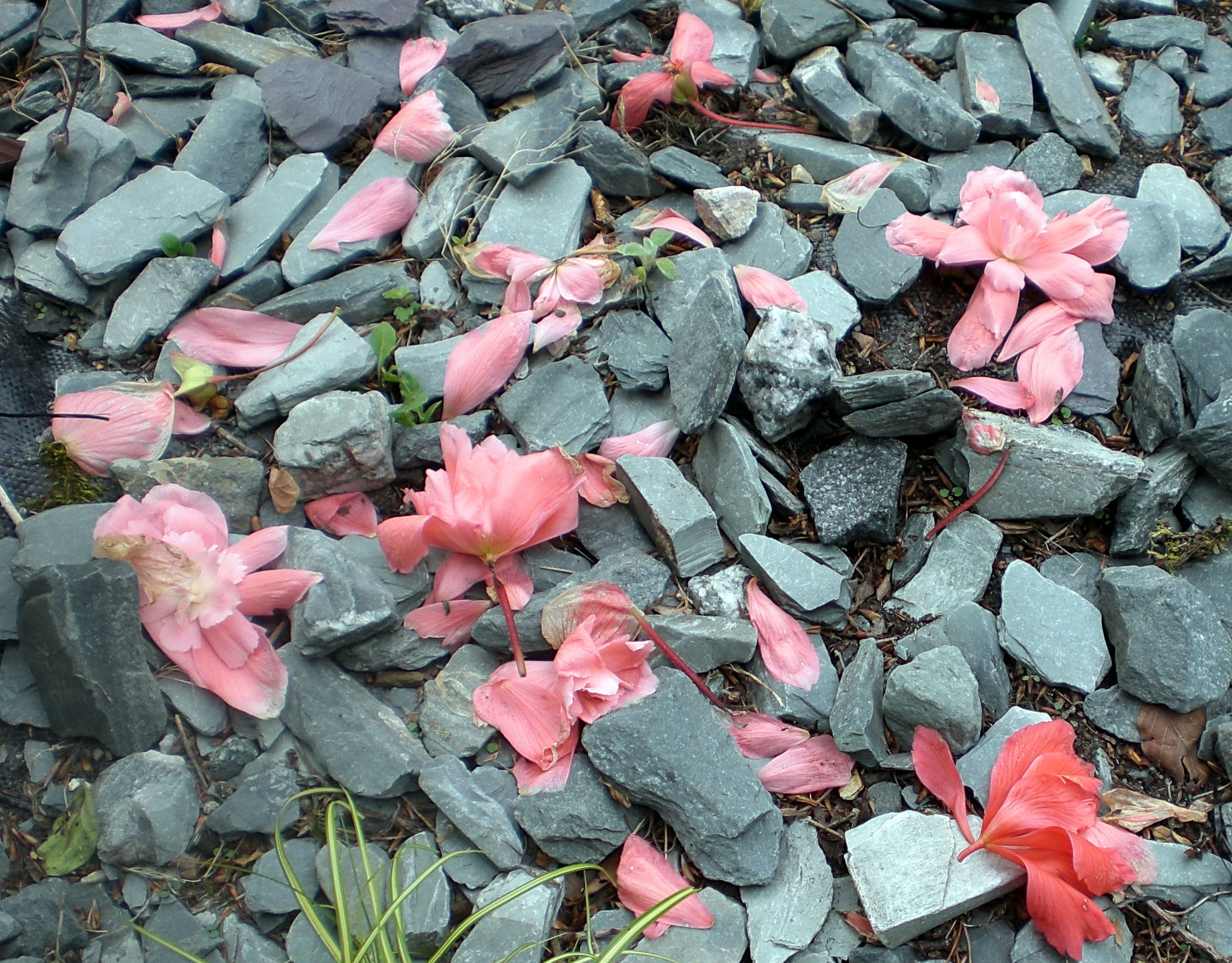
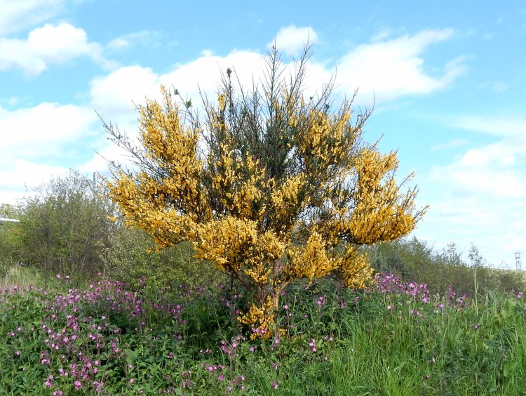
Where the manicured non-place runs out, there is a sense of encroaching wildness, biding its time. An explosive wild bouquet of whin sits amongst a covering of red campion:

SLIDE

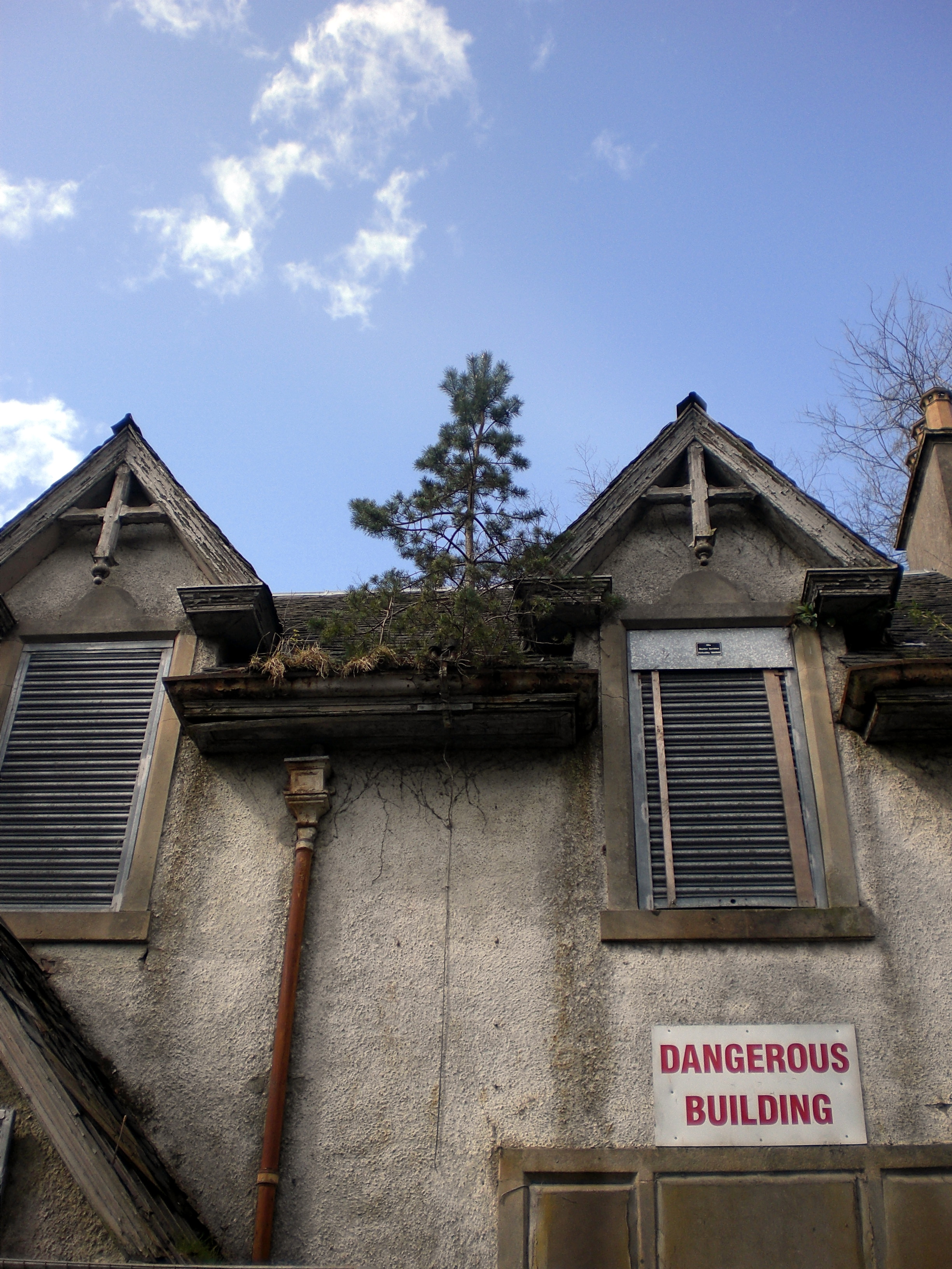
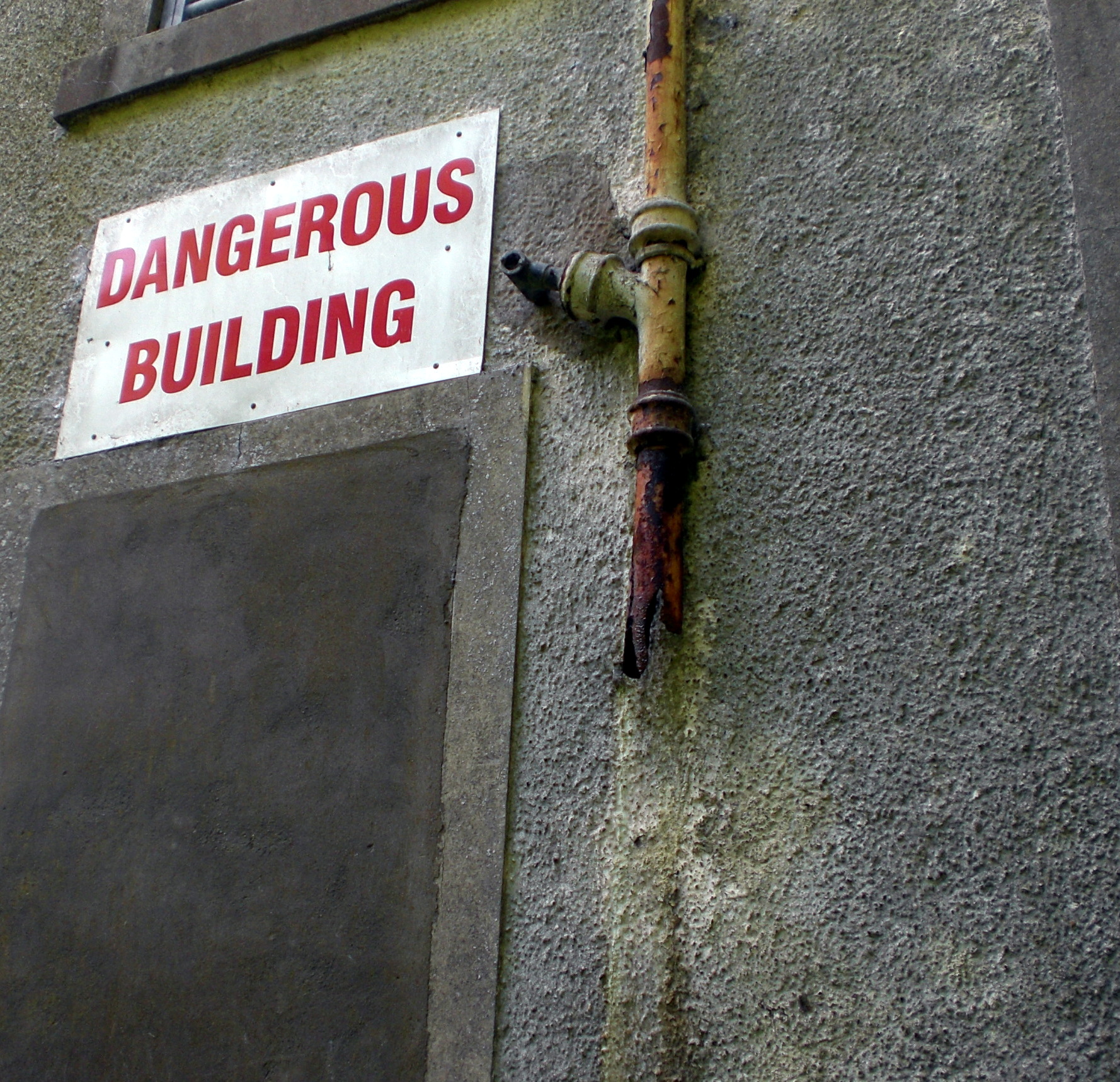
And yet amongst all the shiny new sheen of this place, older voices intrude. A hexagonal brick structure whose original purpose is unclear:

SLIDE


time stacked textures

brick and concrete

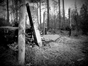
Nestled at the side of the main road into the campus we come across the cairn. As far as we are aware it is the only explicit acknowledgement of what happened on this land.

SLIDE

the Scots were driven back to the level ground between Hillfield and Pitreavie. Here, in one of the most famous episodes of the Battle of Inverkeithing, the Clan Maclean of Mull commanded by their chief, Sir Hector,  found themselves surrounded by superior enemy forces. The clansmen fought fiercely in defence of their chief, calling out, [“Fear eile airson Eachainn!” ] “Another for Hector!” as they sacrificed themselves.

This cairn was only erected in 2001 by the Clan MacLean Heritage Trust. It is thought that the McLean dead are likely to have been buried in a mass grave somewhere within the field.

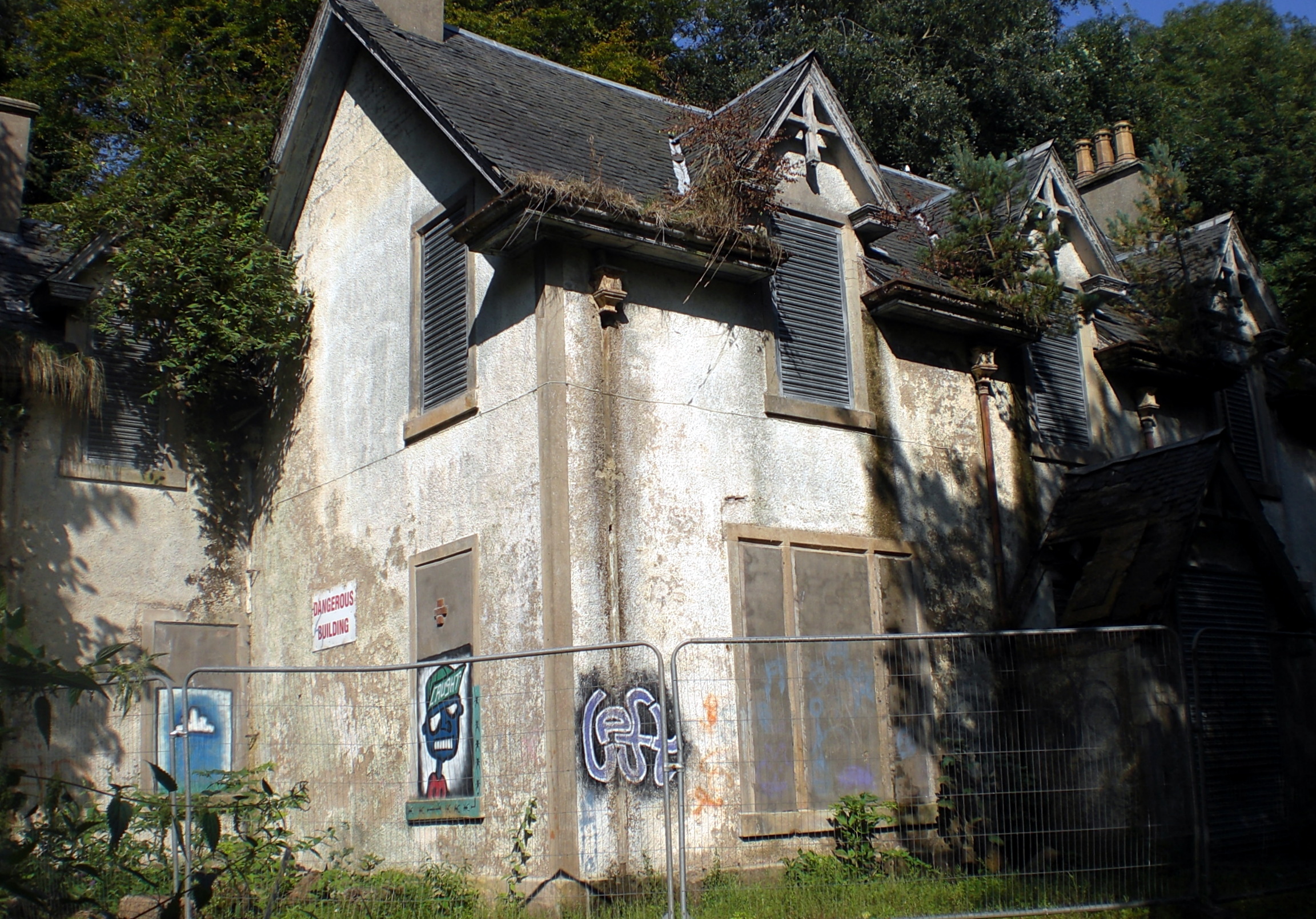
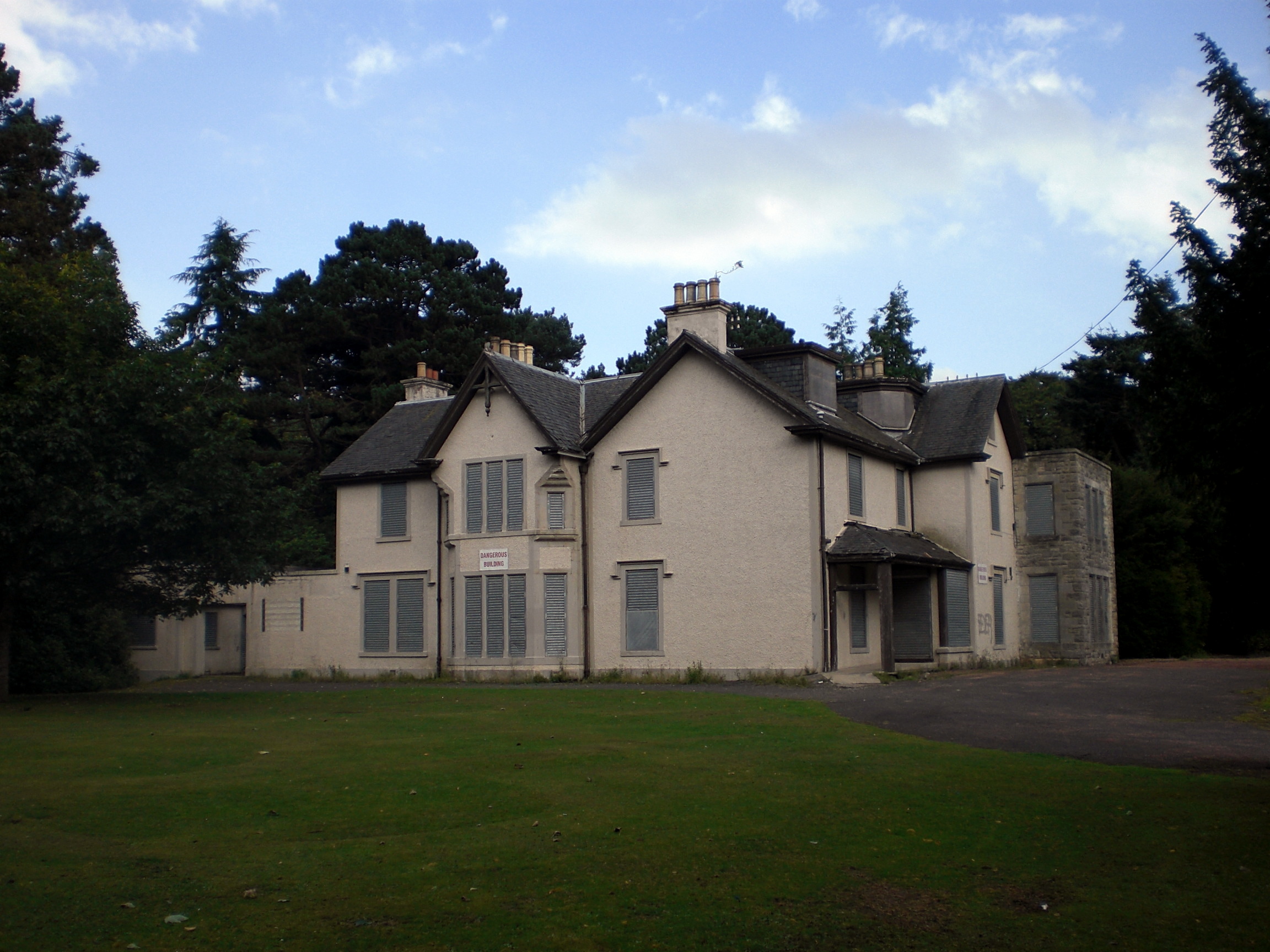
Nearby, stands another material presence in the layered history of this land. Peering over a substantial stone wall allows us a view of the Doocot in the grounds of Pitreavie Castle.

SLIDE

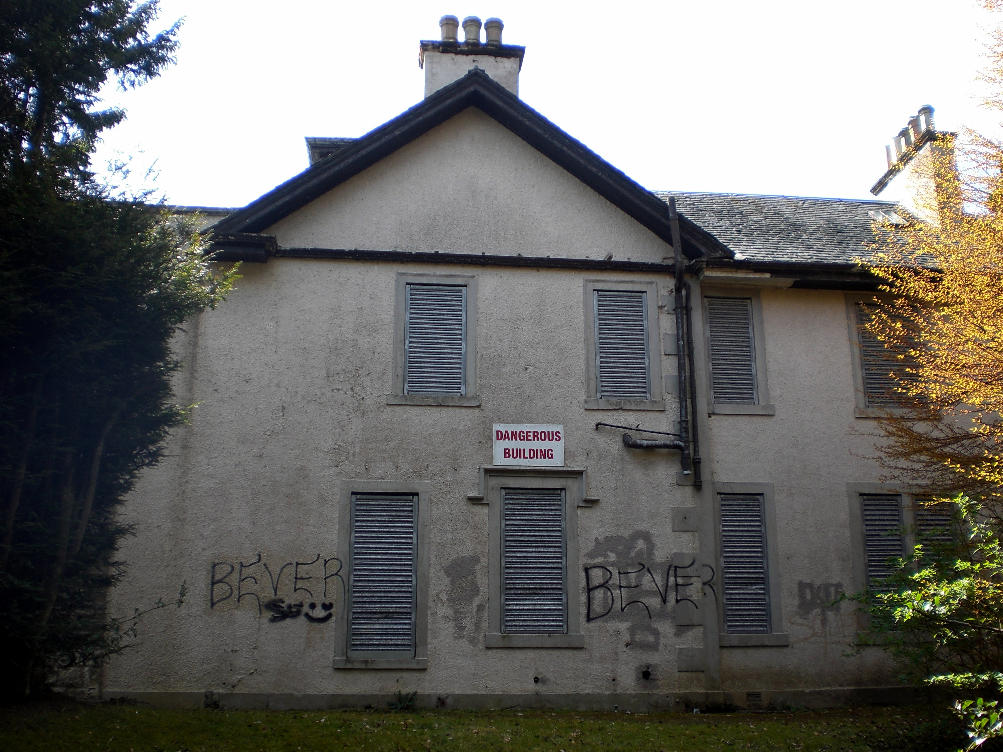
Pitreavie Castle was originally built in the early 17th century by Henry Wardlaw of Balmule. We pass the doocot, turn left and walk past the front doors of the Castle where the initials of another Henry – Henry Beveridge are recorded. Beveridge purchased the Castle in 1883 and extensively re-modelled it in 1885.

SLIDE

Beveridge was a wealthy mill-owner, philanthropist and educator from Dunfermline. He was an associate of the Scottish polymath Patrick Geddes having attended Geddes’s summer meetings in Edinburgh. Geddes also introduced Beveridge to the artists John Duncan and Charles Mackie who painted murals in the castle illustrating the legends of Orpheus and, due to the local historical connection, the famous ballad of Sir Patrick Spens.

“The king sits in Dunfermline toune
drinking the blude reid wine,
“O whar will I get a guid sailor,
To sail this schip of mine?”

[It has been claimed that Elizabeth Wardlaw, the granddaughter-in-law of Henry Wardlaw was the author of  Sir Patrick Spensalthough the evidence appears to be somewhat tenuous].

It is believed that the Castle murals may now be at best over-painted and at worst destroyed but a good example of John Duncan’s Symbolist style can be seen in his famous work, The Riders of the Sidhe:

Walking past Pitreavie Castle today, now converted into flats and apartments, offers no clue as to another more recent past life. It was bought by the Ministry of Defence in 1938 and after the second world war, deep in a basement bunker, became the headquarters of NATO’s Northern Maritime Region. During the Cold War, all Soviet ships and submarines on exercise in the North Sea were monitored from here. The base only closed in 1996 and operations moved to RAF Kinloss. There is little or no outward trace of this today, although some photographs of its past life exist:

SLIDE

The first picture shows access to the underground bunker

And the second is the teleprinter room from 1944.

As we head along Castle Drive, we notice that a small housing estate also has a story embedded in the landscape, hidden amongst the street names:

SLIDE

Covenanters Rise: The Scottish army that fought against Cromwell was a Covenanter army, acting under allegiance to Charles II.

Then there is MacLean Walk: a reference to Sir Hector Maclean.

Sir John Brown Place is named after the commander of the Scottish lowland infantry and

Overton Crescent: refers to Colonel Robert Overton who led the assault party of New Model Army troops that landed in Fife on that night in July.

Our final part of the walk will take us along Castle Drive where we will loop around to return us to where we entered the field by the station.  Despite the changes over the centuries, we have walked the area of the field as it was in 1651. A shifting terrain of presence and absence only partly represented on the maps. As the great Polish poet Wisława Szymborska says:

 I like maps, because they lie.

Because they give no access to the vicious truth.

they spread before me a world

not of this world.

And we continue to ponder our mysterious encounter with the solitary roe deer. How did it access the field and why was it there? Perhaps, a glimpse of the eerie leaking into the everyday. We think of ghostly highlanders, adrift in their field with only the skylarks for company.

As we walk down Castle Drive we pass another new addition to the landscape on the left. A customer contact centre for Rupert Murdoch’s Sky empire.

On the other side of the road, a magpie picks at the carcass of a dead squirrel.

SLIDE

So, I hope that gave you a bit of a flavour of what could be described as a psychogeographic approach to landscape and how it can interact with the past, the present and the everyday. The key point is that this is not, let’s say, a destination landscape. It is literally embedded in the material fabric of the everyday. People traveling to work, actual places of human activity, arteries of transport infrastructure and housing. You don’t have to travel to London to do psychogeography. Why not Rosyth or Lochgelly? It can be on your doorstep or in very close proximity and is one way of becoming engaged in your local environment wherever that may be.

SLIDE


So What is Psychogeography?

Now the term psychogeography may be unfamiliar to some people in the audience but I would guess that most of you will have experienced it. To adapt Joseph Beuys – who incidentally stalks the corridors of this building – Everyone is a Psychogeographer.

Think back to when you were a child. You had little interest in moving through space in a linear fashion from place A to place B. Time was much more fluid. You would encounter playful distractions in the landscape – a tree to climb, or in my case, a concrete hippo or toadstool in the New Town of Glenrothes.  You may have unwittingly performed part of Yoko Ono’s City Piece

Step in all the Puddles in the City

You might find sticks to pick up; objects to poke with a stick. You might sit down to observe a line of ants crawling across the pavement. Following the sound of a distant ice-cream van may lead you through new routes in familiar streets.  You may have pondered questions such as why does that building have such a large fence around it? Why does that sign say ‘Keep Out’?

Fast forward to walking through an unfamiliar city. It is likely that you will encounter different zones of feeling as you move through the environment. You may end up in an area that for whatever reason makes you feel uncomfortable and you want to walk away quickly. Conversely, the particular ambiance of an area may make you feel relaxed or even carnivalesque. At other times a particular city environment may make you feel literally ‘out of place’.

Contemporary psychogeography has many different strands which makes it difficult to pin down precisely, but from the above we can pull out certain common characteristics:

  • It usually requires walking or moving through space;
  • there is some form of subjective engagement with the environment and
  • probably some form of implicit questioning as to why the environment is the way it is.

The follow-on question, may be, does the environment have to be like this and how could it be changed (or even preserved)?

SLIDE

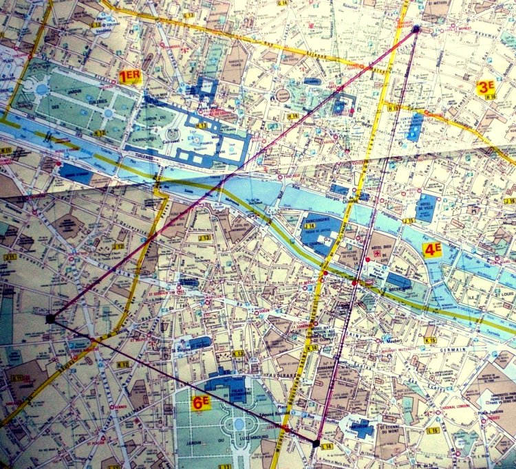
In the history of ideas, most of the literature about psychogeography refers back to the Lettrists and the Situationists who defined and developed their psychogeographic activities, such as the dérive – or drift – in Paris during the 1950s. (Most of it within that triangle I’ve mapped out on the slide).

Guy Debord’s definition of psychogeography is commonly cited:

Psychogeography sets for itself the study of the precise laws and specific effects of the geographical environment, whether consciously organised or not, on the emotions and behavior of individuals.

[Guy Debord, Introduction to a Critique of Urban Geography, (1955)]


(Mmm – I’ve always had a bit of a problem with the ‘precise laws aspect of that definition’. I very much doubt that psychogeography can ever be subject to precise laws. Another cognac required for Guy perhaps.

Our own research has uncovered that the term was used much earlier by an American anthropologist, J. Walter Fewkes in a non-urban context in the early 1900s:

 SLIDE

There it is … “psychogeography, deals with the influence of geographical environment on the human mind”.

Fewkes wrote this in 1905 and was using the term to examine the Native American Hopi people’s strong connection with their landscape. The arid conditions led them to develop a set of beliefs, practices and folk rituals, such as the rain dance, to appeal to the sky gods for water.

We have yet to see any mention of Fewkes in the psychogeographic literature but firmly embrace the idea of an expansive psychogeography: the influence of the geographical environment on the human mind in both urban and non-urban contexts. This also recognizes the presence of the non-human world in our landscapes. In this respect, we are probably more influenced by Patrick Geddes than anything else. Indeed, the name of our book From Hill to Sea is a nod towards Geddes’s concept of the Valley Section (basically – “it takes a whole region to make the city”) which was adapted from the ideas of the anarchist geographer Élisée Reclus.

I personally, like this comment on psychogeography from Alan Moore:

 SLIDE

So, all of the above definitions kind of pull at the same strings but what about doing it in practice? As a starting point, I think you could do worse than consider this piece Open Field from Pauline Oliveros, the pioneering, American composer and proponent of Deep Listening.  I like how this emphasises being present, engaged and attentive in the everyday. A succinct manifesto for being-in-the-world.

SLIDE

 SLIDE

 So, moving on to the final part of this talk, I want to try to link three elements together: psychogeography, folk horror and the everyday.  Here are some short extracts of walks undertaken which show how elements of the uncanny, folk tales, and horror are all there – embedded in the landscape of the everyday.

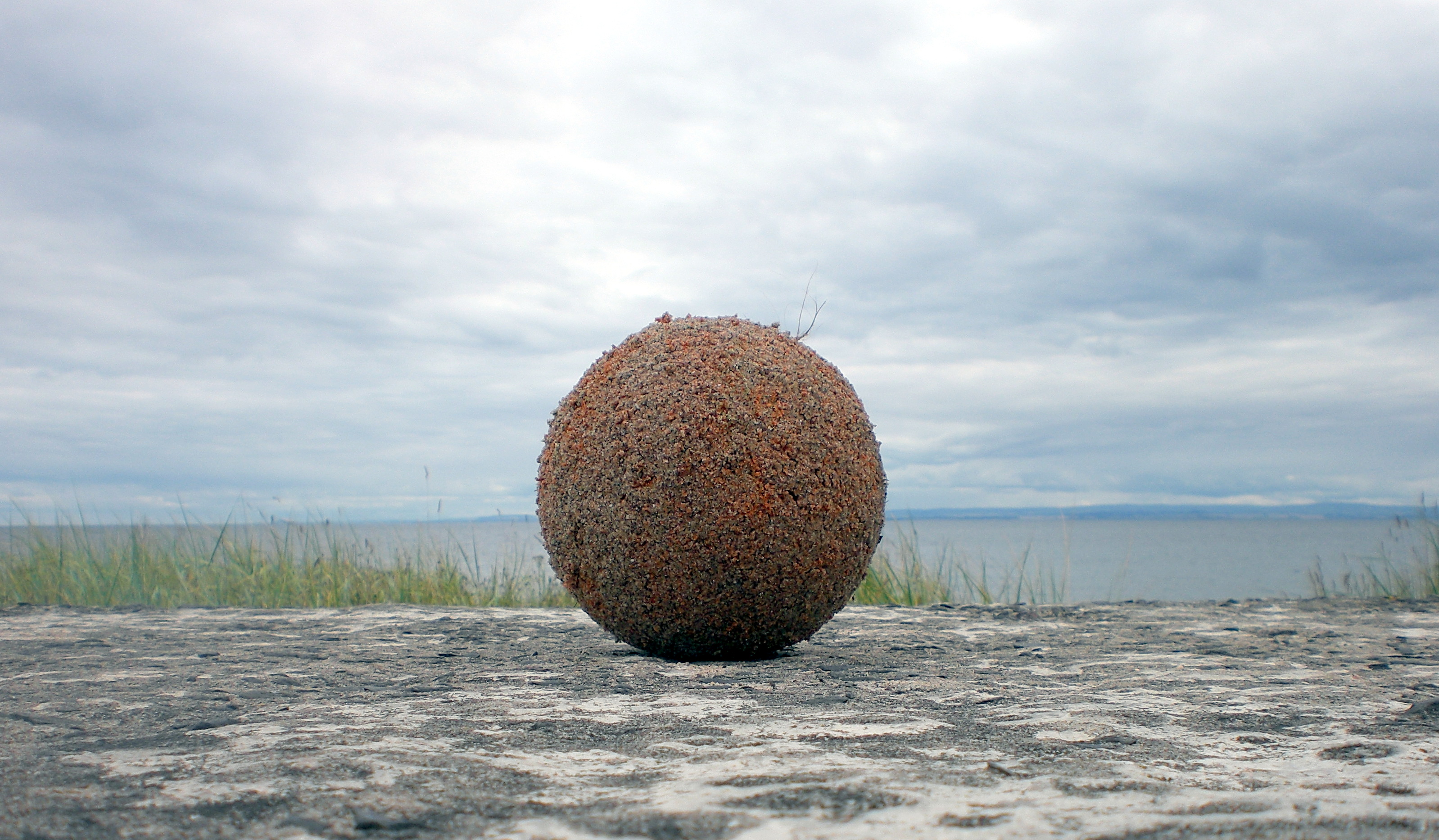
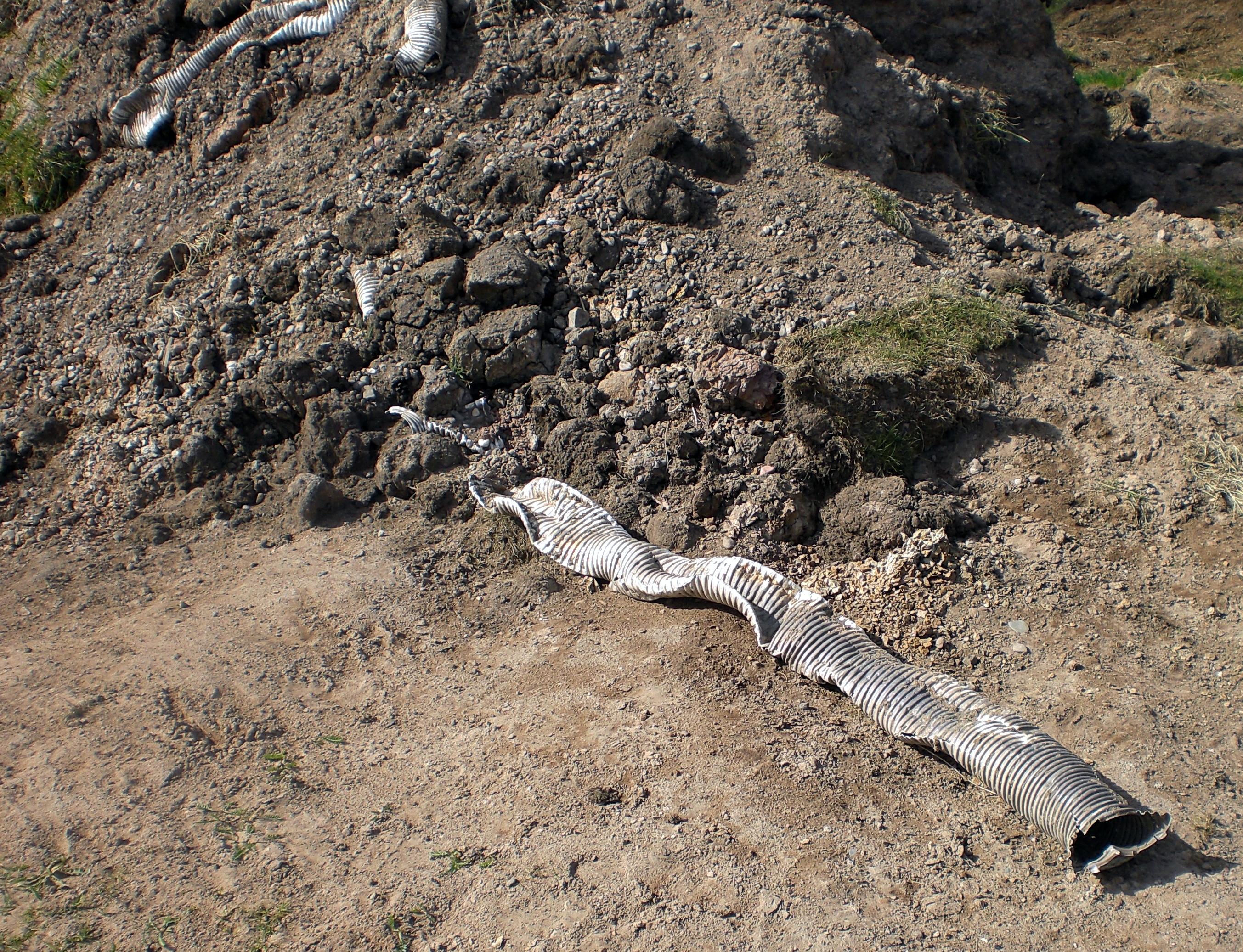
This image was taken up on the Fife Coast Near Largo Law (or Hill for anyone unfamiliar with the term).

We soon encounter the talisman lying in the dunes. It’s protective, synthetic membrane, perished long ago by wind and water.  Now crusted with sand and water-logged, it has transmuted into a living entity. Green tendrils sprout from the surface. It appears to be an auspicious omen, a process of alchemy worthy of the legendary Wizard of Balwearie, Michael Scot, (1175 – c.1232), reputed to have form in these parts.

Local legend has it that Scot summoned his three imp familiars, Prig, Prim and Pricker to Largo Law with a view to levelling it. A sort of job creation scheme for hyper-active familiars. As they began to dig, Scot had a change of plan and the imps were hurriedly dispatched to Kirkcaldy to make ropes out of sand. This was to assist Scot in his showdown with the devil on Kirkcaldy beach.  Scot appears to have triumphed in the encounter as evidenced by a local saying: “The devil’s dead and buried in Kirkcaldy”.  Due to the ‘Kirkcaldy interruption’, only a single shovelful of earth was thrown from Largo Law to create the cairn of Norrie’s Law at the wonderfully named farm of Baldastard.  There are also local folk tales about an abundant goldmine that supposedly exists underneath Largo Law and that sheep have returned from grazing on the foothills with golden fleeces.

Balwearie, Kirkcaldy

Moving down the coast to Kirkcaldy itself, you will find plenty more everyday references to our wizard Michael Scot. As a historical person, he most certainly existed although like many similar figures it is difficult to untangle history and myth.  He studied, maths, philosophy and theology at Oxford, translated Eastern and Arabic texts and developed a strong interest in alchemy, astrology and sorcery. He was appointed as personal astrologer to Frederick II, the holy Roman emperor and pops up in Dante’s The Divine Comedy, where he is consigned to the Eighth Circle of Hell reserved for astrologers and sorcerers.

Every school day, the young people of local Balwearie High School wear the school badge depicting Lions Heads, stars and crescent moons of the Scot family coat of arms. In local Beveridge Park you can find a wizard’s trail to follow which claims that Michael Scot lived in nearby Balwearie Castle and recounts the afore-mentioned story of him fighting Lucifer on Kirkcaldy beach and also managing to travel to France in one evening on a magical black steed. (Take that Harry Potter).

You can still walk to the ruins of Balwearie Castle today. It is fair to say that it manages to conjure up a certain atmosphere worthy of a practitioner of the dark arts.

SLIDE

Moving on to a short walk between Crombie Point and Torryburn

 SLIDE


 Ink etched blue silence.

Cold harbour spires, sketched over cubist sails.

Thorn pinned birds still tethered.

Wings opening, sensing the sky

 SLIDE

We pass the ruined pier at Crombie Point where Jules Verne arrived on 30th August 1859 following a three-day exploration of Edinburgh.

 SLIDE

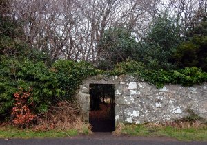
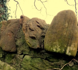
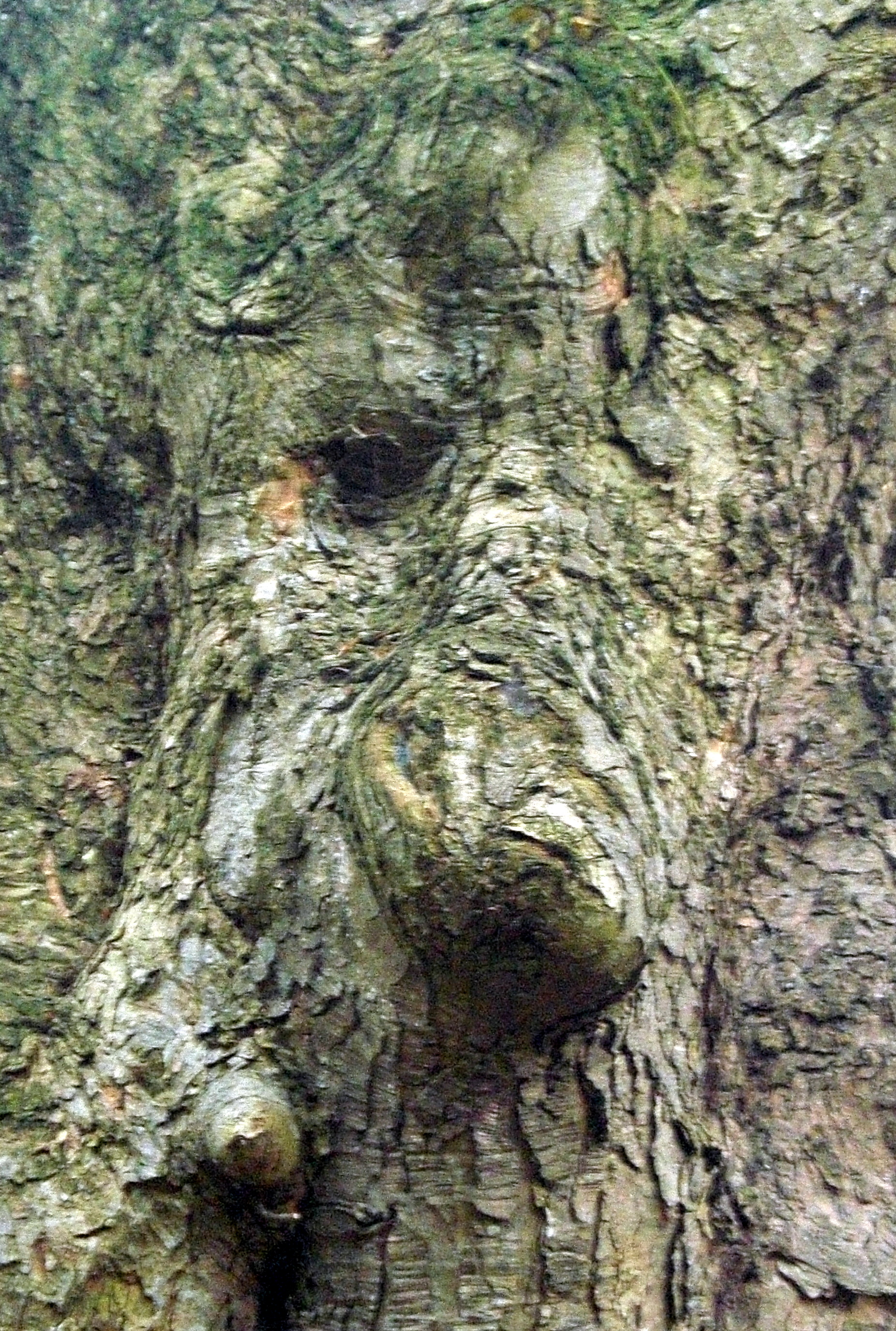
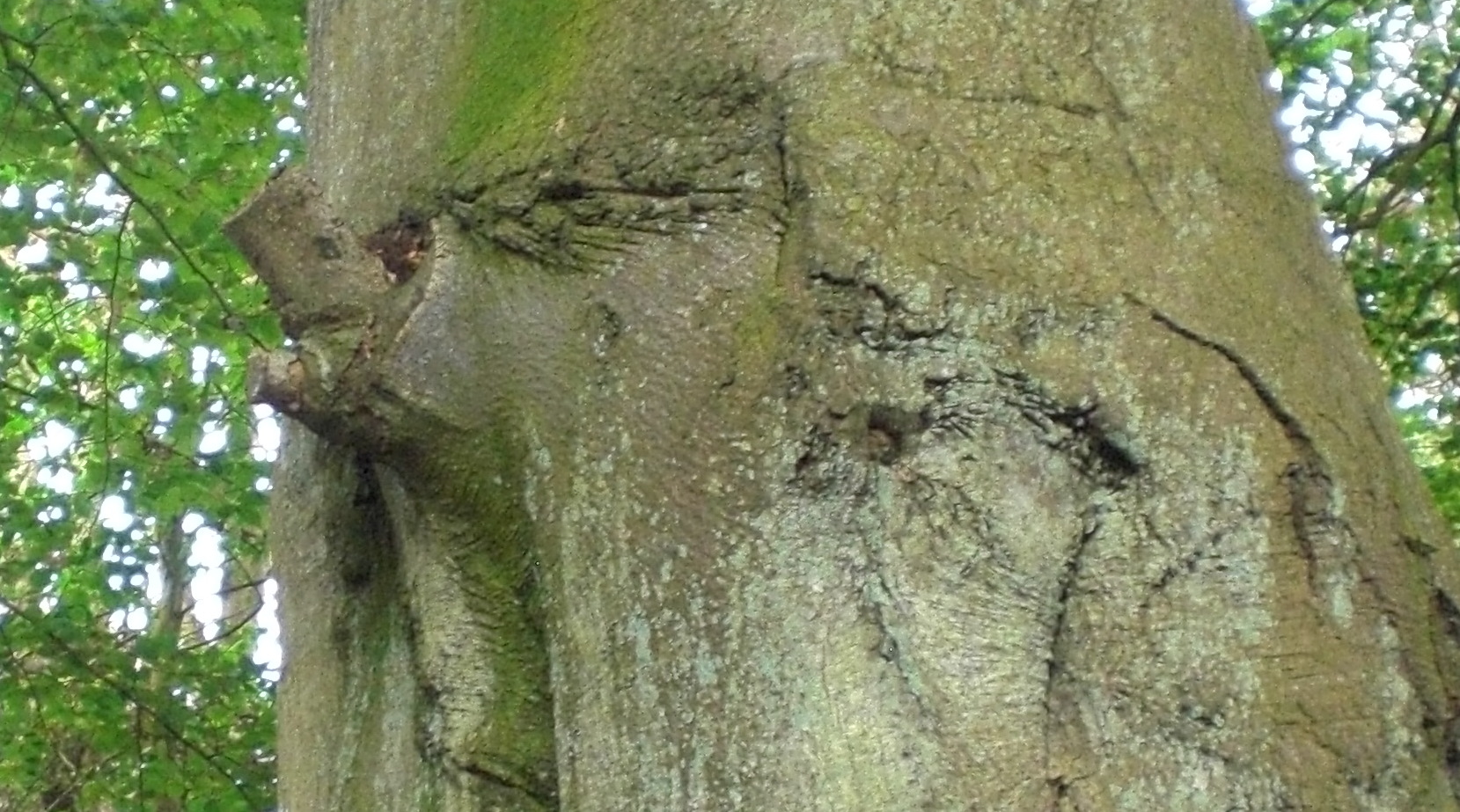
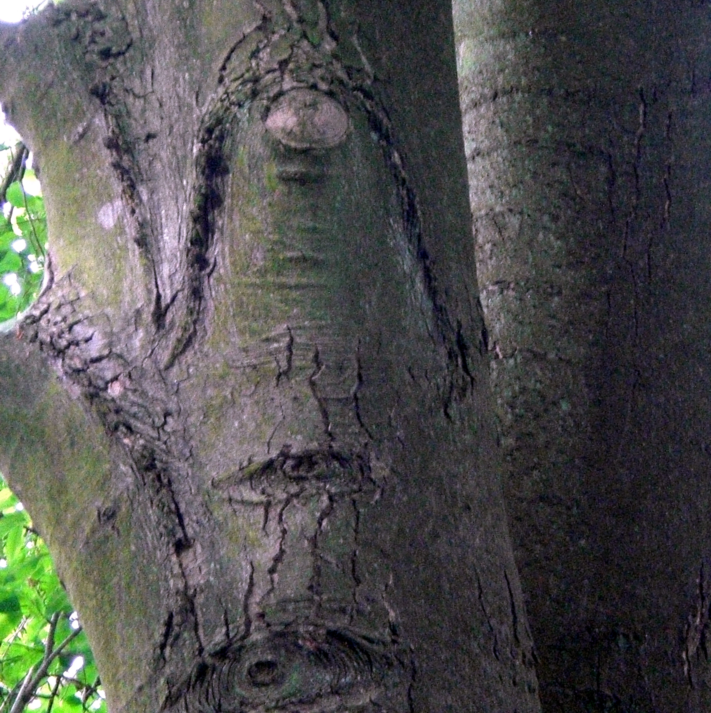
Beyond the door-less door. An invitation to enter? What lies beyond the threshold, the scattering of leaves and crouched shadows?

On the ancient, whispering walls, the faces start to appear.

Language of the stones, silent tongues ….

And on this short stretch of coastal path, the receding tide and dying light coats Torry Bay in an emulsion of gun-metal grey. A vista of colour-bleached beauty with a tangible undertow of concealed violence bleeding over the mudflats.

SLIDE

In the middle of Torry Bay you will see witches rock. This rock was used to tie-up and restrain anyone suspected of witchcraft. Here the witches were judged and simultaneously sentenced as the tide rose. If they drowned, they were absolved of being a witch, but if they survived they were deemed to be a witch and burned at the stake.

(that is actually from one of the heritage interpretation boards located on Torry Bay)

More on the dark history of this short stretch of Fife coastline emerged from the Tales for Travellers Project which we participated in last year which included a social walk following a journey originally undertaken by Ben Jonson from Culross to Dunfermline in 1618.

On Torry Bay the sky appears to expand to a grey cloak as we experience a brief rain shower. It’s a suitable backdrop for Kate Walker to tell us of the dark history of witch hunting along this coast in the seventeenth century. Zealous, self-appointed witch-finders, usually being local clergymen searching for those who had ‘danced with the devil’. They used an armoury of pseudo-scientific techniques to prey on poor, elderly, and vulnerable women, with their use of witch pricking and searching for the devil’s mark. The familiar power structures embedded in organised religion and misogyny. Kate recounted the tragic story of local woman Lilias Adie, buried face down in the mud on the beach, between the high tide and low tide marks as it was outside consecrated ground. Buried neither on land or at sea, huge stone slabs were placed on top of her; a folk remedy for revenants who were suspected of returning from the grave to torment the living.

SLIDE


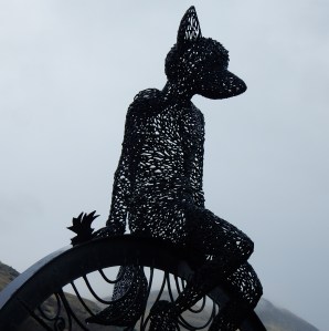
Up in the village of Menstrie in Clackmannanshire we find the silent contemplation of Fox Boy. A sculpture inspired by the now-extinct practice of children keeping foxes as pets”.

SLIDE


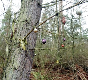
Devilla Forest, near Kincardine is an area with a long history of land use. Prehistoric coffins, stone circles and Roman urns have all been found here together with more recent structures such as the remains of a World War II explosives research establishment. There is a stone which local legend says is marked by the grooves from a witch’s apron string and there is a history of numerous big black cat sightings in the area. There is also the rather unsettling setting of the Plague Graves where trinkets and offerings are still left and hung on nearby trees.

SLIDE

 Windylaw

Just outside Pattiesmuir, you can find a quite inviting path leading up to a crest of trees.

SLIDE

I wonder if your perception may change if I tell you that this is Windylaw, an extremely old coffin track leading down to the long-abandoned churchyard of Rosyth. I would also add that from the crest of the hill you can look over to Rosyth dockyard where seven, decommissioned Polaris nuclear submarines, lie rusting in storage. A real example of horror embedded in the landscape.

At the very least, the psychogeographer can reverse the panoptical gaze of the modern political machine.  Standing here we can use landscape as a mirror to reflect back. We can see the war machines, the entropic processors of fossil fuels, how the local is connected to the global.  On this spot we can be the watchers. We can see what you are up to and imagine and enact alternative possibilities. (Such as going for a walk!).

Sometimes the everyday world can be made strange in an instant, when you alight on an unexpected object in the landscape, awaiting a story to be told.

SLIDE


The sun reflects from the elegant curve of bleached white bone amongst a bed of grey feathers. Ribs sparkle like some primitive xylophone and still attached to the leg, a small dark hoof.  The sweep of bones and sinew appear to retain some residue of movement –  of a life-force that has been so abruptly arrested. Who knows what happened to this (we guess) young deer?

Detached and slightly further away lies the white skull, stripped and pecked clean. The downy feather bed suggests that some of the birds who came to feast on the carcass ended up being part of someone else’s meal.

Fur, feather, rib, bone

Old Nature Writing

 And finally:

 SLIDE

He’s back!

I must admit that this extends the concept of the everyday somewhat as it happened last year whilst on holiday in Istria, Croatia.

A visit to a small hilltop town called Motovun which had only a handful of people walking around, to the extent that the labyrinth of tiny curving, cobbled streets were mostly deserted, creating its own sense of the eerie.

You can perhaps imagine how this was compounded upon turning a corner and being confronted with this straw giant staring us out with his silent gaze. I reckon he must have been over twenty feet tall and at his feet a band of acolytes engaged in some folk ritual or dance, arms thrown open to embrace the sun. There was a distinct feeling of something of the Wicker Man about it all.

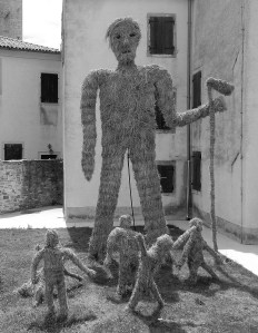
As far as I could find out, his name is Veli Jože, a giant who lived (or lives?) in a nearby truffle-rich forest. Local stories suggest that he has been known to enter the town and physically shake the church tower to sound the bell.

Ending

 And so that brings me to the end of my talk. I hope it has given you some flavor of potential linkages between Psychogeography, Folk Horror and the Everyday.  I’ll be around for the rest of the day and this evening if you want a chat. There are also a couple of books available on the goodies table if you are at all interested. From Hill to Sea which I’ve mentioned before and Language of Objects which has just been released and is a collaboration between myself and the sound artist Brian Lavelle who is in the audience somewhere. (Book includes a CD of Brian’s sound piece).

And just to mention that when you do leave this evening, look up at the skies over the Old Town of Edinburgh. You may be surprised at what you see:

SLIDE

Witches over The Outlook Tower

[Endpiece from Dramatizations’ of History: The Masque of Ancient Learning and Its Many Meanings by Patrick Geddes, Edinburgh: Patrick Geddes and Colleagues, (1923)].

Thank you for listening.

and as you head for lunch – a final thought to leave you with:

≈≈≈

Many thanks to the Folk Horror Revival team for the invite to talk and for putting on such a great day and evening of words and music.  A special thanks also to Chris Lambert for stepping in to manage the slide show after the slide pointer appeared to give up the ghost. (May well have been operator error!).


This is not the Garden of Cosmic Speculation

dscn4630-001

The concept includes the fact that many foreigners have settled in Scotland and contributed to its identity. Indeed, the notions of geology as destiny, the Rock People, and the Atlantic People that plied the shores from Galicia to Norway (from roughly 5,000-1,500 BC) are part of the larger Scottish World …

Charles Jencks

Anyone who has driven up the M90 motorway in the last twenty years could hardly have failed to notice the St Ninians open-cast coal mine near Kelty.

A landscape transformed and consumed through raw material extraction, technology and human labour. The coloured flecks of jabbing industrial machinery appearing to shrink to insect scale as the vast grey void opened up. An unfolding Burtynsky portrait of post-industrial scarring:

lassodie_open_cut
St Ninians from the air (c) Ken Whitcombe

In 2003, the international landscape artist and cultural theorist Charles Jencks was commissioned by the mine owners, Scottish Resources Group, to develop a landform proposal to regenerate the area. Jencks is perhaps best known as an architectural theorist of postmodernism and in Scotland, for landscape design projects such as his own Garden of Cosmic Speculation, the recently completed Crawick Multiverse and smaller scale works at Jupiter Artland (Cells of Life) and The Scottish National Gallery of Modern Art (Landform Ueda).

Jencks coined the project The Scottish World which was based on ideas of the Scottish diaspora and immigration. There was no doubt as to the physical scale of its ambition with four colossal earth mounds representing four continents where Scots had travelled and settled.

Whilst work commenced on the restoration project, and was originally due to complete in 2012, the scheme collapsed in 2013 when Scottish Resources Group went into administration. The site was subsequently taken over by Hargreaves Resources and an agreement was made with Fife Council that would see a degree of the restoration project completed, in exchange for a licence to extract the remaining coal still to be mined. However, it soon became clear that the project would not be completed according to Jencks’ original design although elements already completed would be kept and maintained.  Despite occasional mutterings in the local press about potential futures for the site, it appears to exist today in a state of limbo ‘officially’ out of bounds to the general public.

We thought we would go and take a look.

dscn4858

It seemed barely credible that this was the first weekend in October as we headed in a vague direction towards the contours of the limbo landscape. First, a short detour to Loch Fitty, looking serene, underneath brilliant blue skies punctuated by billowing clouds scudding overhead. A solitary duck on the water placed like a calligraphy mark on a sheet of blue marbled paper.

dscn4622

dscn4623-002

Looking out over the loch today, it is difficult to comprehend that in 2013, there was a consented planning proposal on the table to drain the water and excavate 7.4m tonnes of coal underneath. (How do you actually drain a loch?) The scheme was only curtailed with the afore-mentioned collapse of Scottish Resources Group. However, the presence of coal workings in the landscape remains evident with a line of black, sooty debris drawn along the shoreline.

From the loch, we couldn’t find any obvious path towards the Jencks landscape but as the ‘European Continent’ mound dominates the area it is easy to set a course towards what looks like a primitive temple complex at the apex of this earth shifted landform.

The weather clearly helped, but the biggest surprise is how the black scarred earth is now re-seeded with lush golden grasses and whilst waterlogged in parts is perfectly suited to walking.  At the bottom of Jencks’ colossal mound, it is identifiably one of his structures, but a rustic, wild version on an explosive scale. All ragged gorse and tufted grasses compared to the carefully turfed manicured versions displayed as artworks. The walk to the top of the earthwork is like walking around the structure of a snail’s shell. An ascent around the unfolding whorls giving spectacular views as we circle higher. Looking to the north, a large body of hidden water provides a sanctuary for a sizeable colony of birds – too far away to identify what they are:

dscn4639

Further around the structure, we look upon another of the completed mounds redolent of Silbury Hill. Will this structure also retain its mysteries when future generations ponder who built it and why?

dscn4643

At the top of the European Continent mound, three tyre and tree structures point to the heavens. Postmodern totems evoking some sense of being placed in a ceremonial landscape. From the highest point, sight lines lock into the elevated energies of the recumbent figure of Benarty Hill, Falkland Hill and what Julian Cope calls the mother mountain of Largo Law.

dscn4659

dscn4696-001

dscn4774

The earth spread out beneath us is a material energy landscape still in flux as it has been for thousands of years. The extracted open-cast void surrounding us directly below. To the east and west a landscape shaped by the deep mining of the Fife coalfield and the towns and villages that grew on the back of it: Kingseat, Ballingry, Kelty, Cowdenbeath, Lumphinnans, Lochgelly, Lochore, Cardenden, Auchterderran. The pit winding gear long since removed from all these places. (although we can still see the winding gear structure of the Mary Colliery at Lochore Meadows which has been left as a memorial to Fife deep mining).

There is also an absence. A village now completely erased from the land on which we are pretty much standing:

lassodie-os
Reproduced with the permission of the National Library of Scotland

Lassodie, in the Parish of Beath, was an agricultural community up until the mid-nineteenth century. In 1859, the Lassodie Coal Company was established and a number of pits were sunk which resulted in new housing being built locally for the miners.

lassodie-new-rows-768x478

By the early 1900’s, Lassodie housed around 1,400 people and included a village school, a number of shops, including two branches of the Co-Op, a Free Church of Scotland and a corrugated iron village hall. However, like many of the Fife towns and villages, the fortunes of the community were inextricably linked to coal. Two pits were closed after the 1921 coal strike which set in motion the gradual drift of families away from the village. By 1931, all the pits had been closed as they had become uneconomical to keep free from flooding. The remaining families were served fourteen days notice to vacate their houses which were owned by the coal company. The church struggled on for a number of years as a Christian retreat and was used at the beginning of the Second World War as a hostel for refugees from Nazi occupied Europe. The buildings of the village were eventually demolished and almost all material traces of it having ever existed disappeared when open-cast mining transformed the land. A memorial to Lassodie villagers killed in the First and Second World Wars now sits in isolation at the side of the B912 road from Kingseat to Kelty.  Detached from its physical referent it now also acts as a memorial to the ghost village itself.

dscn4890-001
Image taken & added 22.10.16
dscn4877
Image taken & added 22.10.16

dscn4770

To the South East, the Mossmorran natural gas fractionation plant is clearly visible, belching plumes of steam into the sky. A folded mass of metal glinting in the sun. In the far distance, the colossal turbine structures of Little Raith wind farm spin silent songs of wind alchemy.

An avenue of coal machinery parts has been placed on top of the structure. Transformed from utilitarian metal and concrete into slowly changing collection of weathered patinas across the colour spectrum:

dscn4796

.

On a landscape of rust

canyons and deserts

of the colourfield

.

dscn4803-001

.

Locked rotational

orbits gather

slow accretions

of elemental colours

.

dscn4810

.

On top of

a human-formed hill

.

Eyeing the curve

of concrete shadow

.

Edges and angles

cutting through the blue

.

dscn4826-003

.

enfolding

               shadows

f / o / l / d

              spaces

of retreat

.

dscn4733

A causeway of hewn rock offers a puzzle to ponder: Stencilled into two rocks: Danzig and Gdańsk. The same physical place that has oscillated between variants of these two names, Prusso-German rule, Polish rule and as a semi-autonomous city-state between 1920 and 1939.

dscn4747dscn4742

The stones are likely symbols of the strong trade links that Scotland enjoyed with the Baltic region from the late fourteenth century onwards. Many Scots emigrated to the Baltic region and established themselves as merchants and traders. Robert Gordon was one merchant who made his fortunes through the Aberdeen-Danzig trade route. He subsequently funded the foundation of a hospital in his hometown which four hundred years later still stands, now known as Robert Gordon University. By the 17th century Gdańsk was home to an estimated 30,000 Scots and today two suburbs of the city exist called Nowe Szkoty and Stary Szkoty. (New Scotland and Old Scotland).

On another split stone, a French proverb Fier comme un Écossais (Proud like a Scot) is a reference to the Auld Alliance between Scotland and France, established in 1295.

dscn4844-001
Proud like a Scot

dscn4726

One of the most surprising aspects of the whole area was the constant presence of dragonflies – if indeed that is what they are? – flitting past, resting, or sunning themselves. Magical, flying shards of stained glass, as if materialising out of light and air. I have never seen so many in one area, so ecological conditions must be very favourable for them. Perhaps tangible evidence of a healing landscape.

dscn4793-001

On the way back down, we reflect on the connections this walk has tapped into. The sense of landscape always being in flux; old energies transitioning to new energies; the wounds of open-cast mining in a process of environmental healing. Of how an outward looking internationalism has been part of the Scottish (and British) psyche for hundreds of years. How we have welcomed refugees in times of crisis. A reminder of how vital this is as resistance to the current raft of Brexit ideologues, attempting to build walls, retreat to nostalgic notions of a country that never existed and shrink imaginations.

And as for Jencks’ stillborn project, we say open it up as it is. It has developed into a fascinating space for walking; nature appears to be transforming the ecology and it is clear that people have started to use it unofficially. On the way back we pick up a path that is easily navigable as an entry point to the site and encounter a few dog walkers and people out for a stroll around the lower levels. A conversation with one of the miners who used to work here illustrates his pleasure in how the land is usable again. He also regales us with a few tales of tax scams and financial deals that he believes went on regarding the management of the site and the failure to create a sufficiently large sinking fund to enable full restoration to take place.

The land is there. Go walk it!

dscn4850

With very special thanks to Kathryn B, who pointed us in the direction and found gold in these lands!

Now playing: Laurie Spiegel – The Expanding Universe.

References:

Charles Jencks

Billy Kay, The Scottish World: A Journey into the Scottish Diaspora (Edinburgh: Mainstream Publishing, 2008).

National Library of Scotland – Map Images

George Robertson, The Lost Village of Lassodie  (Dunfermline Historical Society).

‘Land art plans for Kelty scrapped’, The Dunfermline Press, 21 October 2014.

Silverburn: in the flux and flow of place

CIMG2422

We are walking out, along the shoreline, from Leven towards Lundin Links. Coastal energies are in full flow, our field of vision filled with an excess of sand, sea and sky.

CIMG2782

In the distance, an intensity of white light appears to drift in the Firth of Forth like a frosted iceberg. The Bass Rock. Invisible threads loop in the conical forms of Berwick Law and the sacred hill of Largo Law. Three nodes of a triangle that collapse North and South; earth and water; land and sky. An energy field that pulls us into an expanded world. Bardic bird yells, brine on the tongue and buffeting sea breezes whip up folding white breakers that fizz over the sand.

We soon encounter the talisman lying in the dunes. It’s protective, synthetic membrane, perished long ago by wind and water.  Now crusted with sand and water-logged, it has transmuted into a living entity. Green tendrils sprout from the surface. It appears to be an auspicious omen, a process of alchemy worthy of the legendary Wizard of Balwearie, Michael Scot, (1175 – c.1232), reputed to have form in these parts.

CIMG2621

Local legend has it that Scot summoned his three imp familiars, Prig, Prim and Pricker to Largo Law with a view to levelling it. A sort of job creation scheme for hyper-active familiars. As they began to dig, Scot had a change of plan and the imps were hurriedly despatched to Kirkcaldy to make ropes out of sand. This was to assist Scot in his showdown with the devil on Kirkcaldy beach.  Scot appears to have triumphed in the encounter as evidenced by a local saying: “The devil’s dead and buried in Kirkcaldy”.  As a result of the ‘Kirkcaldy interruption’, only a single shovelful of earth was thrown from Largo Law to create the cairn of Norrie’s Law at the wonderfully named farm of Baldastard.  There are also local folk tales about an abundant goldmine that supposedly exists underneath Largo Law and that sheep have returned from grazing on the foothills with golden fleeces.

CIMG2780
Giant stepping-stones. Largo Law ahead.

Huge concrete blocks line this part of the coast like giant stepping-stones.  Could we step all the way to Largo Law?  The blocks were part of the necklace of coastal defences installed during WW2 and were designed to frustrate any German tank invasion from the sea. The blocks were constructed and laid by the Polish army who had several divisions based in Fife during WW2.  Today, the original purpose of the blocks may be somewhat forgotten but their solidity and mass provide a pleasing sculptural rhythm to the foreshore.   

One of the blocks serves as a makeshift altar to revere the action of the natural world on our talismanic old football. A process of transmutation – of rebirth and growth.

We turn inland from the coast to take the path, called Mile Dyke, that heads between the links golf courses.  This will take us to Silverburn and we can now feel its connection to Leven and the coast.  S  i  l  v  e  r  –  b  u  r  n  is a name to roll around the mouth and along with golden fleeces and transmuted footballs we can sense that we are truly in an alchemical landscape. 

CIMG2756

Silverburn – a Brief History

Silverburn is the former estate of The Russell family who were owners of the Tullis Russell paper making business.  The land was originally part of the Barony of Durie and was leased to Mr David Russell by Charles Maitland Christie of Durie in 1854.  Arthur Russell purchased the land in 1866 and rebuilt Silverburn House. A dower house known as Corriemar was also built and a flax mill was established on the site. 

David Russell died in 1906. His son, (also named David) and who later became Sir David Russell was born at Silverburn in 1872 and in 1912 married and went to live in Aithernie House. He returned to Silverburn in 1929. Sir David had a great interest in trees and many were planted including some rare and unusual species which continue to thrive today.

The flax mill closed around 1930.

In 1973, Sir David Russell’s grandson, Major Russell (Head of Tullis Russell Paperworks) gifted the houses and grounds to Leven Town Council, but also stipulated through the National Trust for Scotland that the “subjects should remain forever as a quiet area used for the benefit of the public in general and the people of Leven in particular for nature trails, quiet parkland and organised camping”. In the mid to late 1980s, the former Kirkcaldy District Council undertook a Job Creation Programme to reinstate Silverburn House for use as a Residential Centre for groups to use such as scouts and guides; school parties, caravan rallies etc. A stand alone wing to the rear of the House was used by crafters to make and show their wares throughout the Summer and Christmas/New Year periods.

Between 1990 and 1999, an average of 20,000 + people per year visited Silverburn. Its main attraction was the former “Mini-Farm” which had on show a wide range of domestic and exotic animals, birds, reptiles and insects.  However, following a Council policy decision in 2002, to cease operating Animal Centres across Fife there have been very few visitors to Silverburn, other than local people. Financial constraints have also led to year-on-year reductions in revenue expenditure with no meaningful capital investment in the Park.

Over the years, various ideas have been proposed for Silverburn including the setting up of a Scottish Music/Arts and Craft Centre and redevelopment as a crematorium.  None of these have come to fruition.

However, work is presently underway by Fife Employment Access Trust (“FEAT”) in collaboration with the local community, agencies and local authorities in the Levenmouth area on a project entitled ‘Heart Mind Soul Silverburn’. This aim of this initiative is to secure a long-term future for the park and to promote wellbeing and employment opportunities. 

We have visited Silverburn a number of times over the past few months.  Drifting around the mixed woodland trails and environs of the estate at different times, on different days and in different weather conditions.  Most apparent is observing and feeling the subtle changes of a thriving natural world; an incipient wildness forever encroaching on the deteriorating materiality of the buildings.  Silverburn is a place highly conducive to the immersive dérive. A locus of past, present and possible. 

The excellent Blacketyside Farm Shop is a wonderful place for sustenance at the start or finish of a Silverburn visit. However, this does means crossing the A915 road which is the main artery into the East Neuk of Fife. The road is a long, straight stretch which can be very busy with vehicles tanking past at high-speed:

wheeeeeeeeeeeeeeeeeeeeeeejjjjjjjjjjjjjjjjjjjggroooooooooooooooooooooooom

mmmmmm oi nnnnnnnnnnnn

nnnnnnnnnnnn oi mmmmmm

mmmmmm oi nnnnnnnnnnnn

wheeeeeeeeeeeeeeeeeeeeeeejjjjjjjjjjjjjjjjjjjggroooooooooooooooooooooooom

Enter Silverburn

Overhead, a charcoal smudged blue, heralds a chorus of rooks riffing off the traffic screech.

CIMG2449CIMG2450

Giant American redwoods stand sentinel, stretching for the sun. “Ambassadors from another time” silently announcing that this may not be your conventional Scottish woodland:

CIMG2770

The redwoods, once seen, leave a mark or create a vision that stay with you always. No one has ever successfully painted or photographed a redwood tree. The feeling they produce is not transferable. From them comes silence and awe. It’s not only their unbelievable stature, nor the color which seems to shift and vary under your eyes, no, they are not like any trees we know, they are ambassadors from another time.

John Steinbeck

N: “do you know you can punch a redwood and it doesn’t hurt your hand?”

Blue melts to green as sunlight showers through the tree canopy, dappling the forest floor. Traffic thrum gradually dissolves in the low lipping burr of the flowing burn.  A sunken path beckons and so our immersion into Silverburn begins. 

CIMG2766 CIMG2752

 Once in the shade, a sprinkling of light and water; a scattering of silver drops:

CIMG2765CIMG2759

A network of wooded paths through and around Silverburn provide ample scope for aimless drifting. The topography is interesting with a long flat elevated plateau where Silverburn House sits which tumbles away quite steeply down to the flax mill with the golf courses and coast beyond.

CIMG2699CIMG2706

Depending which path you take you will soon stumble across one of the ghosts…

Corriemar: The Dower House

CIMG2821

Corriemar is thought to have been the dower house for Silverburn House.  A dower house is usually a moderately large house available for use by the widow (dowager) of the estate-owner.

Corriemar has been vacant since 1970, having previously served as day patient accommodation for Stratheden Hospital or the Fife and Kinross District Asylum as it was formerly known. (Stratheden will be a place-name that resides in the (un)consciousness of many Fifers. My mother used to say that the teenage antics of my brother and I would send her there. In hindsight, I hope that she was only joking. RIP Mum).

The house today is a crumbling ghost of a building. Buildings need capital, care and a purpose to thrive and Corriemar has had neither of these since the 1970s. Now officially classified as a dangerous building and on the Buildings at Risk register, nature is slowly restaking her claim.

CIMG2387

A pine tree grows out of the roof guttering. Many slate tiles have been lost to the elements, leaving the roof like a mouth full of smashed teeth.

CIMG2386

The building is not just boarded but sealed.

Mute.

All flow and circulation broken:

CIMG2828
Mute
CIMG2829
Broken Flow

Graffiti abhors a blank surface and Corriemar has become a canvas for a surprisingly diverse display:

CIMG2670

CIMG2678CIMG2680
CIMG2677
CIMG2672CIMG2668

CIMG2669

Interesting in that all of these shots, the green leaves of nature always encroach into the frame.

Silverburn House

CIMG2839

Once a home to the Russell family. Old, super-8 film shows children playing and running around on the lawn in front of the house. Adults relax in deck chairs, smoking and chatting…

Now, like Corriemar, Silverburn House is sealed up and dangerous:

CIMG2377CIMG2687

Broken Flows:

CIMG2379CIMG2374

CIMG2378CIMG2380

The entrance to the old crafts centre:

CIMG2383

Stretching for the sky:

CIMG2371

On our last visit, we noticed a new addition. Some outdoor seating has been added, fashioned out of tree trunks:

CIMG2694CIMG2691

CIMG2692

And at the opposite end of the lawn, a collection of shamanistic divining posts in the family sculpture area:

CIMG2834CIMG2836

As is common with any drift, with a little attention, a surreal world can reveal itself:

The shoe tree:

CIMG2413

The worm mound:

CIMG2406

One tries to wriggle free:

CIMG2408

The giant pencil:

CIMG2411

The stalled roundabout:

CIMG2445

The unknown and undecipherable signs:

CIMG2410CIMG2409

.

.

One visit, late Saturday afternoon, a dull twilight. No other humans around and even the bird song is subdued. Only the rustle of leaves – hopping blackbird and scurrying rabbit.  The fungi radiate a pale light:

CIMG2662

A message from the trees:
CIMG2658-001CIMG2659

Stare for long enough and the tree spirits begin to reveal themselves:

dog-bear

CIMG2704

Tusked boar

CIMG2700

Cyclops

CIMG2682

Preying Mantis

CIMG2844tentacle clawed … ?

CIMG2711

The Flax Mill & Retting Pond

On the lower level of Silverburn sits the Flax Mill and its associated retting pond.

CIMG2801

Retting is a process which employs the action of micro-organisms and moisture on plants to dissolve or rot away much of the cellular tissues and pectins surrounding bast-fibre bundles. This process is used in the production of fibre from plant materials such as flax and hemp stalks and coir from coconut husks.

CIMG2640

The flax mill was built in the mid 1800s and was one of the first industrial buildings to be roofed with a ‘new material’ called corrugated iron.  Flax fibre was prepared for spinning at Silverburn and was soaked in the retting ponds for about 10 days, after which it was thrashed. Retting Ponds were brought into play after an Act in 1806 prohibited the use of local streams due to excessive pollution which occurred from the process. The flax mill itself was run on steam power. The mill closed in 1930, although, as previously mentioned, the outbuildings were used for the mini zoo during the 1990s.  Today, the brickwork is failing in some places, with over 50% of the brick turned to dust.  An adjacent row of cottages were probably built for the flax mill workers and remain used and in good condition today.

CIMG2652

Look out for the face in the factory:

CIMG2642

and the quizzical ghost:

CIMG2655

CIMG2654CIMG2648

.

.

The outbuildings:

CIMG2644

The old stables:

CIMG2441CIMG2442

Inside the old stable

the darkest corners – bleed

in slatted sunlight

CIMG2440

The retting pond where the flax was soaked is close by. Now heavily overgrown with vegetation, it is a meditative spot to watch the reflected trees in the water and the teeming pond life on the surface:

CIMG2396

CIMG2815

The Tree House and Formal Gardens

How could anyone not be captivated by the tree house? It looks as if it could walk away at any moment on its stilted legs:

CIMG2729

The sense of being watched by the animal heads on either side add a touch of the uncanny:

CIMG2421CIMG2425

.

.

By complete coincidence, N has a copy of Reforesting Scotland in his bag. The cover illustration an echo of what we are standing underneath:

CIMG2424

The formal gardens, also comprise a sensory and walled garden. They are clearly places of meaning and memory. On our first visit, we find a wreath of knitted flowers:

CIMG2435 CIMG2434

By the time of our second visit they have gone. There are also the lives commemorated and remembered. Emotional linkages between people and place.

CIMG2717

From the sensory garden, the gentle trickle of running water projects around the natural amphitheatre. Bees congregate upon yellow and pink petals shower down on grey.

CIMG2719CIMG2715

CIMG2720CIMG2722

Perhaps there is also evidence of the cunning folk at play. A small entrance through a hedge; a portal to another world?

CIMG2429

CIMG2430

What is in a Name?

We leave Silverburn to head for the coast once again. Following the flow of the burn back down Mile Dyke to where the silver stream meets the sea.

CIMG2792

We reflect on the name:

Silver – precious, with, the highest conductivity of any metal, allowing energy to flow.

Burn – always in flux/flow. As Heraclitus said, you never step in the same river twice and we know we will never visit the same Silverburn twice. There is also the idea of how prescribed burning of vegetation can recycle nutrients tied up in old plant growth to invigorate new growth.  With the current FEAT and community initiative ‘Heart Mind Soul Silverburn’ perhaps new possibilities for Silverburn are emerging.

And to end. A whispered message from a beach encounter:

CIMG2795

To end with a name and only the name. To end with only the letters of the name:

.

Silver sun sliver –

burrs liven us.

.

River veils runes

in blue siren lures.

.

Briers line ruins,

burn rises in

river lens.

.

Vein in burn

silver in vein

burn silver

S  i  l  v  e  r  b  u  r  n.

CIMG2790

Now playing: The Necks – Silverwater

References:

Buildings at Risk Register for Scotland

County Folk-Lore Vol VII. Examples of Printed Folk-Lore concerning Fife with some notes on Clackmannan and Kinross-Shires collected by John Ewart Simpkins (London: Sidgwick & Jackson for the Folk-Lore Society, 1914).

RCHAMS, Canmore

John Steinbeck, Travels with Charley: In Search of America.  (New York: Viking, 1962).

Marysia Lachowicz, Polish Army in Fife. (Work in Progress).

With very special thanks to Margaret and Aiveen for the invitation to “come and see what we make of it” and also Aiveen, Margaret, Graham and Ninian for inspiration and sharing that first visit.

The Lundin Links Stones

On the cover of Julian Cope’s album Rite is a picture of three colossal megaliths.  The human form giving some indication of the size and scale of this unusual grouping. Whether a function of crafted intent or the ageing process, the three distinctly shaped stones (especially the foregrounded ‘pin head’ or finger?) conjure up a strong sense of the uncanny when you see them up close.  Imagine my delight when I found out that these beauties, the remains of the largest of all the Scottish four-poster stone circles, are located in Lundin Links. Even more surreal is to find out they are presently located on the second fairway of a ladies golf course. It was a mild, drizzly day as I snaked along the A915, into the East Neuk. It was a bit of an opportunistic visit so hadn’t fully determined  the exact location of the stones. All I knew was that they were located on a golf course in Lundin Links.  Of course I hadn’t realised that there are two golf course in Lundin Links so initially stopped off at The Lundin Golf Club, which has the appearance of catering for the affluent, Edinburgh-on-sea weekenders who tend to congregate around this part of the coast at their weekend cottages. By this time it was a pretty dreich day so not a lot of people were around to ask.  I just set off, going on the basis that the size of these monsters should make them fairly easy to track down.  However, the landscape didn’t feel ‘right’. Largo Law was too far away, and the Lundin Club is right on the coast. Nonetheless I had an enjoyable saunter along the seaward side of the links, back towards Leven, watching the white breakers fizz on the shore.  I soon realised that this was not a landscape where sacred stones would be erected.  It was too windswept, open, and there was no relationship to Largo Law. Back I trudged, gazing up the coast and feeling the wind, spray and drizzle on my face. I had to be guided by the Law – what Julian Cope refers to (rather poetically) as a mother mountain – and set off once again in search of the stones. I soon found some signposts to the Lundin Ladies Golf Club and I could tell that this location was going to yield a more fruitful expedition.  I subsequently found out that Lundin Ladies is the oldest ladies golf club in the world (established in 1890) and is run completely independently by the lady members.  In the unreconstructed chauvinism of the typical male golf club, there was something quite radical and subversive about all this.  It was further confirmed when I asked two ladies who were loading their clubs into the car where I may find the stones and whether I need to seek formal permission to go and have a look.  They couldn’t have been more welcoming, and it was pleasant to observe their local accents and nay a set of pearls in sight.  As indicated, I crunched along the stone path to the starters hut and as soon as you turn the corner, you can see the stones way up the fairway in the distance. Once again, the starter was very welcoming and told me that there was no-one on the course so I could go and have a good look without worrying about any balls passing nearby. This time the land did ‘feel right’. A clear relationship is evident with Largo Law, and the stones nestle in the rolling foothills.  Notwithstanding the sand bunkers, tee boxes, and suburban sprawl on the south side, this still feels like a special place, and the light drizzle, absence of people and eerie quietness added to this.  As I walked up the edge of the fairway, the sheer size of the stones soon becomes apparent. These are towering monsters at thirteen, seventeen and eighteen feet high, with the finger/pinhead stone, twisting and pointing to the heavens, radiating a strange, seductive energy.  There used to be four stones, and apparently the fourth stone lay prostrate until around 1792 before it was no doubt removed for more utilitarian purposes. There is a local story that Michael Scot, the Wizard of Balwearie, summoned the demon familiars, Prig, Prim and Pricker to the sacred hill of Largo Law with a view to dismantling it.  As they began to dig, Scott had a change of plan and their single shovelful was thrown to create the nearby cairn of Norrie’s Law at the wonderfully named farm of Baldastard.  There is also a local story that a rich goldmine exists somewhere underneath Largo Law and that sheep have returned from grazing  on the foothills with golden fleeces. I guess that these stones must be one of the best kept secrets in Fife, (Scotland?) and yet as a site for experiencing the uncanny, difficult to surpass. I can understand that the good ladies of Lundin Links do not want hordes of trampling visitors all over their gold course, so perhaps there is something poetic that they remain available to the seeker and yet are well looked after and protected by the Lundin Ladies, drawing energy from their mother mountain. I wonder if it helps their golf? Thanks to Julian Cope’s magisterial The Modern Antiquarian. Now playing: John Barleycorn Reborn: Dark Britannica, V/A.